Road Stream Crossing Site LTB-223
Little Traverse Bay Watershed, Fineout Creek
M-75 Downstream
Melrose Twp,
Charlevoix County
Information collected by:
Site Location
GPS Coordinates: 45.24517339
, -84.96605914
Fish Passability 0.9
Total Erosion: 0.3538 tons/year
Severity: Minor
Year Inventoried: 2014
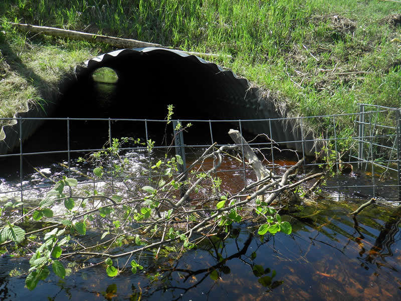
Inlet
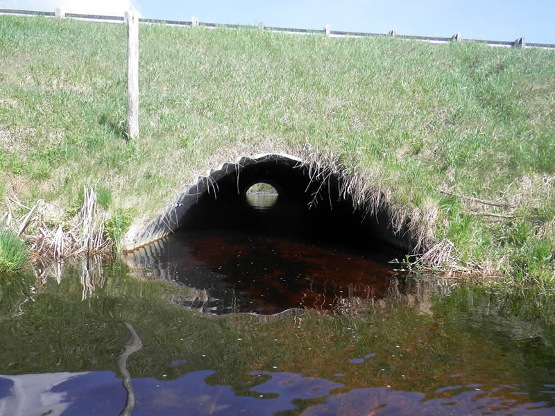
Outlet
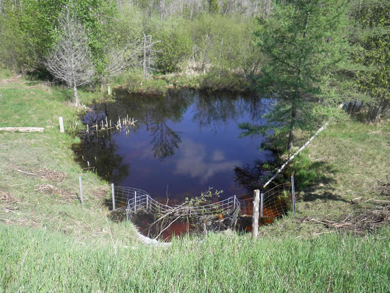
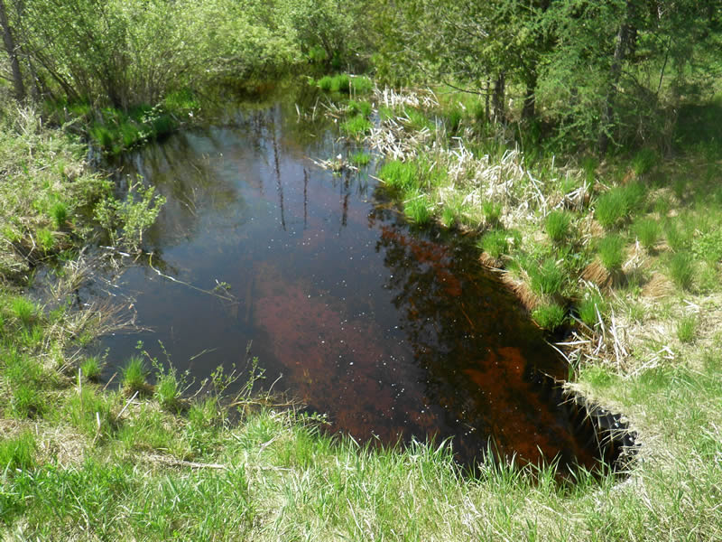
Upstream Conditions
Downstream Conditions
Road Approach - Left
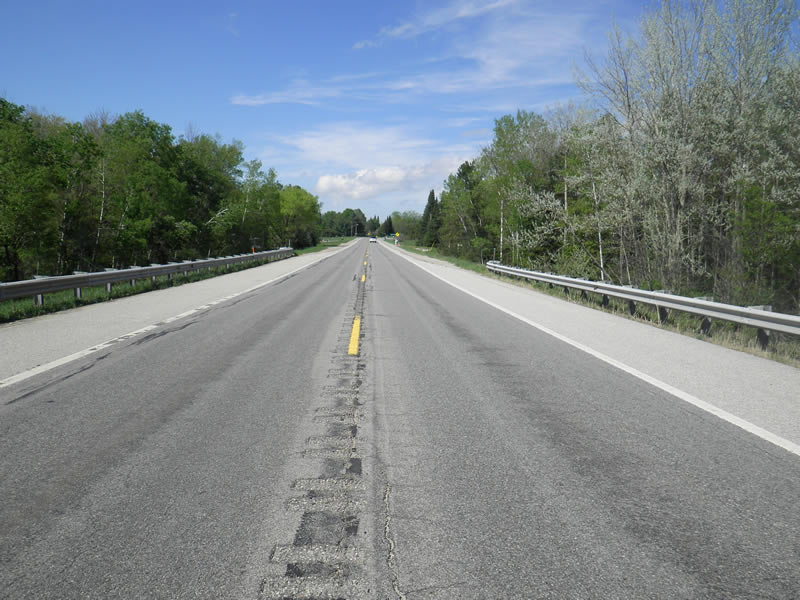
Road Approach - Right
Crossing Information
Type of Crossing: culvert(s)
Number of Structures: 1
Structure Shape: Pipe Arch
Inlet Type: Mitered
Outlet Type: At Stream Grade
Structure Material: Metal
Structure Substrate: Sand
General Conditions: Good
Structure Interior: corrugated
Dimensions of Structure: Length 113 ft.
, Width 9 ft.
, Height 5 ft.
Structure Inlet
Water Depth: 1.25 ft.
Embedded Depth of Structure: 1.1 ft.
Water Velocity*: 1.25 ft./sec.
Structure Outlet
Water Depth: 1.85 ft.
Embedded Depth of Structure: 1 ft.
Water Velocity*: 0.68 ft./sec.
*Water Velocities were measured 0.63 ft. below Surface
(with Meter)
Additional Comments
Old site ID: FO-2.
Stream Information
Stream Flow: Bankfull
Scour Pool: Length 15 ft.
, Width 15 ft.
, Depth 1.4 ft.
Upstream Pond: Length 30 ft.
, Width 20 ft.
Riffle Information
Water Depth: 1.5 ft.
Bankfull Width: 45 ft.
Wetted Width: 44 ft.
Water Velocity: 0.2 ft./sec.
(Measured with Meter)
Dominant Substrate: Organics
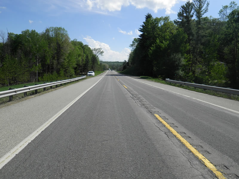
Road Information
Paved
State Road
Road Condition: Good
Road Width at Culvert: 41 ft.
Location of Low Point: At Stream
Runoff Path: Ditch
Embankments
Upstream
Fill Depth: 15 ft.
Slope: 1:1.5
Downstream
Fill Depth: 13 ft.
Slope: 1:1.5
Approaches
Left Approach
Length: 200 ft.
Slope: 1% to 5%
Vegetation: Partial
LS Factor: 0.48
Erosion: 0.1301 tons/year
Right Approach
Length: 300 ft.
Slope: 1% to 5%
Vegetation: Partial
LS Factor: 0.55
Erosion: 0.2236 tons/year
Erosion Information
Total Erosion at Crossing: 0.3538 tons/year
Notes: No erosion.
Summary Information
Fish Passability 0.9
�