Road Stream Crossing Site LTB-224
Little Traverse Bay Watershed, Fineout Creek
M-75 Upstream
Melrose Twp,
Charlevoix County
Information collected by:
Site Location
GPS Coordinates: 45.23155903
, -84.9779187
Owned by Private
Fish Passability 1
Structure is NOT Perched
Total Erosion: 0.1383 tons/year
Severity: Minor
Year Inventoried: 2014
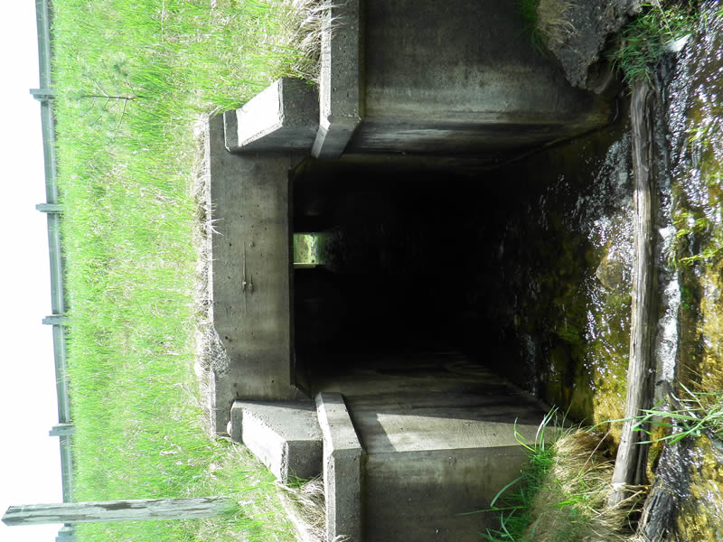
Inlet
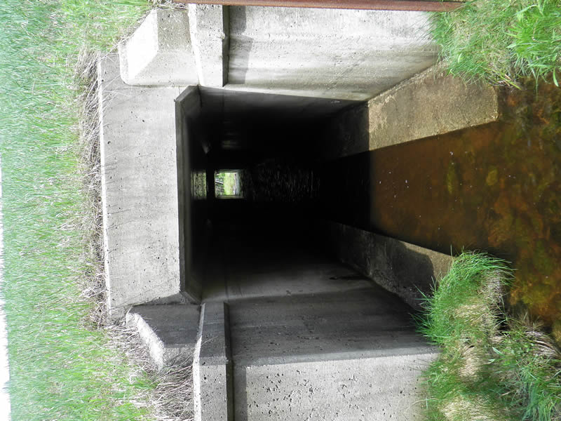
Outlet
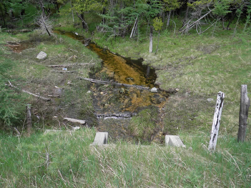
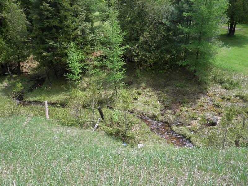
Upstream Conditions
Downstream Conditions
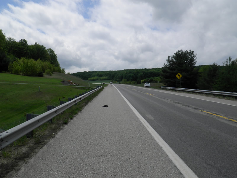
Road Approach - Left
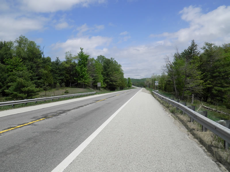
Road Approach - Right
Crossing Information
Type of Crossing: culvert(s)
Number of Structures: 1
Structure Shape: Open Bottom Square/Rectangle
Inlet Type: Headwall
Outlet Type: At Stream Grade
Structure Material: Concrete
Structure Substrate: Mixture
General Conditions: Good
Structure Interior: smooth
Dimensions of Structure: Length 97 ft.
, Width 5 ft.
, Height 5 ft.
Structure is NOT Perched
Structure Inlet
Water Depth: 0.4 ft.
Embedded Depth of Structure: 0 ft.
Water Velocity*: 1.5 ft./sec.
Structure Outlet
Water Depth: 0.85 ft.
Embedded Depth of Structure: 0 ft.
Water Velocity*: 1.3 ft./sec.
*Water Velocities were measured 0.25 ft. below Surface
(with Meter)
Additional Comments
01658 M75. Old site ID: FO-13.
Stream Information
Stream Flow: Less than Bankfull
Upstream Pond: Length 12 ft.
, Width 8 ft.
Riffle Information
Water Depth: 0.6 ft.
Bankfull Width: 10 ft.
Wetted Width: 4.83 ft.
Water Velocity: 0.7 ft./sec.
(Measured with Meter)
Dominant Substrate: Sand
Road Information
Paved
State Road
Road Condition: Good
Road Width at Culvert: 44 ft.
Location of Low Point: Other
Runoff Path: Ditch
Embankments
Upstream
Fill Depth: 12 ft.
Slope: 1:2
Downstream
Fill Depth: 12 ft.
Slope: 1:1.5
Approaches
Left Approach
Length: 0 ft.
Slope: Less Than 1%
Vegetation: Heavy
LS Factor: 0.05
Erosion: 0 tons/year
Right Approach
Length: 200 ft.
Slope: 1% to 5%
Vegetation: Heavy
LS Factor: 0.43
Erosion: 0.1251 tons/year
Erosion Information
Total Erosion at Crossing: 0.1383 tons/year
Extent of Erosion: Minor
Erosion is occurring and corrective actions can be installed to address the problem.
Notes: Limiting mowing and plantings would eliminate erosion.
Location of Erosion | Erosion Dimensions | Eroded Material | Material Eroded | Total Erosion | ||
facing downstream | Length | Width | Depth | Reaching Stream? | (tons/year) | |
Right Downtream Ditch |
15 ft. |
3 ft. |
0.8 ft. |
yes |
Sand |
0.0132 |
Summary Information
Fish Passability 1
�