Road Stream Crossing Site BT_B016
Betsie River Watershed, Betsie River
Long Rd
Colfax Twp,
Benzie County
Information collected by:
Site Location
GPS Coordinates: 44.565289
, -85.898065
T25N
R13W
Sec 17
Owned by Private
State
State
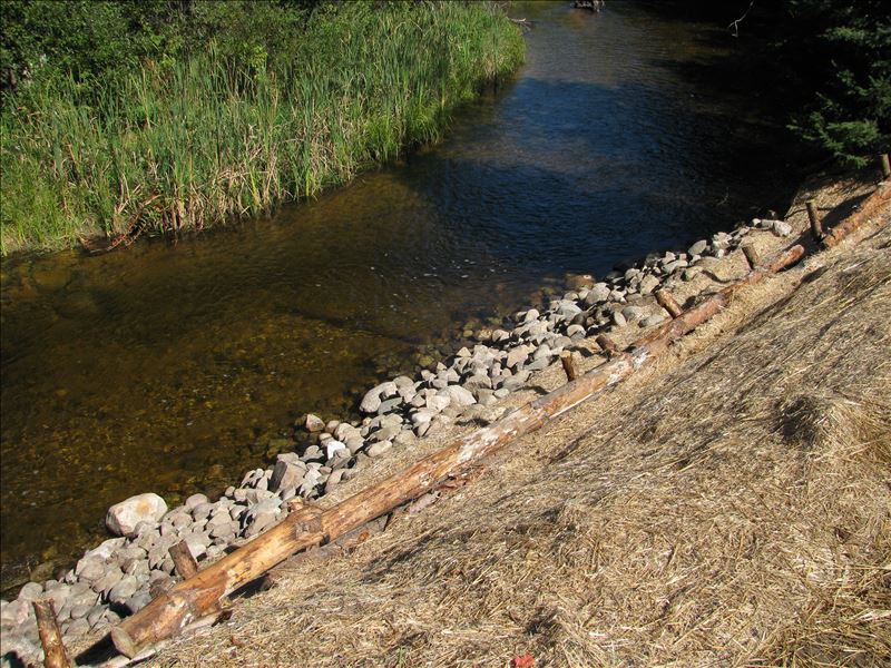
Upstream Conditions
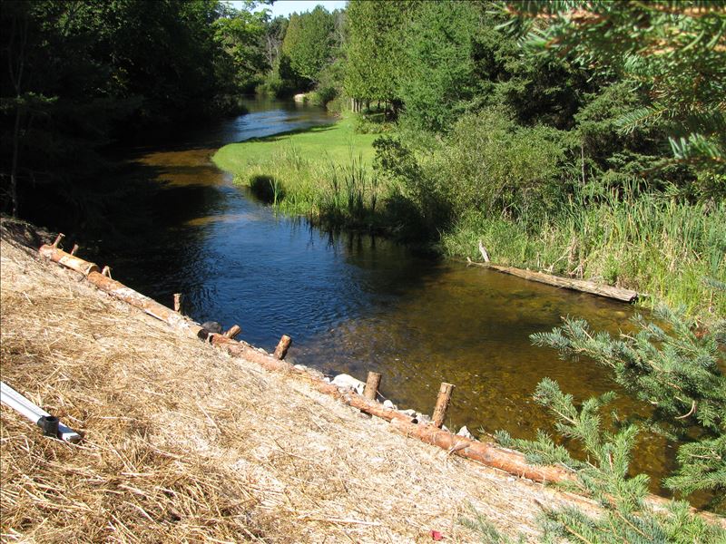
Downstream Conditions
Crossing Information
Type of Crossing: Other
Structure Shape: Open Bottom Square/Rectangle
Inlet Type: Other
Outlet Type: At Stream Grade
Structure Material: Wood
Structure Substrate: Mixture
General Conditions: Good
Structure Interior: smooth
Dimensions of Structure: Length 0 ft.
, Width 0 ft.
, Height 0 ft.
Structure is NOT Perched
Structure Inlet
Water Depth: 2.6 ft.
Embedded Depth of Structure: 0 ft.
Water Velocity*: 2.2 ft./sec.
Structure Outlet
Water Depth: 2.6 ft.
Embedded Depth of Structure: 0 ft.
Water Velocity*: 2.2 ft./sec.
*Water Velocities were measured 1.3 ft. below Surface
(with Meter)
Additional Comments
CRA removed old bridge abutment wall and restored adjacent banks/erosion-summer 2015.
Stream Information
Stream Flow: Less than Bankfull
Scour Pool: Length 0 ft.
, Width 0 ft.
, Depth 0 ft.
Upstream Pond: Length 0 ft.
, Width 0 ft.
, Depth 0 ft.
Riffle Information
Water Depth: 0 ft.
Bankfull Width: 0 ft.
Wetted Width: 0 ft.
Water Velocity: 0 ft./sec.
(Measured with Meter)
Dominant Substrate: Sand
Road Information
Sand
Other Road
Road Condition: Good
Location of Low Point: At Stream
Runoff Path: Roadway
Fill Depth: 0 ft.
Slope: More than 1:2
Fill Depth: 0 ft.
Slope: More than 1:2
Length: 0 ft.
Slope: Less Than 1%
Vegetation: Heavy
Length: 0 ft.
Slope: Less Than 1%
Vegetation: Heavy
Erosion Information
Extent of Erosion: Stabilized
Summary Information
Erosion is an area of concern for this site.
No.
�