Road Stream Crossing Site BT_B033
Betsie River Watershed, Red Creek
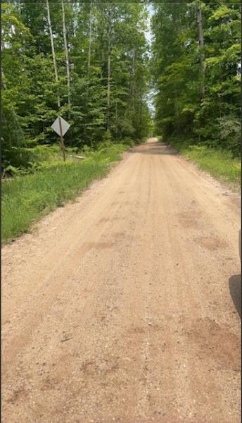
Haze Rd
Weldon Twp,
Benzie County
Information collected by:
Site Location
GPS Coordinates: 44.52831
, -85.95883
T25N
R14W
Sec 26
Owned by State
Contact Point
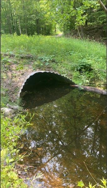
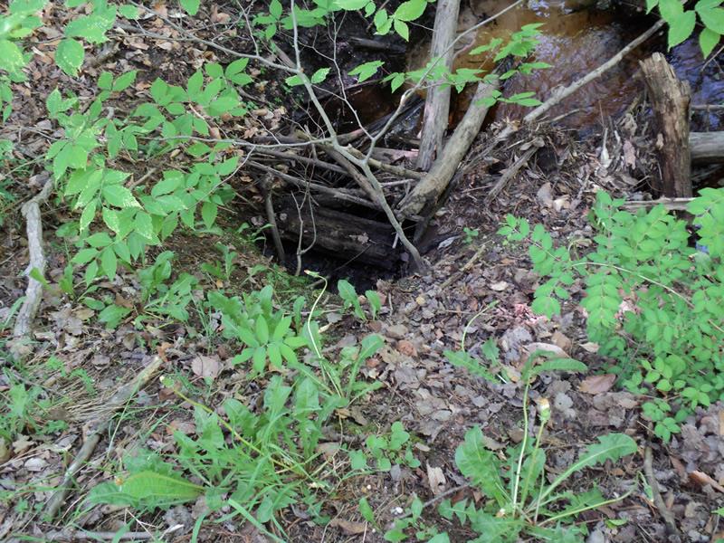
Inlet
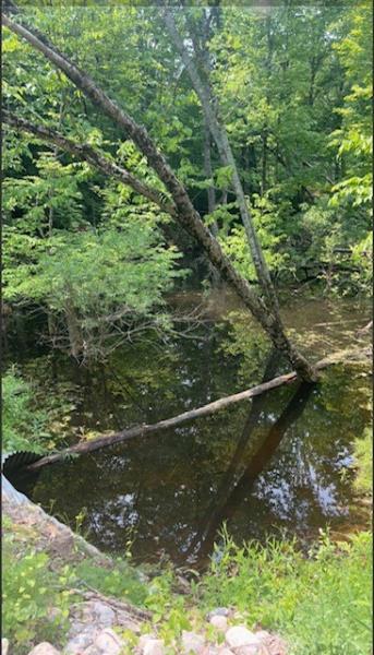
Outlet
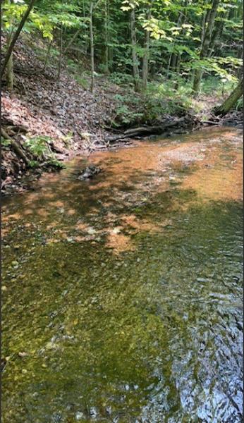
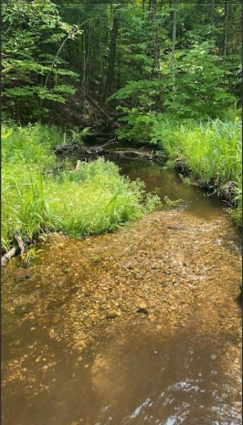
Upstream Conditions
Downstream Conditions
Road Approach - Left
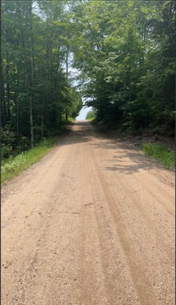
Road Approach - Right
Erosion
Erosion
Crossing Information
Type of Crossing: culvert(s)
Number of Structures: 1
Structure Shape: Pipe Arch
Inlet Type: Mitered
Outlet Type: At Stream Grade
Structure Material: Metal
Structure Substrate: Mixture
General Conditions: Good
10.7 ft.
67 ft.
6.9 ft.
Structure Interior: corrugated
Dimensions of Structure: Length 67 ft.
, Width 10.7 ft.
, Height 6.9 ft.
Percentage Plugged:
Inlet: 51% to 75%
Outlet: 0%
In Pipe: 0%
Structure Inlet
Water Depth: 2.5 ft.
Embedded Depth of Structure: 1.6 ft.
Water Velocity*: 0 ft./sec.
Structure Outlet
Water Depth: 0.7 ft.
Embedded Depth of Structure: 1 ft.
Water Velocity*: 0.2 ft./sec.
*Water Velocities were measured 0.5 ft. below Surface
(with Meter)
Additional Comments
Site was restored in 2016. Beaver activity is an issue at the inlet though.
Stream Information
Stream Flow: Less than 1/2 Bankfull
Riffle Information
Water Depth: 0.12 ft.
Bankfull Width: 14.3 ft.
Wetted Width: 13.2 ft.
Water Velocity: 0.6 ft./sec.
(Measured with Meter)
Dominant Substrate: Gravel
Road Information
Gravel
County Road
Road Condition: Good
Road Width at Culvert: 17.4 ft.
Location of Low Point: Other
Runoff Path: Ditch
Embankments
Upstream
Fill Depth: 4.25 ft.
Slope: More than 1:2
Downstream
Fill Depth: 4.85 ft.
Slope: More than 1:2
Approaches
Left Approach
Length: 0 ft.
Slope: Less Than 1%
Vegetation: Heavy
LS Factor: 0.05
Erosion: 0 tons/year
Right Approach
Length: 350 ft.
Slope: 6% to 10%
Vegetation: Heavy
LS Factor: 1.465
Erosion: 2.46 tons/year
Erosion Information
Total Erosion at Crossing: 2.3921 tons/year
Extent of Erosion: Minor
Erosion is occurring and corrective actions can be installed to address the problem.
Notes:
Addition of a spillway at lowest point on east side would possibly stop erosion.
Location of Erosion | Erosion Dimensions | Eroded Material | Material Eroded | Total Erosion | ||
facing downstream | Length | Width | Depth | Reaching Stream? | (tons/year) | |
Right Approach |
20 ft. |
5 ft. |
6.6 ft. |
no |
Gravelly Loam |
0.132 |
Summary Information
Erosion is an area of concern for this site.
Impoundment at inlet is causing severe flooding.
A future visit to this site is recommended.
Erosion monitoring, and to clean up blockages on inlet/upstream side.
�