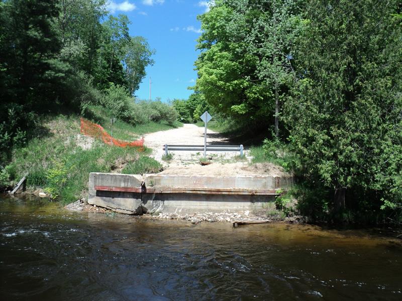
Road Stream Crossing Site BT_B034
Betsie River Watershed, Betsie River
Haze Rd
Weldon Twp,
Benzie County
Information collected by:
Site Location
GPS Coordinates: 44.52507
, -85.9588
T25N
R14W
Sec 35
Owned by Private
State
State
Severity: Severe
Year Inventoried: 2014
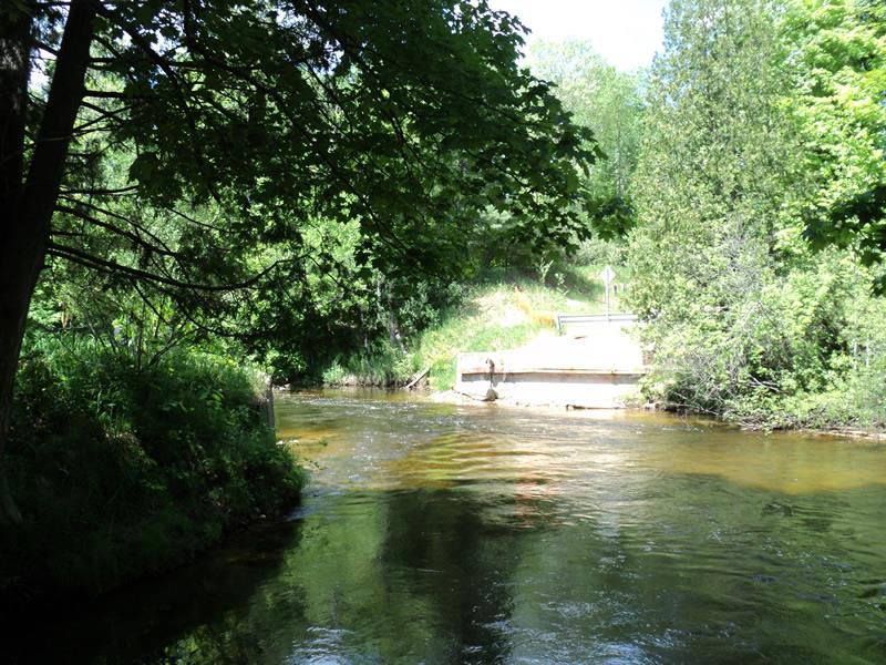
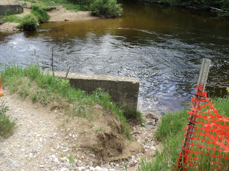
Inlet
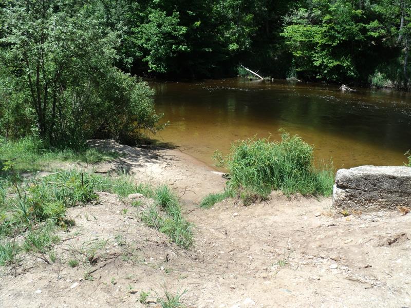
Outlet
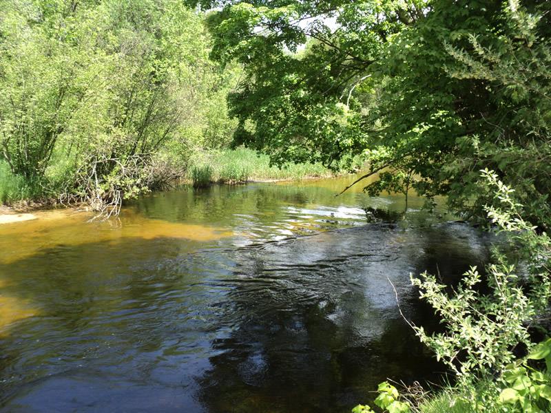
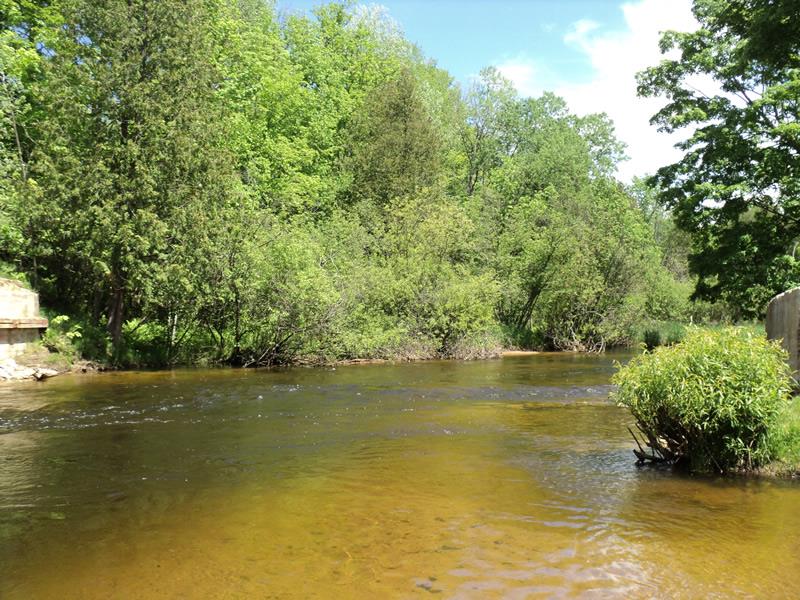
Upstream Conditions
Downstream Conditions
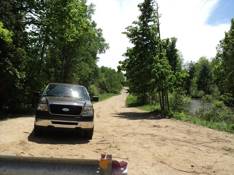
Road Approach - Left
Road Approach - Right
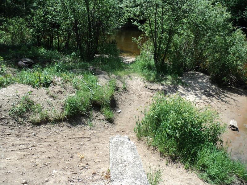
Erosion
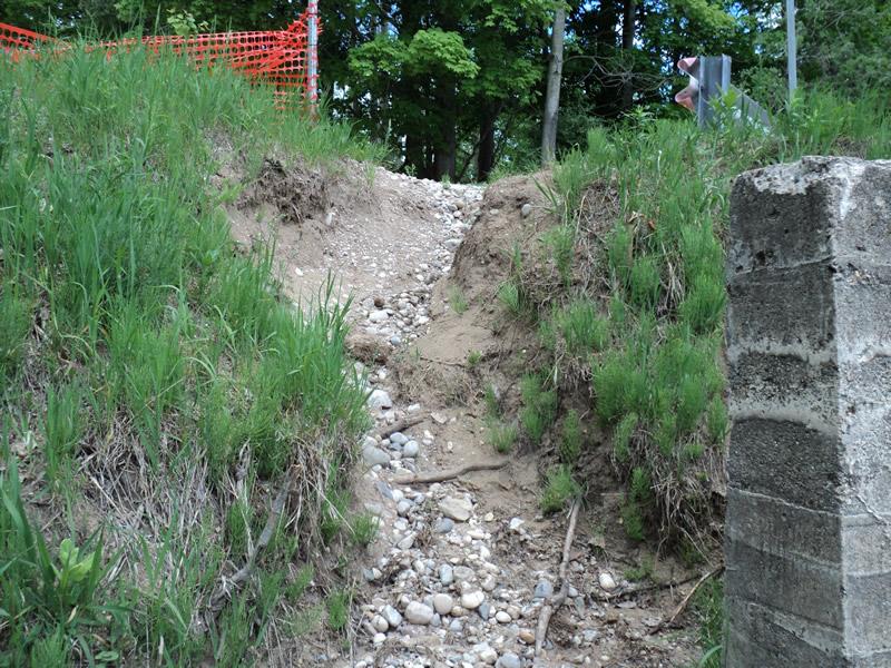
Erosion
Erosion
Erosion
Crossing Information
Type of Crossing: Bridge
Structure Shape: Open Bottom Square/Rectangle
Inlet Type: Headwall
Outlet Type: At Stream Grade
Structure Material: Concrete
Structure Substrate: Mixture
General Conditions: Poor
Structure Interior: smooth
Dimensions of Structure: Length 54 ft.
, Width 19 ft.
, Height 6 ft.
Structure Inlet
Water Depth: 5 ft.
Embedded Depth of Structure: 0 ft.
Water Velocity*: 5 ft./sec.
Structure Outlet
Water Depth: 5 ft.
Embedded Depth of Structure: 0 ft.
Water Velocity*: 5 ft./sec.
*Water Velocities were measured 3 ft. below Surface
(with Meter)
Additional Comments
Site of a former bridge crossing that washed out in the spring of 2014.
Stream Information
Stream Flow: Less than Bankfull
Scour Pool: Length 0 ft.
, Width 0 ft.
, Depth 0 ft.
Upstream Pond: Length 0 ft.
, Width 0 ft.
, Depth 0 ft.
Riffle Information
Water Depth: 2 ft.
Bankfull Width: 70 ft.
Wetted Width: 60 ft.
Water Velocity: 5.6 ft./sec.
(Measured with Meter)
Dominant Substrate: Gravel
Road Information
Gravel
County Road
Road Condition: Fair
Road Width at Culvert: 19 ft.
Location of Low Point: Other
Runoff Path: Roadway
Fill Depth: 0 ft.
Slope: Vertical
Fill Depth: 0 ft.
Slope: Vertical
Length: 0 ft.
Slope: Less Than 1%
Vegetation: Heavy
Length: 1000 ft.
Slope: 6% to 10%
Vegetation: Heavy
Erosion Information
Extent of Erosion: Moderate
Notes:
Large amounts of sediment entering the river.
Location of Erosion | Erosion Dimensions | Eroded Material | Material Eroded | Total Erosion | ||
facing downstream | Length | Width | Depth | Reaching Stream? | (tons/year) | |
Left Downstream Embankment |
30 ft. |
35 ft. |
5 ft. |
yes |
Gravelly Loam |
1.05 |
Right Downstream Embankment |
16 ft. |
13 ft. |
8 ft. |
no |
Gravelly Loam |
0.896 |
Summary Information
Erosion is an area of concern for this site.
Revisit if there are plans to replace the bridge also to monitor erosion.
A future visit to this site is recommended.
If a new bridge is to be built or possibly create a recreational access site on the East side where there is state land.
�