Road Stream Crossing Site BT_G015
Betsie River Watershed, Duck Lake/Green Lake connector stream
M-137
Green Lake Twp,
Grand Traverse County
Information collected by:
Site Location
GPS Coordinates: 44.64146
, -85.76734
T26N
R12W
Sec 21
Owned by Other
Fish Passability 0.5
Structure is NOT Perched
Total Erosion: 0.6343 tons/year
Severity: Moderate
Year Inventoried: 2014
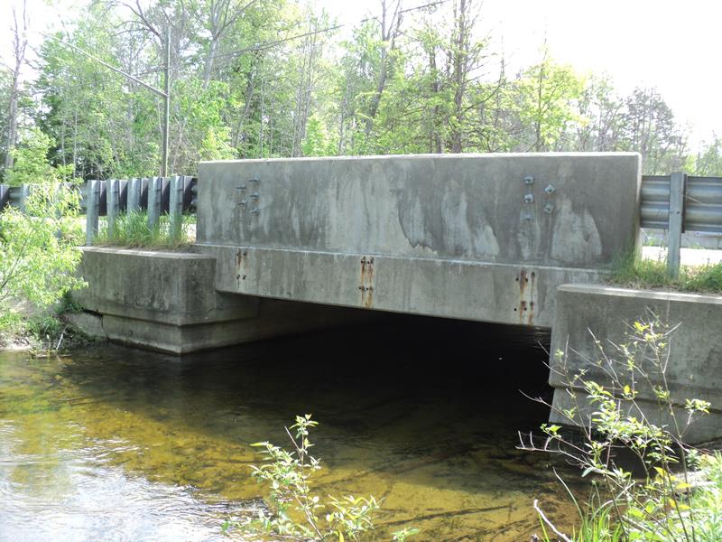
Inlet
Outlet
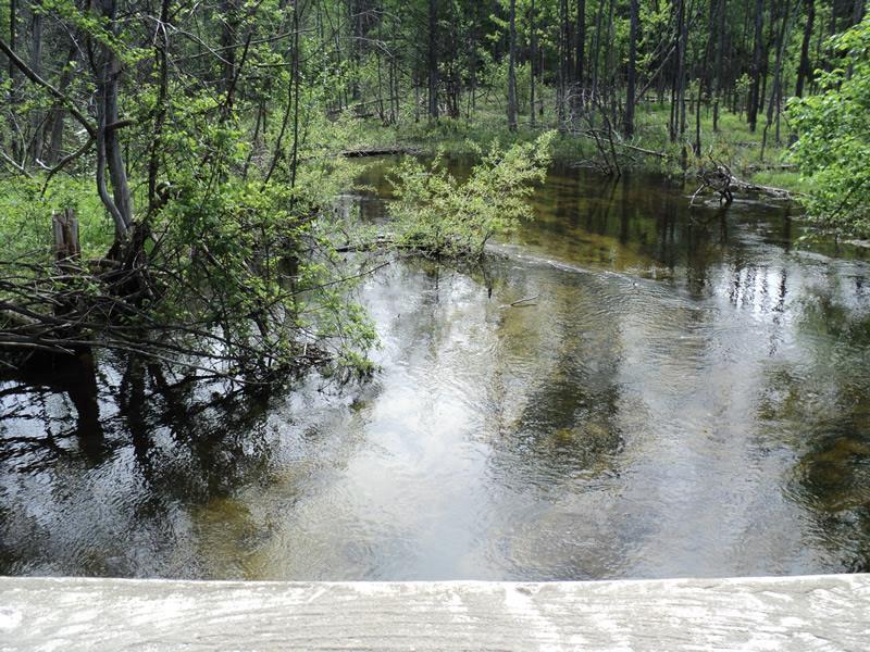
Upstream Conditions
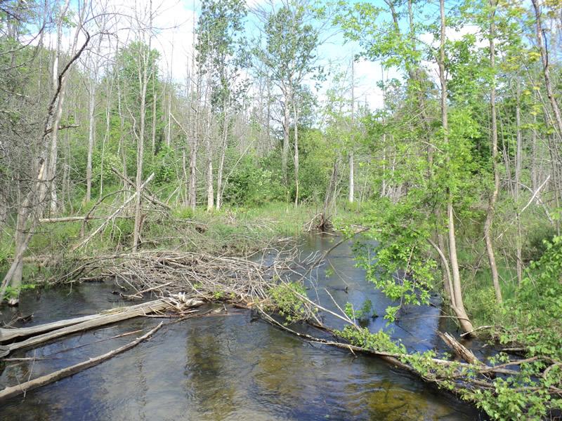
Downstream Conditions
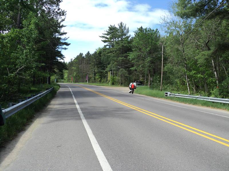
Road Approach - Left
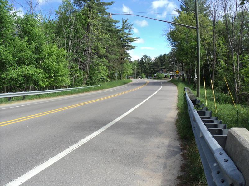
Road Approach - Right
Crossing Information
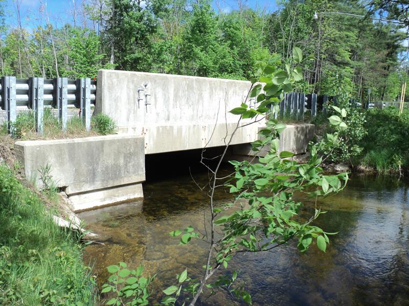
Type of Crossing: Bridge
Structure Shape: Open Bottom Square/Rectangle
Inlet Type: Headwall
Outlet Type: At Stream Grade
Structure Material: Concrete
Structure Substrate: Mixture
General Conditions: Good
Structure Interior: smooth
Dimensions of Structure: Length 40 ft.
, Width 15.5 ft.
, Height 5.4 ft.
Structure is NOT Perched
Structure Inlet
Water Depth: 2.6 ft.
Embedded Depth of Structure: 0 ft.
Water Velocity*: 1 ft./sec.
Structure Outlet
Water Depth: 2.8 ft.
Embedded Depth of Structure: 0 ft.
Water Velocity*: 2 ft./sec.
*Water Velocities were measured 2 ft. below Surface
(with Meter)
Additional Comments
Land owners-Interlochen Arts Academy
Stream Information
Stream Flow: Less than Bankfull
Scour Pool: Length 0 ft.
, Width 0 ft.
, Depth 0 ft.
Upstream Pond: Length 0 ft.
, Width 0 ft.
, Depth 0 ft.
Riffle Information
Water Depth: 3.2 ft.
Bankfull Width: 40 ft.
Wetted Width: 36 ft.
Water Velocity: 1.3 ft./sec.
(Measured with Meter)
Dominant Substrate: Sand
Road Information
Paved
State Road
Road Condition: Good
Road Width at Culvert: 37 ft.
Location of Low Point: At Stream
Runoff Path: Roadway
Fill Depth: 0 ft.
Slope: Vertical
Fill Depth: 0 ft.
Slope: Vertical
Approaches
Left Approach
Length: 550 ft.
Slope: 1% to 5%
Vegetation: Heavy
LS Factor: 0.51
Erosion: 0.3431 tons/year
Right Approach
Length: 480 ft.
Slope: 1% to 5%
Vegetation: Heavy
LS Factor: 0.496
Erosion: 0.2912 tons/year
Erosion Information
Total Erosion at Crossing: 0.6343 tons/year
Summary Information
Fish Passability 0.5
�