Road Stream Crossing Site BT_G019
Betsie River Watershed, Unknown (Near Cedar Hedge Lake)
US-31
Green Lake Twp,
Grand Traverse County
Information collected by:
Site Location
GPS Coordinates: 44.65886
, -85.78359
T26N
R12W
Sec 8
Owned by Private
Fish Passability 1
Structure is NOT Perched
Total Erosion: 1.7712 tons/year
Severity: Moderate
Year Inventoried: 2014
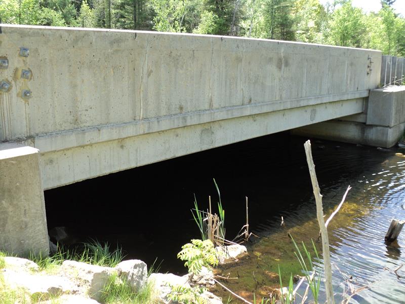
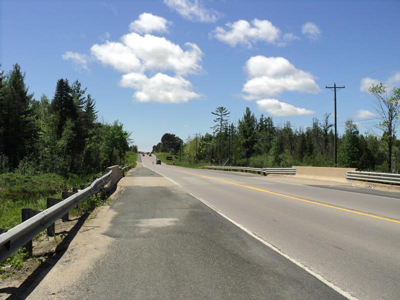
Inlet
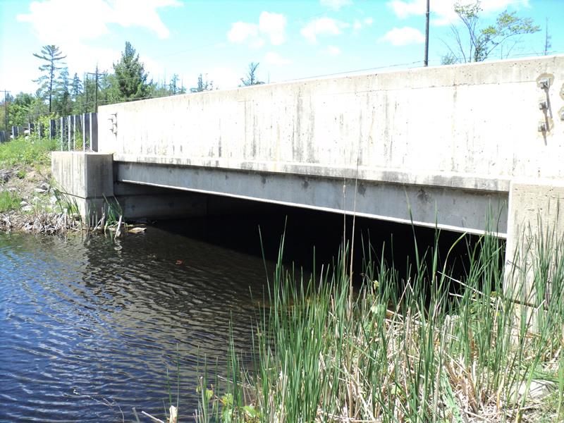
Outlet
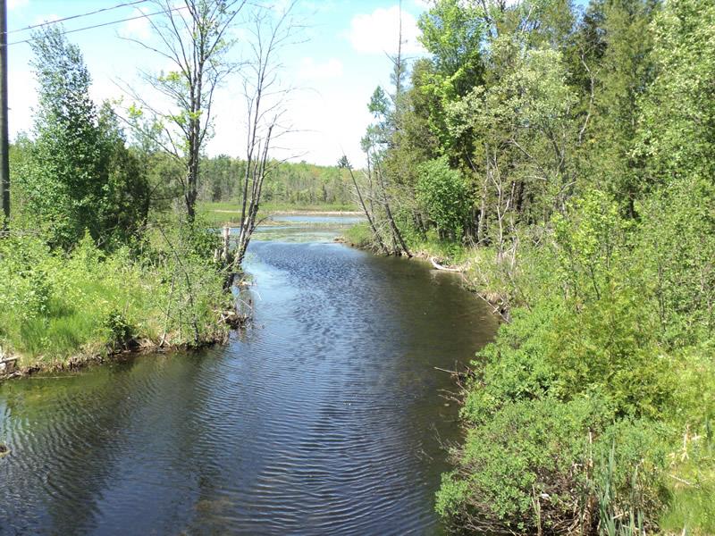
Upstream Conditions
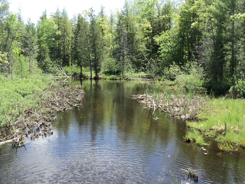
Downstream Conditions
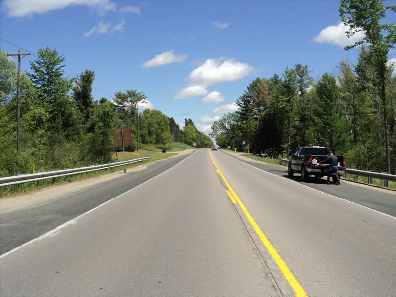
Road Approach - Left
Road Approach - Right
Other
Crossing Information
Type of Crossing: Bridge
Structure Shape: Open Bottom Square/Rectangle
Inlet Type: Headwall
Outlet Type: At Stream Grade
Structure Material: Concrete
Structure Substrate: Mixture
General Conditions: Good
Structure Interior: smooth
Dimensions of Structure: Length 50 ft.
, Width 30 ft.
, Height 5.8 ft.
Structure is NOT Perched
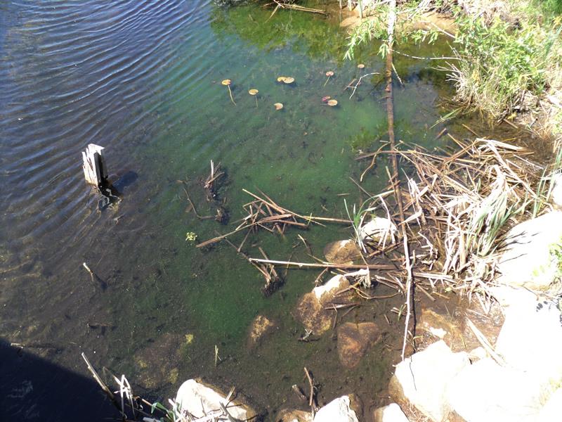
Structure Inlet
Water Depth: 2.2 ft.
Embedded Depth of Structure: 0 ft.
Water Velocity*: 0.2 ft./sec.
Structure Outlet
Water Depth: 2.4 ft.
Embedded Depth of Structure: 0 ft.
Water Velocity*: 0.2 ft./sec.
*Water Velocities were measured 2 ft. below Surface
(with Meter)
Stream Information
Stream Flow: Bankfull
Scour Pool: Length 0 ft.
, Width 0 ft.
, Depth 0 ft.
Upstream Pond: Length 0 ft.
, Width 0 ft.
, Depth 0 ft.
Riffle Information
Water Depth: 2.1 ft.
Bankfull Width: 33 ft.
Wetted Width: 25 ft.
Water Velocity: 0.4 ft./sec.
(Measured with Meter)
Dominant Substrate: Organics
Road Information
Paved
Federal Road
Road Condition: Good
Road Width at Culvert: 47 ft.
Location of Low Point: At Stream
Runoff Path: Roadway
Fill Depth: 0 ft.
Slope: Vertical
Fill Depth: 0 ft.
Slope: Vertical
Approaches
Left Approach
Length: 1000 ft.
Slope: 1% to 5%
Vegetation: Heavy
LS Factor: 0.57
Erosion: 0.8856 tons/year
Right Approach
Length: 1000 ft.
Slope: 1% to 5%
Vegetation: Heavy
LS Factor: 0.57
Erosion: 0.8856 tons/year
Erosion Information
Total Erosion at Crossing: 1.7712 tons/year
Summary Information
Fish Passability 1
�