Road Stream Crossing Site PM_L009
Pere Marquette River Watershed, Little South Branch
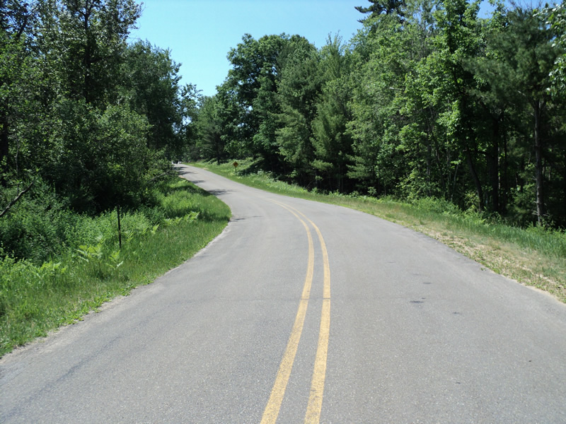
Foreman Rd
Yates Twp,
Lake County
Information collected by:
Site Location
GPS Coordinates: 43.81698
, -85.79997
T17N
R12W
Sec 31
Owned by Private
Federal
Federal
Total Erosion: 0.9495 tons/year
Severity: Moderate
Year Inventoried: 2014
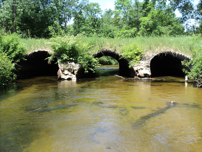
Inlet
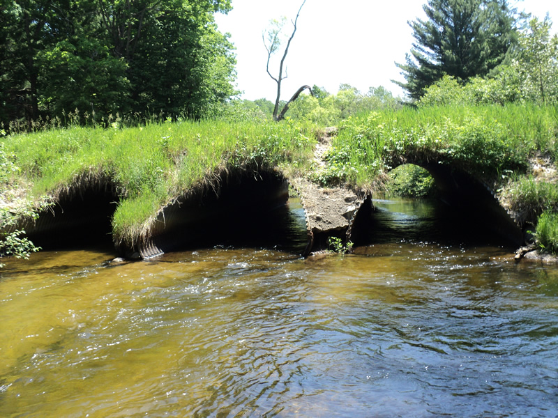
Outlet
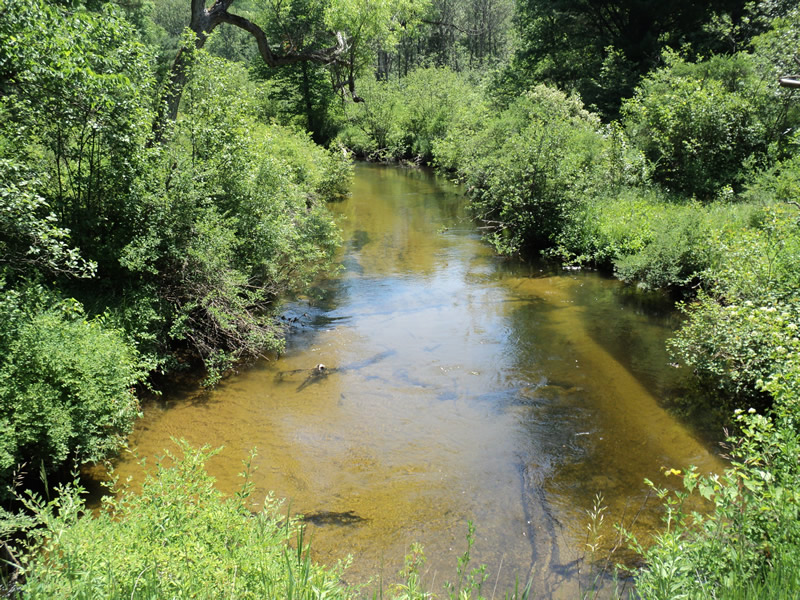
Upstream Conditions
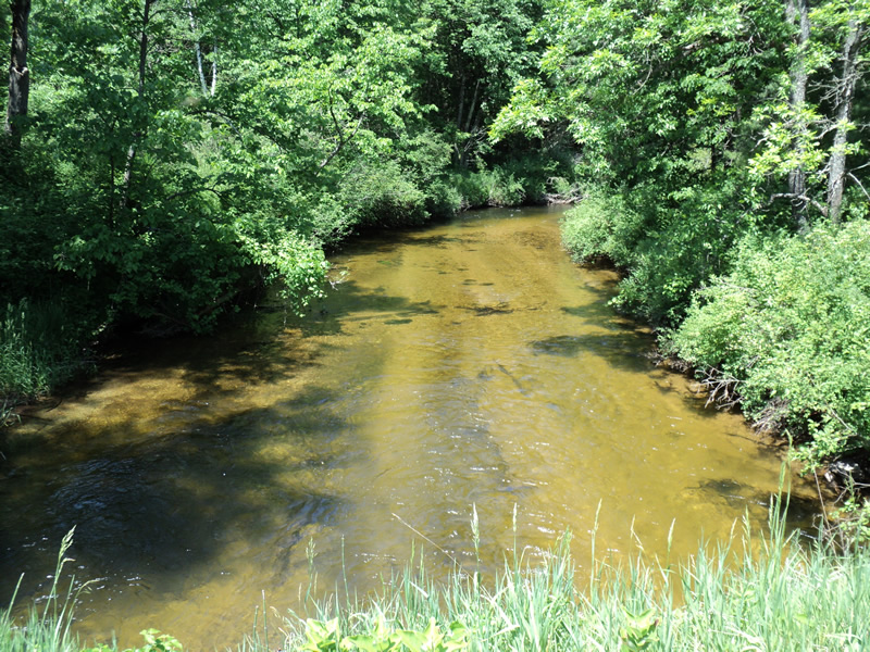
Downstream Conditions
Road Approach - Left
Road Approach - Right
Crossing Information
Type of Crossing: culvert(s)
Number of Structures: 3
Structure Shape: Pipe Arch
Inlet Type: Mitered
Outlet Type: At Stream Grade
Structure Material: Metal
Structure Substrate: Mixture
General Conditions: Good
Multiple Culverts/Spans | ||||
Culvert/Span | Width | Length | Height | Material |
1 |
11 ft. |
50 ft. |
7 ft. |
Metal |
2 |
11 ft. |
50 ft. |
7 ft. |
Metal |
3 |
11 ft. |
50 ft. |
7 ft. |
Metal |
Structure Interior: corrugated
Dimensions of Structure: Length 50 ft.
, Width 11 ft.
, Height 7 ft.
Structure Inlet
Water Depth: 1.8 ft.
Embedded Depth of Structure: 0.2 ft.
Water Velocity*: 1.8 ft./sec.
Structure Outlet
Water Depth: 1.8 ft.
Embedded Depth of Structure: 0.2 ft.
Water Velocity*: 2 ft./sec.
*Water Velocities were measured 1 ft. below Surface
(with Meter)
Additional Comments
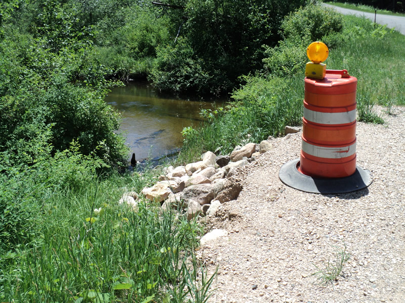
Erosion recently stabilized.
Stream Information
Stream Flow: Less than 1/2 Bankfull
Riffle Information
Water Depth: 0.7 ft.
Bankfull Width: 35 ft.
Wetted Width: 33 ft.
Water Velocity: 2.4 ft./sec.
(Measured with Meter)
Dominant Substrate: Sand
Road Information
Paved
County Road
Road Condition: Good
Road Width at Culvert: 30 ft.
Location of Low Point: At Stream
Runoff Path: Roadway
Embankments
Upstream
Fill Depth: 2 ft.
Slope: 1:1.5
Downstream
Fill Depth: 2.5 ft.
Slope: 1:1.5
Approaches
Left Approach
Length: 360 ft.
Slope: 6% to 10%
Vegetation: Heavy
LS Factor: 1.478
Erosion: 0.5277 tons/year
Right Approach
Length: 300 ft.
Slope: 6% to 10%
Vegetation: Heavy
LS Factor: 1.4
Erosion: 0.4165 tons/year
Erosion Information
Total Erosion at Crossing: 0.9495 tons/year
Extent of Erosion: Minor
Notes:
Right upstream embankment erosion recently stabilized-photo L9_erosion
Location of Erosion | Erosion Dimensions | Eroded Material | Material Eroded | Total Erosion | ||
facing downstream | Length | Width | Depth | Reaching Stream? | (tons/year) | |
Right Upstream Embankment |
12 ft. |
5 ft. |
0.5 ft. |
no |
Loam |
0.0053 |
Summary Information
Erosion is an area of concern for this site.
�