Road Stream Crossing Site PM_L014
Pere Marquette River Watershed, Middle Branch tributary
S Mac Rd
Lake Twp,
Lake County
Information collected by:
Site Location
GPS Coordinates: 43.8891
, -85.95907
T17N
R14W
Sec 3
Owned by Private
Total Erosion: 4.7221 tons/year
Severity: Severe
Year Inventoried: 2014
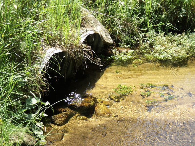
Inlet
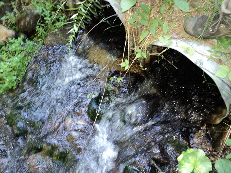
Outlet
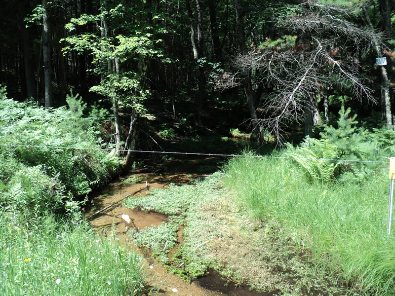
Upstream Conditions
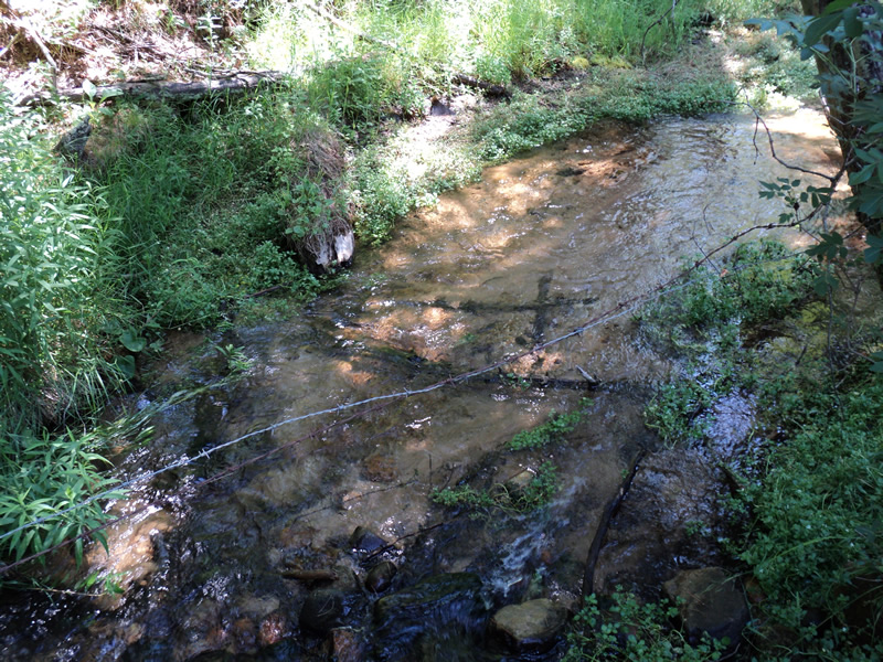
Downstream Conditions
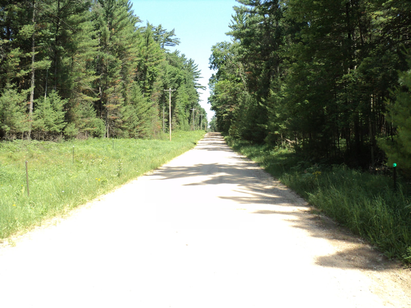
Road Approach - Left
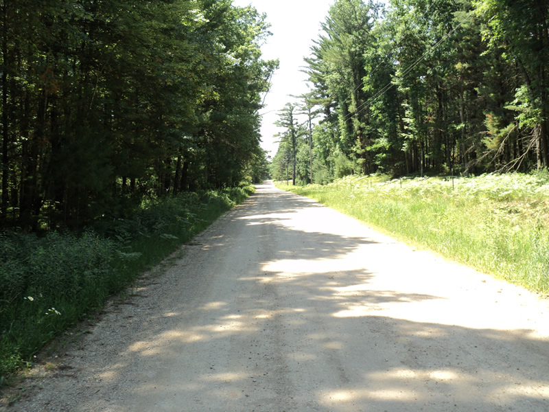
Road Approach - Right
Crossing Information
Type of Crossing: culvert(s)
Number of Structures: 2
Structure Shape: Round
Inlet Type: Projecting
Outlet Type: Cascade over Riprap
Structure Material: Metal
Structure Substrate: Sand
General Conditions: Fair
Multiple Culverts/Spans | ||||
Culvert/Span | Width | Length | Height | Material |
1 |
2 ft. |
40 ft. |
2 ft. |
Metal |
2 |
2 ft. |
40 ft. |
2 ft. |
Metal |
Structure Interior: corrugated
Dimensions of Structure: Length 40 ft.
, Width 2 ft.
, Height 2 ft.
Structure Inlet
Water Depth: 0.8 ft.
Embedded Depth of Structure: 0.1 ft.
Water Velocity*: 1.1 ft./sec.
Structure Outlet
Water Depth: 0.5 ft.
Water Velocity*: 4.6 ft./sec.
*Water Velocities were measured at the Surface
(with Meter)
Stream Information
Stream Flow: Less than 1/2 Bankfull
Riffle Information
Water Depth: 0.2 ft.
Bankfull Width: 15 ft.
Wetted Width: 12 ft.
Water Velocity: 1.1 ft./sec.
(Measured with Meter)
Dominant Substrate: Sand
Road Information
Gravel
County Road
Road Condition: Fair
Road Width at Culvert: 21 ft.
Location of Low Point: At Stream
Runoff Path: Roadway
Embankments
Upstream
Fill Depth: 2 ft.
Slope: 1:1.5
Downstream
Fill Depth: 1.5 ft.
Slope: 1:2
Approaches
Left Approach
Length: 430 ft.
Slope: 6% to 10%
Vegetation: Heavy
LS Factor: 1.562
Erosion: 3.8844 tons/year
Right Approach
Length: 120 ft.
Slope: 6% to 10%
Vegetation: Heavy
LS Factor: 1.042
Erosion: 0.7234 tons/year
Erosion Information
Total Erosion at Crossing: 4.7221 tons/year
Extent of Erosion: Minor
Location of Erosion | Erosion Dimensions | Eroded Material | Material Eroded | Total Erosion | ||
facing downstream | Length | Width | Depth | Reaching Stream? | (tons/year) | |
Right Approach |
120 ft. |
1 ft. |
0.1 ft. |
yes |
Gravel |
0.012 |
Right Approach |
120 ft. |
1 ft. |
0.1 ft. |
yes |
Gravel |
0.012 |
Left Approach |
430 ft. |
1 ft. |
0.1 ft. |
yes |
Gravel |
0.043 |
Left Approach |
430 ft. |
1 ft. |
0.1 ft. |
yes |
Sand |
0.0473 |
Summary Information
Erosion is an area of concern for this site.
�