Road Stream Crossing Site PM_L022
Pere Marquette River Watershed, Baldwin River
24th St
Cherry Valley Twp,
Lake County
Information collected by:
Site Location
GPS Coordinates: 43.944312
, -85.774341
T18N
R12w
Sec 20
Owned by Private
Fish Passability 0.9
Total Erosion: 3.2281 tons/year
Severity: Severe
Year Inventoried: 2014
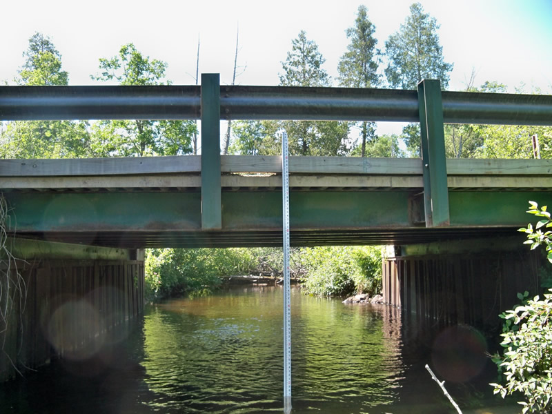
Inlet
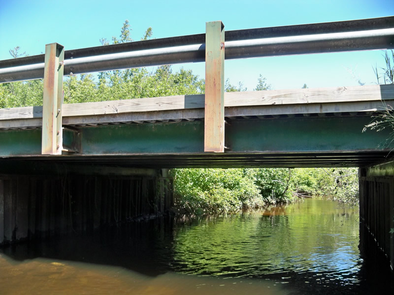
Outlet
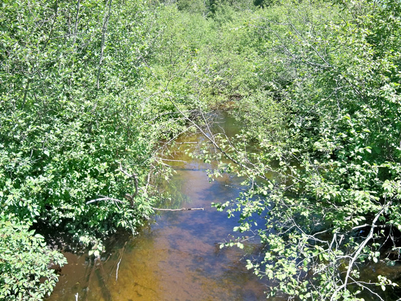
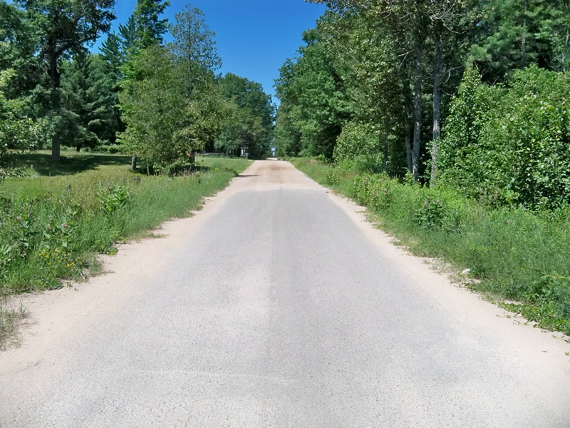
Upstream Conditions
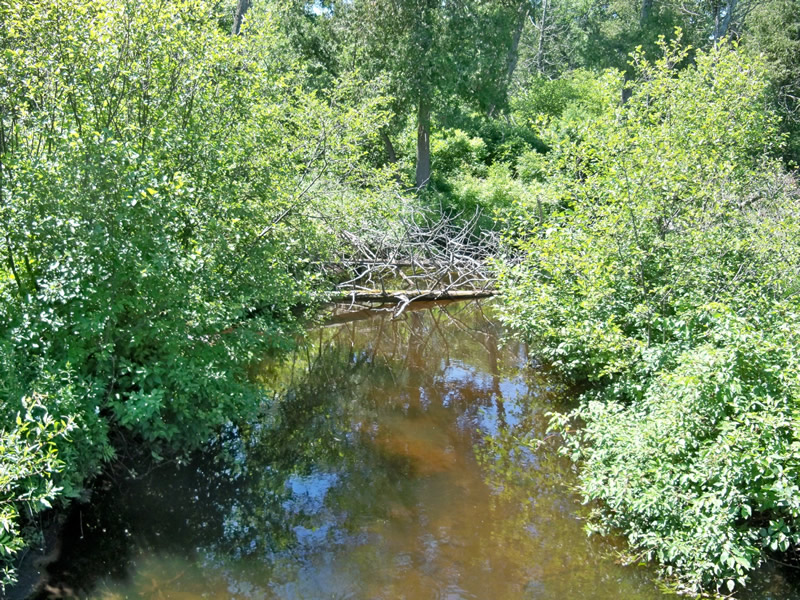
Downstream Conditions
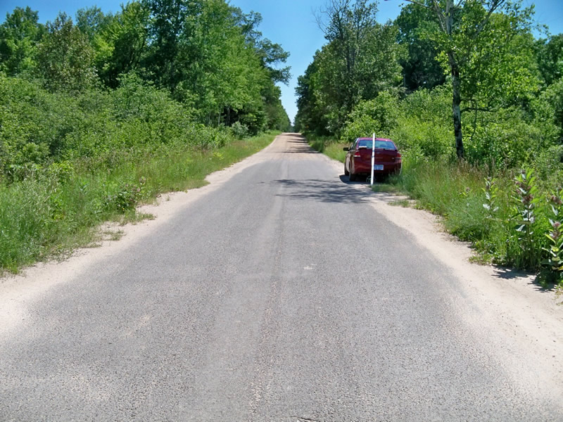
Road Approach - Left
Road Approach - Right
Crossing Information
Type of Crossing: Bridge
Structure Material: Metal
Structure Substrate: Sand
General Conditions: Fair
Dimensions of Structure: Length 18 ft.
, Width 23 ft.
, Height 6 ft.
Structure Inlet
Water Depth: 1.7 ft.
Water Velocity*: 0.4 ft./sec.
Structure Outlet
Water Depth: 3 ft.
Water Velocity*: 0.8 ft./sec.
*Water Velocities were measured 1 ft. below Surface
(with Meter)
Stream Information
Stream Flow: Less than Bankfull
Riffle Information
Water Depth: 1 ft.
Bankfull Width: 26 ft.
Wetted Width: 20 ft.
Water Velocity: 0.6 ft./sec.
(Measured with Meter)
Dominant Substrate: Sand
Road Information
Gravel
County Road
Road Condition: Good
Road Width at Culvert: 23 ft.
Location of Low Point: At Stream
Runoff Path: Roadway
Fill Depth: 0 ft.
Slope: 1:1.5
Fill Depth: 0 ft.
Slope: 1:1.5
Approaches
Left Approach
Length: 600 ft.
Slope: 1% to 5%
Vegetation: Heavy
LS Factor: 0.52
Erosion: 1.9769 tons/year
Right Approach
Length: 350 ft.
Slope: 1% to 5%
Vegetation: Heavy
LS Factor: 0.47
Erosion: 1.0423 tons/year
Erosion Information
Total Erosion at Crossing: 3.2281 tons/year
Extent of Erosion: Minor
Erosion is occurring and corrective actions can be installed to address the problem.
Notes: Road surface on approaches are washing into stream. Needs pavement in the future. Bridge "bumpers" are intact preventing sediment from washing over the bridge deck.
Location of Erosion | Erosion Dimensions | Eroded Material | Material Eroded | Total Erosion | ||
facing downstream | Length | Width | Depth | Reaching Stream? | (tons/year) | |
Right Approach |
350 ft. |
3 ft. |
0.1 ft. |
yes |
Sand |
0.0385 |
Right Approach |
350 ft. |
3 ft. |
0.1 ft. |
yes |
Sand |
0.0385 |
Left Approach |
600 ft. |
3 ft. |
0.1 ft. |
yes |
Sand |
0.066 |
Left Approach |
600 ft. |
3 ft. |
0.1 ft. |
yes |
Sand |
0.066 |
Summary Information
Fish Passability 0.9
Erosion is an area of concern for this site.
When bridge is eventually in need of replacement, need to pave the approaches.
�