Road Stream Crossing Site PM_L023
Pere Marquette River Watershed, North Branch Cole Creek
24th St
Cherry Valley twp,
Lake County
Information collected by:
Site Location
GPS Coordinates: 43.944322
, -85.767066
T18N
R12W
Sec 20
Owned by Private
Fish Passability 0
Perch Height: 0.5 ft.
Total Erosion: 0.8969 tons/year
Severity: Severe
Year Inventoried: 2014
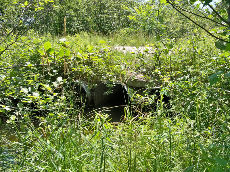
Inlet
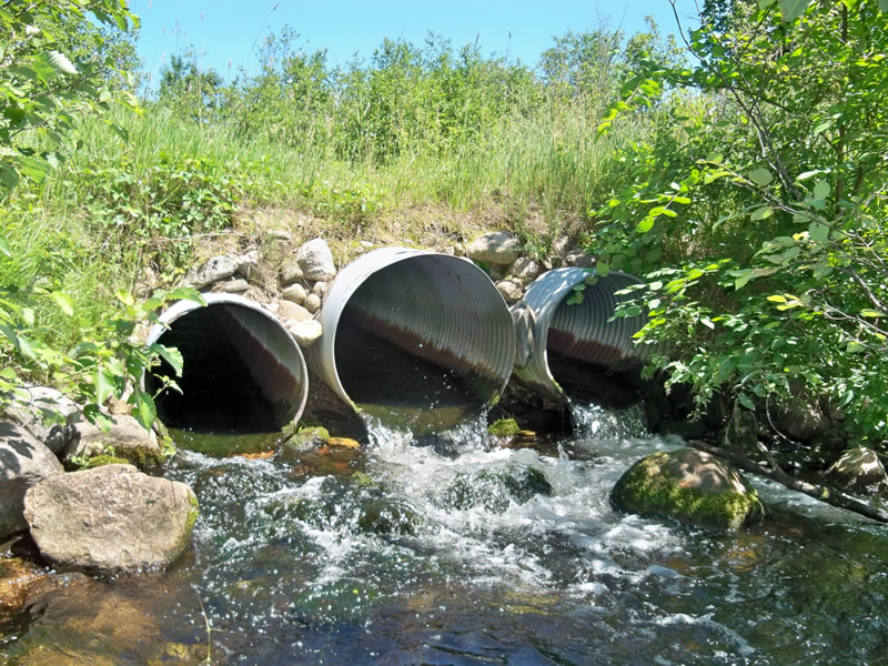
Outlet
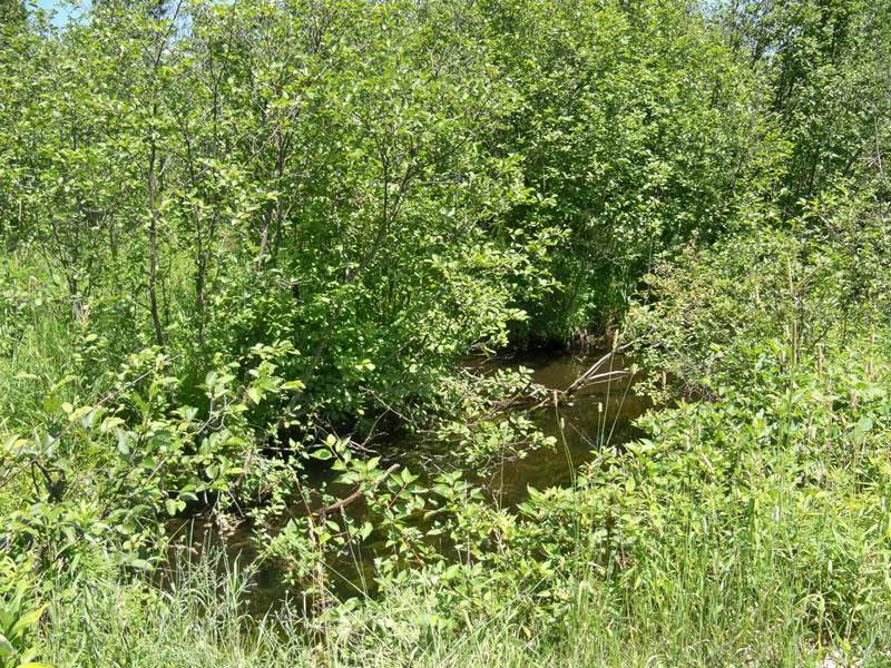
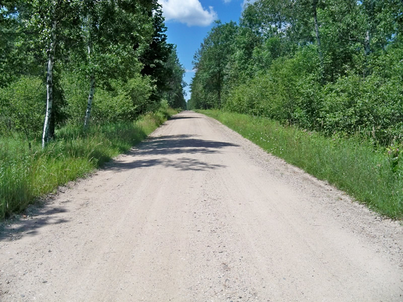
Upstream Conditions
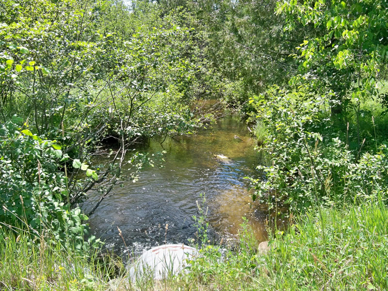
Downstream Conditions
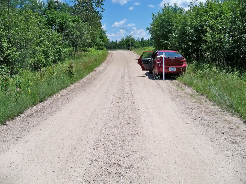
Road Approach - Left
Road Approach - Right
Crossing Information
Type of Crossing: culvert(s)
Number of Structures: 3
Structure Shape: Round
Inlet Type: Projecting
Outlet Type: Cascade over Riprap
Structure Material: Metal
Structure Substrate: None
General Conditions: Good
Multiple Culverts/Spans | ||||
Culvert/Span | Width | Length | Height | Material |
1 |
2.5 ft. |
30 ft. |
2.5 ft. |
Metal |
2 |
3 ft. |
30 ft. |
3 ft. |
Metal |
3 |
2.5 ft. |
30 ft. |
2.5 ft. |
Metal |
Structure Interior: corrugated
Perch Height: 0.5 ft.
Structure Inlet
Water Depth: 0.5 ft.
Embedded Depth of Structure: 0 ft.
Water Velocity*: 0.9 ft./sec.
Structure Outlet
Water Depth: 0.5 ft.
Embedded Depth of Structure: 0 ft.
Water Velocity*: 3 ft./sec.
*Water Velocities were measured 0.5 ft. below Surface
(with Meter)
Additional Comments
Adjacent to conservation easement property.
Stream Information
Stream Flow: Less than Bankfull
Scour Pool: Length 20 ft.
, Width 20 ft.
, Depth 2.5 ft.
Riffle Information
Water Depth: 0.6 ft.
Bankfull Width: 22 ft.
Wetted Width: 18 ft.
Water Velocity: 0.4 ft./sec.
(Measured with Meter)
Dominant Substrate: Gravel
Road Information
Gravel
County Road
Road Condition: Good
Road Width at Culvert: 18 ft.
Location of Low Point: At Stream
Runoff Path: Roadway
Embankments
Upstream
Fill Depth: 1.5 ft.
Slope: 1:1
Downstream
Fill Depth: 1.7 ft.
Slope: 1:1
Approaches
Left Approach
Length: 200 ft.
Slope: 1% to 5%
Vegetation: Heavy
LS Factor: 0.43
Erosion: 0.4264 tons/year
Right Approach
Length: 200 ft.
Slope: 1% to 5%
Vegetation: Heavy
LS Factor: 0.43
Erosion: 0.4264 tons/year
Erosion Information
Total Erosion at Crossing: 0.8969 tons/year
Extent of Erosion: Minor
Erosion is occurring and corrective actions can be installed to address the problem.
Notes: Needs approaches paved.
Location of Erosion | Erosion Dimensions | Eroded Material | Material Eroded | Total Erosion | ||
facing downstream | Length | Width | Depth | Reaching Stream? | (tons/year) | |
Left Approach |
200 ft. |
17 ft. |
0.1 ft. |
yes |
Sand |
0.022 |
Right Approach |
200 ft. |
17 ft. |
0.1 ft. |
yes |
Sand |
0.022 |
Summary Information
Fish Passability 0
Fish Passage is an area of concern for this site.
Multiple perched culverts.
�