Road Stream Crossing Site PM_L024
Pere Marquette River Watershed, North Branch Cole Creek
Broadway Ave
Cherry Valley Twp,
Lake County
Information collected by:
Site Location
GPS Coordinates: 43.9398460203127
, -85.771970897913
T18N
R12W
Sec 20
Total Erosion: 0.4039 tons/year
Severity: Restored
Year Inventoried: 2014
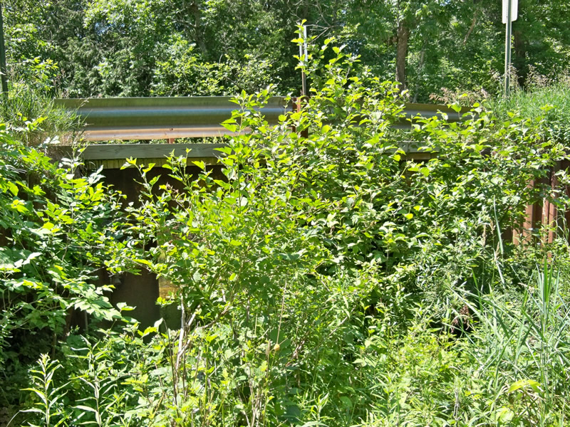
Inlet
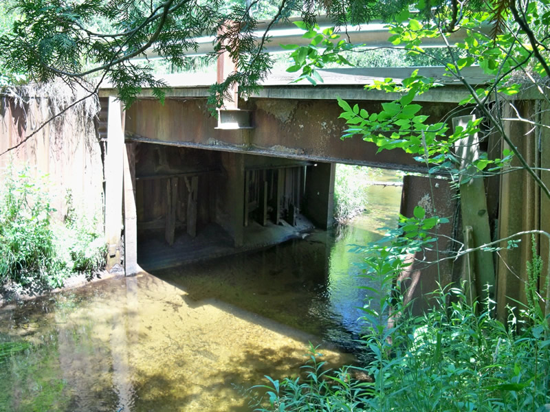
Outlet
Outlet
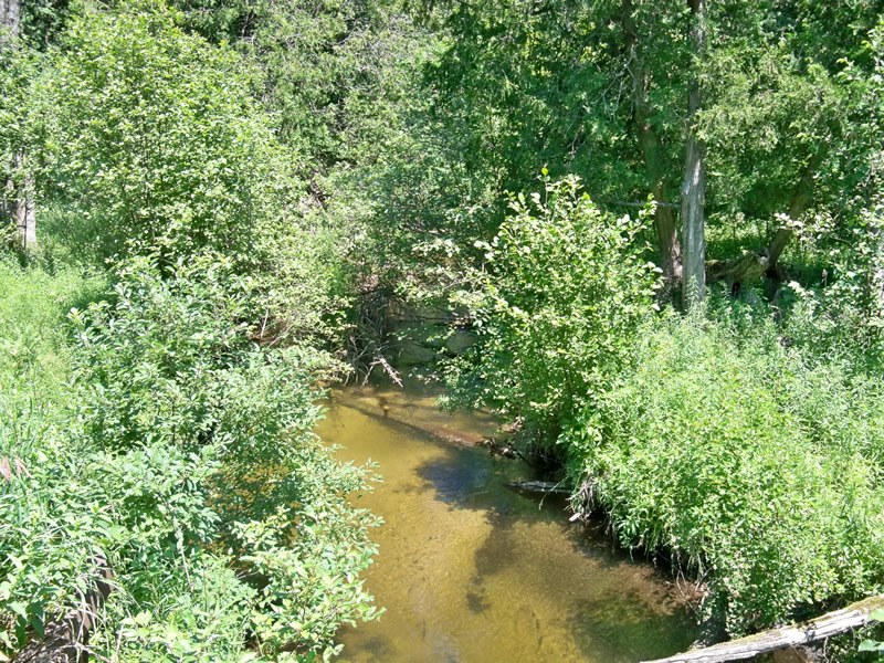
Upstream Conditions
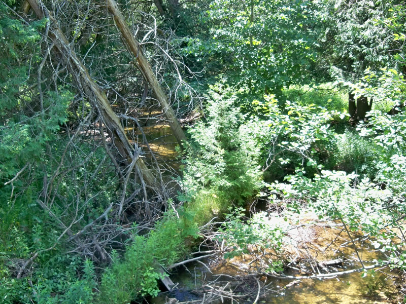
Downstream Conditions
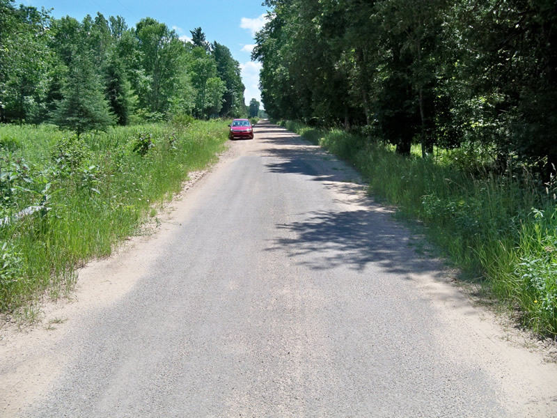
Road Approach - Left
Road Approach - Right
Crossing Information
Type of Crossing: Bridge
Structure Shape: Open Bottom Square/Rectangle
Inlet Type: Wingwall 30-70 Degree
Outlet Type: Cascade over Riprap
Structure Material: Metal
Structure Substrate: Mixture
General Conditions: Fair
Structure Interior: smooth
Dimensions of Structure: Length 16 ft.
, Width 19 ft.
, Height 8 ft.
Structure Inlet
Water Depth: 1.5 ft.
Water Velocity*: 1.1 ft./sec.
Structure Outlet
Water Depth: 1.5 ft.
Water Velocity*: 1.3 ft./sec.
*Water Velocities were measured 1 ft. below Surface
(with Meter)
Stream Information
Stream Flow: Less than Bankfull
Riffle Information
Water Depth: 1.3 ft.
Bankfull Width: 21 ft.
Wetted Width: 15 ft.
Water Velocity: 0.9 ft./sec.
(Measured with Meter)
Dominant Substrate: Sand
Road Information
Gravel
County Road
Road Condition: Good
Road Width at Culvert: 16 ft.
Location of Low Point: Other
Runoff Path: Roadway
Slope: Vertical
Slope: Vertical
Approaches
Left Approach
Length: 305 ft.
Slope: Less Than 1%
Vegetation: Heavy
LS Factor: 0.05
Erosion: 0.0672 tons/year
Right Approach
Length: 235 ft.
Slope: Less Than 1%
Vegetation: Heavy
LS Factor: 0.05
Erosion: 0.0518 tons/year
Erosion Information
Total Erosion at Crossing: 0.4039 tons/year
Extent of Erosion: Moderate
Erosion is occurring and corrective actions can be installed to address the problem.
Notes:
Bridge bumpers intact. When bridge is eventually replaced, the approaches will need to be paved.
Right Approach
150 ft.
23 ft.
0.1 ft.
yes
Sand
0.1155
Summary Information
Erosion is an area of concern for this site.
�