Road Stream Crossing Site PM_L035
Pere Marquette River Watershed, Middle Branch
72nd St
Chase Twp,
Lake County
Information collected by:
Site Location
GPS Coordinates: 43.85893
, -85.60835
T17N
R11W
Sec 15
Owned by Private
Fish Passability 0.9
Total Erosion: 3.1593 tons/year
Severity: Severe
Year Inventoried: 2014
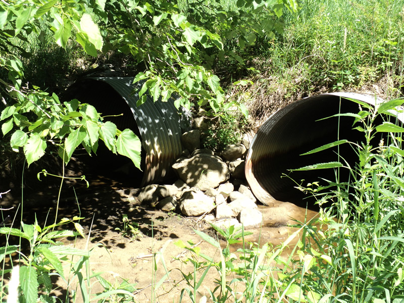
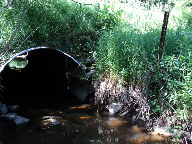
Inlet
Outlet
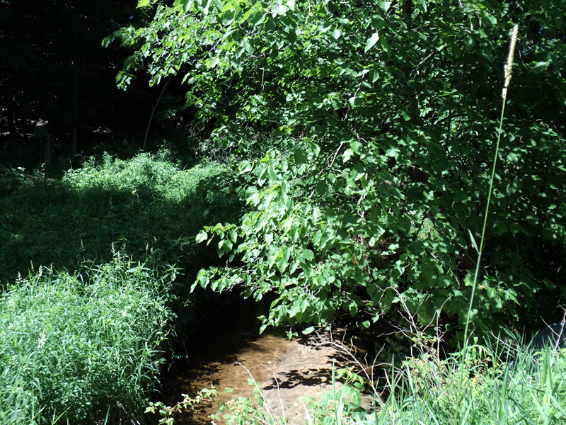
Upstream Conditions
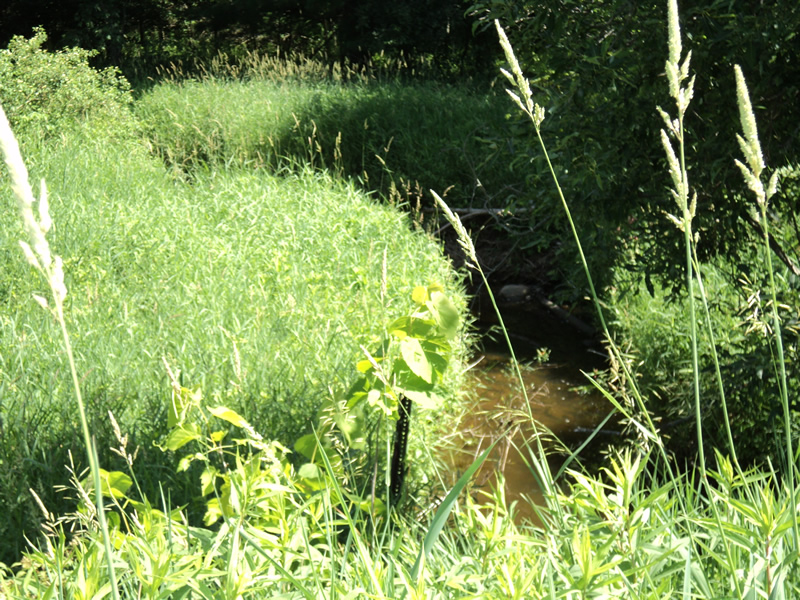
Downstream Conditions
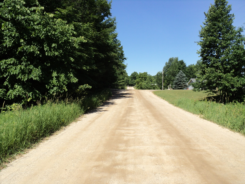
Road Approach - Left
Road Approach - Right
Crossing Information
Type of Crossing: culvert(s)
Number of Structures: 2
Structure Shape: Pipe Arch
Inlet Type: Projecting
Outlet Type: At Stream Grade
Structure Material: Metal
Structure Substrate: Sand
General Conditions: Fair
Multiple Culverts/Spans | ||||
Culvert/Span | Width | Length | Height | Material |
1 |
7 ft. |
75 ft. |
6 ft. |
Metal |
2 |
7 ft. |
75 ft. |
6 ft. |
Metal |
Structure Interior: corrugated
Dimensions of Structure: Length 75 ft.
, Width 7 ft.
, Height 6 ft.
Structure Inlet
Water Depth: 0.4 ft.
Embedded Depth of Structure: 0.3 ft.
Water Velocity*: 0.1 ft./sec.
Structure Outlet
Water Depth: 1.1 ft.
Embedded Depth of Structure: 0.4 ft.
Water Velocity*: 0.1 ft./sec.
*Water Velocities were measured 0.2 ft. below Surface
(with Meter)
Additional Comments
culvert #1 is dry and 1/4 filled with sand-water only reaches intermittently
Stream Information
Stream Flow: Less than 1/2 Bankfull
Riffle Information
Water Depth: 0.3 ft.
Bankfull Width: 8 ft.
Wetted Width: 7 ft.
Water Velocity: 0.6 ft./sec.
(Measured with Meter)
Dominant Substrate: Gravel
Road Information
Gravel
County Road
Road Condition: Fair
Road Width at Culvert: 22 ft.
Location of Low Point: At Stream
Runoff Path: Ditch
Embankments
Upstream
Fill Depth: 8 ft.
Slope: 1:1.5
Downstream
Fill Depth: 10 ft.
Slope: 1:1.5
Approaches
Left Approach
Length: 160 ft.
Slope: 1% to 5%
Vegetation: Heavy
LS Factor: 0.406
Erosion: 0.3937 tons/year
Right Approach
Length: 320 ft.
Slope: 6% to 10%
Vegetation: Heavy
LS Factor: 1.426
Erosion: 2.7656 tons/year
Erosion Information
Total Erosion at Crossing: 3.1593 tons/year
Location of Erosion | Erosion Dimensions | Eroded Material | Material Eroded | Total Erosion | ||
facing downstream | Length | Width | Depth | Reaching Stream? | (tons/year) | |
Left Approach |
160 ft. |
1 ft. |
0.1 ft. |
yes |
Sand |
|
Right Approach |
320 ft. |
1 ft. |
0.1 ft. |
yes |
Sand |
|
Summary Information
Fish Passability 0.9
�