Road Stream Crossing Site PM_L082
Pere Marquette River Watershed, Sanborn Creek
Kings Highway
Cherry Valley Twp,
Lake County
Information collected by:
Site Location
GPS Coordinates: 43.908931
, -85.711985
T18N
R12W
Sec 35
Owned by Private
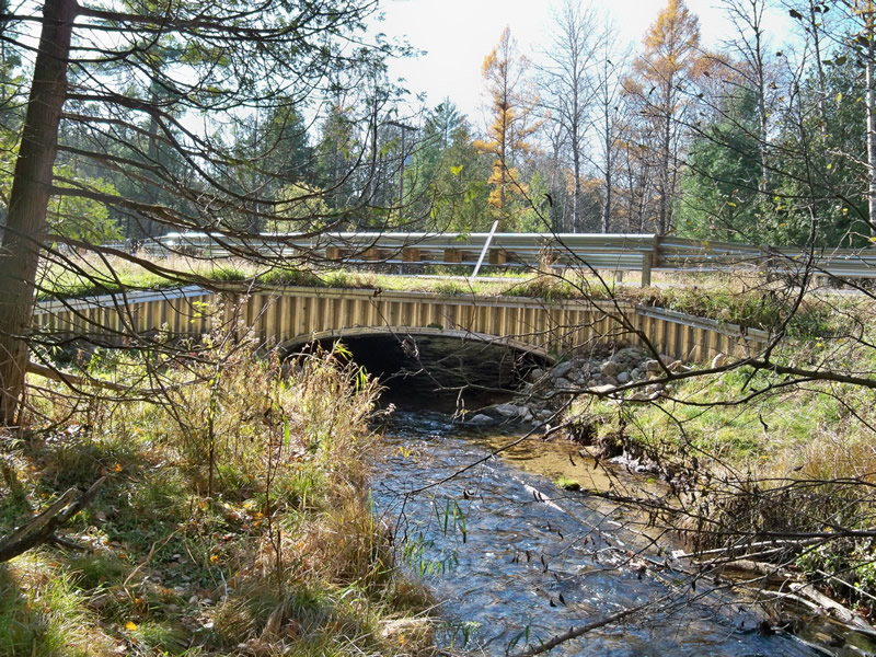
Inlet
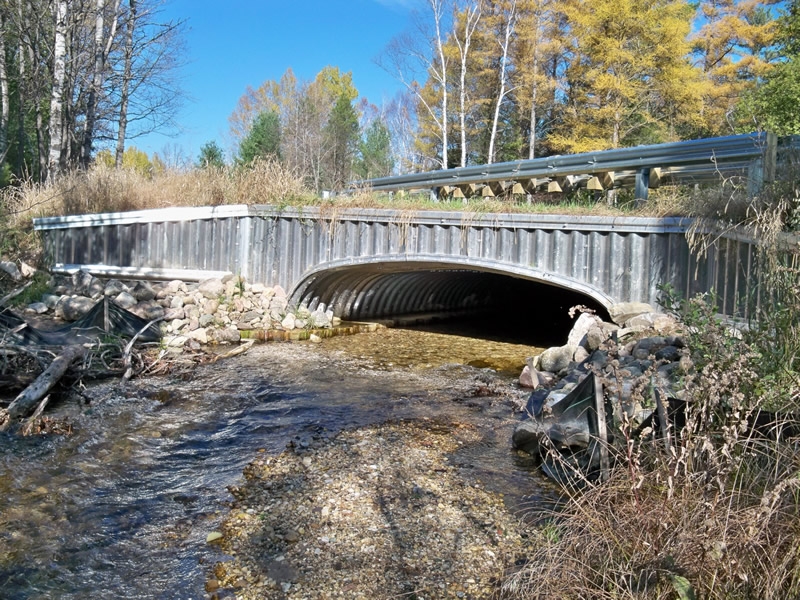
Outlet
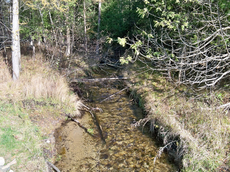
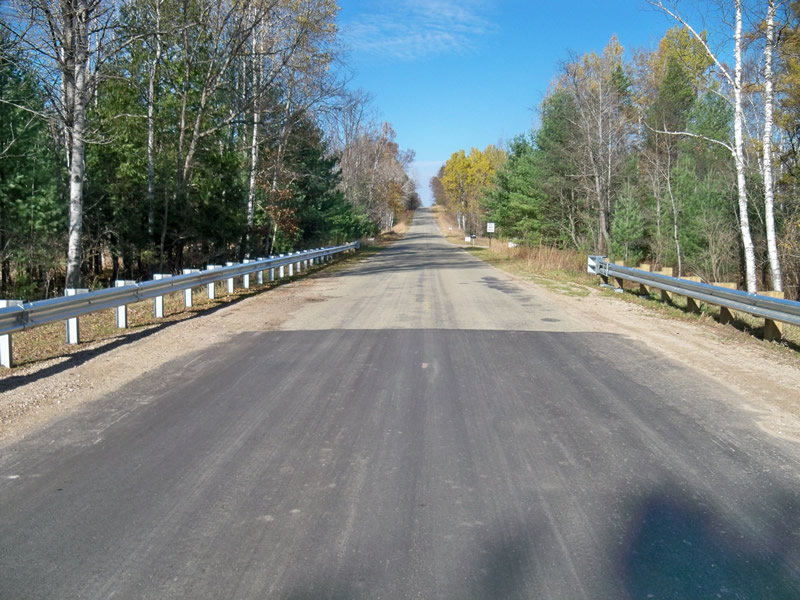
Upstream Conditions
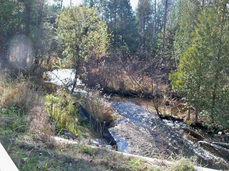
Downstream Conditions
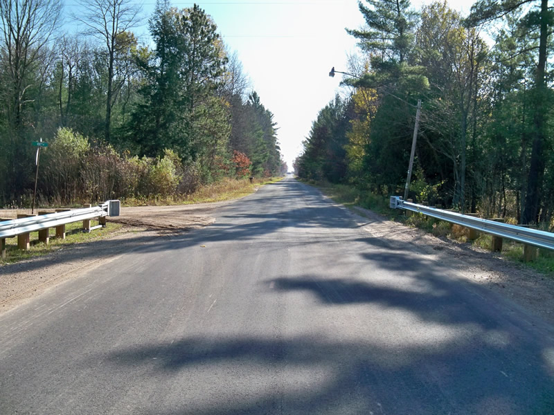
Road Approach - Left
Road Approach - Right
Crossing Information
Type of Crossing: culvert(s)
Number of Structures: 1
Structure Shape: Open Bottom Arch
Inlet Type: Headwall
Outlet Type: At Stream Grade
Structure Material: Metal
Structure Substrate: Gravel
General Conditions: New
Structure Interior: corrugated
Dimensions of Structure: Length 58.5 ft.
, Width 16.2 ft.
, Height 5.1 ft.
Structure Inlet
Water Depth: 1.5 ft.
Water Velocity*: 1.5 ft./sec.
Structure Outlet
Water Depth: 0.7 ft.
Water Velocity*: 1.5 ft./sec.
*Water Velocities were measured at the Surface
(with Float Test)
Additional Comments
Crossing replacement completed in 2011 with USFS ARRA $ & Road Commission match, under partnership with CRA.
Stream Information
Stream Flow: Less than Bankfull
Riffle Information
Water Depth: 0.5 ft.
Bankfull Width: 12 ft.
Wetted Width: 11 ft.
Water Velocity: 1.3 ft./sec.
(Measured with Float Test)
Dominant Substrate: Gravel
Road Information
Paved
County Road
Road Condition: Good
Road Width at Culvert: 23 ft.
Location of Low Point: At Stream
Runoff Path: Roadway
Embankments
Upstream
Fill Depth: 1 ft.
Slope: 1:2
Downstream
Fill Depth: 1 ft.
Slope: 1:2
Approaches
Left Approach
Length: 280 ft.
Slope: Less Than 1%
Vegetation: Heavy
LS Factor: 0.05
Erosion: 0.0106 tons/year
Right Approach
Length: 800 ft.
Slope: 1% to 5%
Vegetation: Heavy
LS Factor: 0.55
Erosion: 0.3345 tons/year
Erosion Information
Total Erosion at Crossing: 0.3452 tons/year
Extent of Erosion: Stabilized
Notes:
2 spillways to handle runoff were constructed.
Summary Information
Erosion is an area of concern for this site.
�