Road Stream Crossing Site PM_M005
Pere Marquette River Watershed, Big South Branch tributary
Wilson Rd
Custer Twp,
Mason County
Information collected by:
Site Location
GPS Coordinates: 43.91731
, -86.182811
T18N
R16W
Sec 26
Owned by Private
Structure is NOT Perched
Total Erosion: 2.3767 tons/year
Severity: Severe
Year Inventoried: 2014
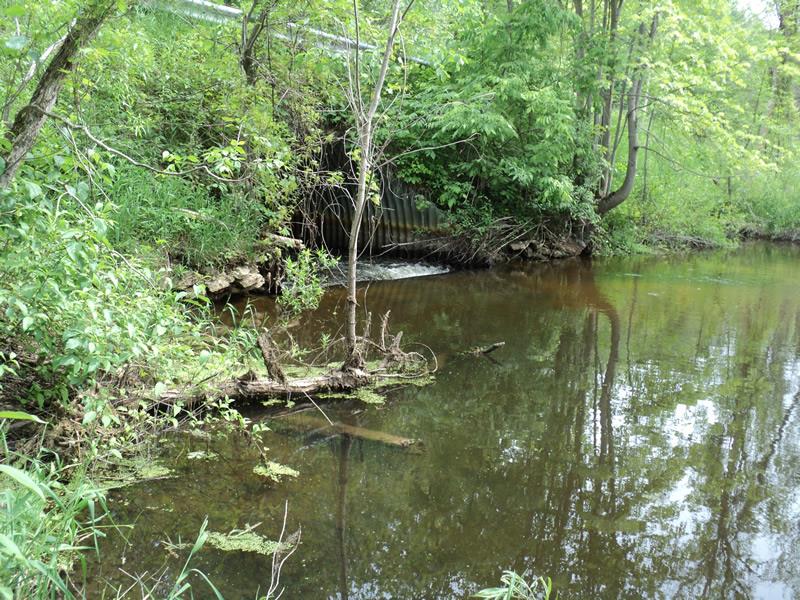
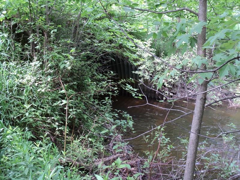
Inlet
Outlet
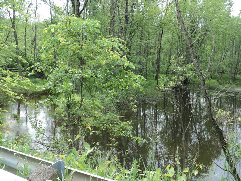
Upstream Conditions
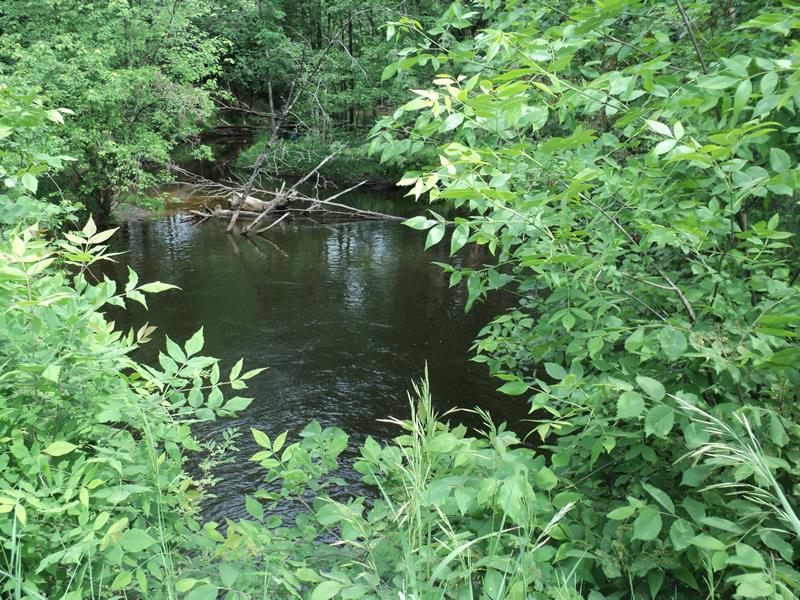
Downstream Conditions
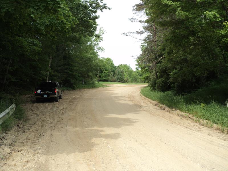
Road Approach - Left
Road Approach - Right
Erosion
Crossing Information
Type of Crossing: culvert(s)
Number of Structures: 1
Structure Shape: Pipe Arch
Inlet Type: Mitered
Outlet Type: At Stream Grade
Structure Material: Metal
Structure Substrate: None
General Conditions: Fair
Structure Interior: corrugated
Dimensions of Structure: Length 30 ft.
, Width 12 ft.
, Height 9 ft.
Percentage Crushed:
Inlet: 1% to 25%
Outlet: 0%
In Pipe: 0%
Structure is NOT Perched
Structure Inlet
Water Depth: 1.6 ft.
Embedded Depth of Structure: 0 ft.
Water Velocity*: 3 ft./sec.
Structure Outlet
Water Depth: 1.9 ft.
Embedded Depth of Structure: 0 ft.
Water Velocity*: 1.9 ft./sec.
*Water Velocities were measured 0.5 ft. below Surface
(with Meter)
Stream Information
Stream Flow: Bankfull
Scour Pool: Length 0 ft.
, Width 0 ft.
, Depth 0 ft.
Upstream Pond: Length 255 ft.
, Width 100 ft.
, Depth 4 ft.
Riffle Information
Water Depth: 1.5 ft.
Bankfull Width: 50 ft.
Wetted Width: 40 ft.
Water Velocity: 2 ft./sec.
(Measured with Meter)
Dominant Substrate: Sand
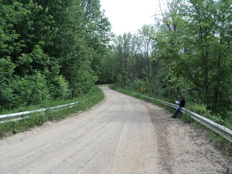
Road Information
Gravel
County Road
Road Condition: Fair
Road Width at Culvert: 22 ft.
Location of Low Point: Other
Runoff Path: Roadway
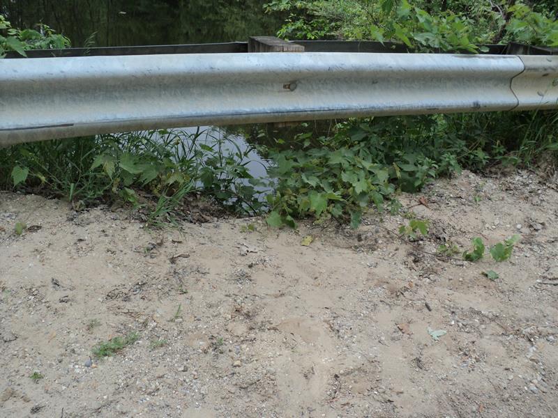
Embankments
Upstream
Fill Depth: 1.5 ft.
Slope: 1:1
Downstream
Fill Depth: 3 ft.
Slope: 1:1
Approaches
Left Approach
Length: 285 ft.
Slope: 6% to 10%
Vegetation: Heavy
LS Factor: 1.376
Erosion: 2.3767 tons/year
Right Approach
Length: 0 ft.
Slope: Less Than 1%
Vegetation: Heavy
LS Factor: 0.05
Erosion: 0 tons/year
Erosion Information
Total Erosion at Crossing: 2.3767 tons/year
Extent of Erosion: Moderate
Summary Information
Erosion is an area of concern for this site.
Yes, fish passage may be restricted due to metal upstream lip on culvert and gravel erosion washing out from roadway.
A future visit to this site is recommended.
Yes, work on runoff from road to stream and metal upstream lip on culvert.
�