Road Stream Crossing Site CHAR_EV03
Lake Charlevoix Watershed, Sears Creek
Sequanota Rd
Eveline Twp,
Charlevoix County
Information collected by:
Site Location
GPS Coordinates: 45.24374
, -85.20168
T33N
R07W
Sec 20
Owned by Private
Structure is NOT Perched
Total Erosion: 1.2694 tons/year
Severity: Moderate
Year Inventoried: 2011
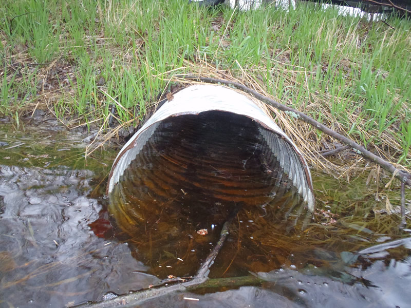
Inlet
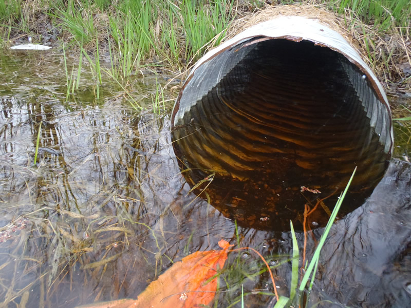
Outlet
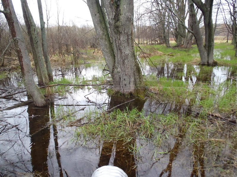
Upstream Conditions
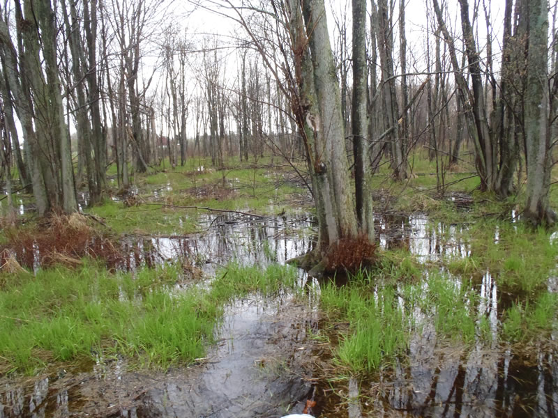
Downstream Conditions
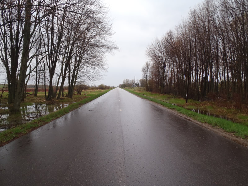
Road Approach - Left
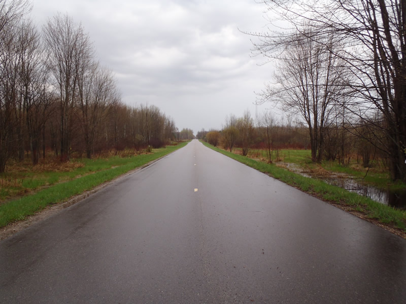
Road Approach - Right
Crossing Information
Type of Crossing: culvert(s)
Number of Structures: 1
Structure Shape: Round
Inlet Type: Projecting
Outlet Type: At Stream Grade
Structure Material: Metal
Structure Substrate: None
General Conditions: Good
Structure Interior: corrugated
Dimensions of Structure: Length 55 ft.
, Width 2 ft.
, Height 2 ft.
Structure is NOT Perched
Structure Inlet
Water Depth: 1.21 ft.
Embedded Depth of Structure: 0 ft.
Water Velocity*: 0 ft./sec.
Structure Outlet
Water Depth: 1.18 ft.
Embedded Depth of Structure: 0 ft.
Water Velocity*: 0 ft./sec.
*Water Velocities were measured 0.6 ft. below Surface
(with Meter)
Additional Comments
Marsh upsteam and downstream of culvert
Stream Information
Stream Flow: None
Dominant Substrate: Organics
Road Information
Paved
Town Road
Road Condition: Good
Road Width at Culvert: 24 ft.
Location of Low Point: At Stream
Runoff Path: Ditch
Embankments
Upstream
Fill Depth: 4 ft.
Slope: More than 1:2
Downstream
Fill Depth: 4 ft.
Slope: 1:2
Approaches
Left Approach
Length: 1000 ft.
Slope: 1% to 5%
Vegetation: Partial
LS Factor: 0.8
Erosion: 0.6347 tons/year
Right Approach
Length: 1000 ft.
Slope: 1% to 5%
Vegetation: Partial
LS Factor: 0.8
Erosion: 0.6347 tons/year
Erosion Information
Total Erosion at Crossing: 1.2694 tons/year
Summary Information
�