Road Stream Crossing Site PM_M165
Pere Marquette River Watershed, Pere Marquette tributary
US-31
Amber Twp,
Mason County
Information collected by:
Site Location
GPS Coordinates: 43.95486
, -86.30433
T18N
R17W
Sec 14
Owned by Local Government
Total Erosion: 1.8351 tons/year
Severity: Severe
Year Inventoried: 2014
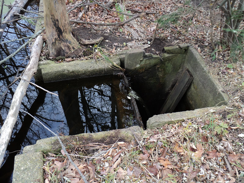
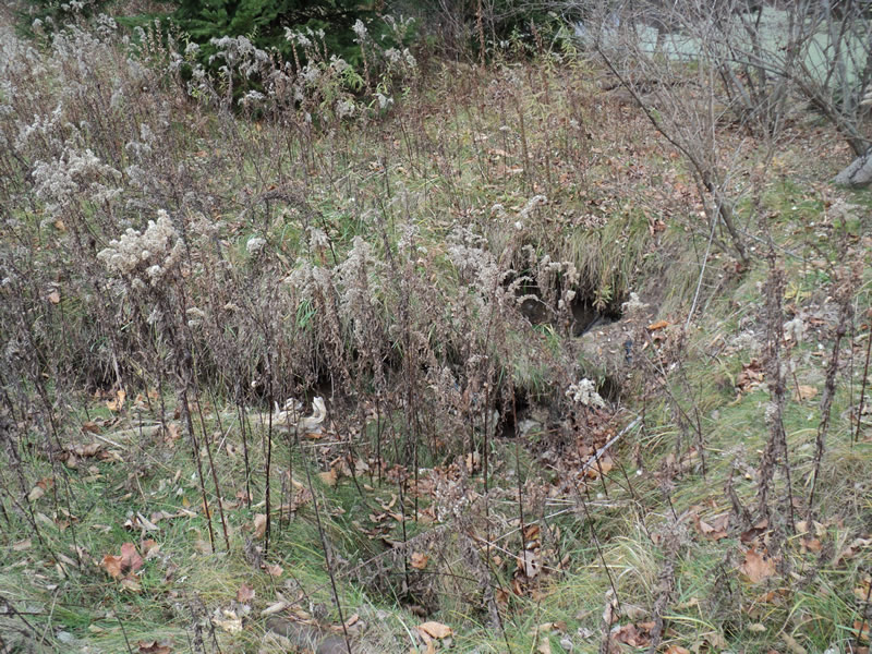
Inlet

Inlet
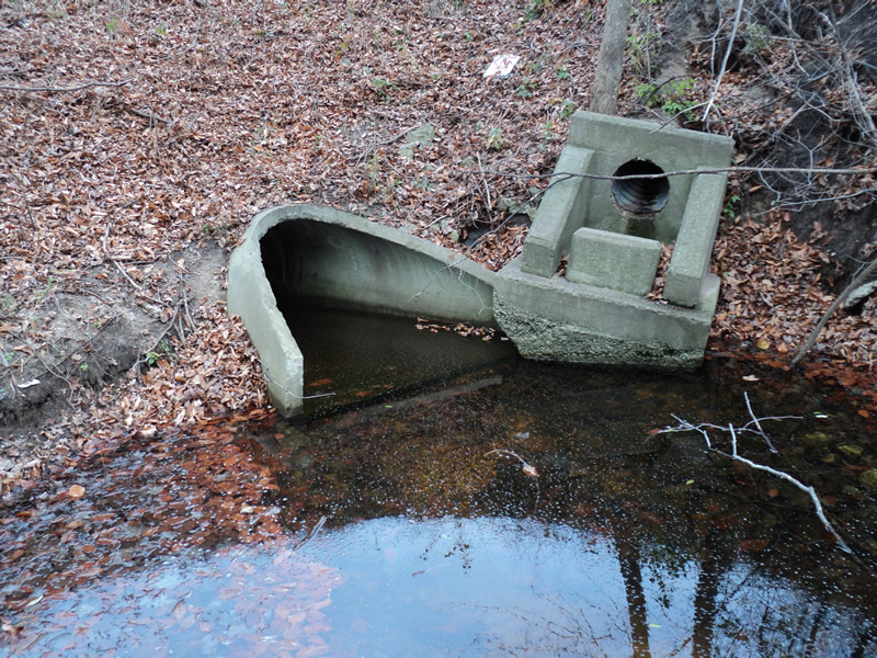
Outlet

Upstream Conditions
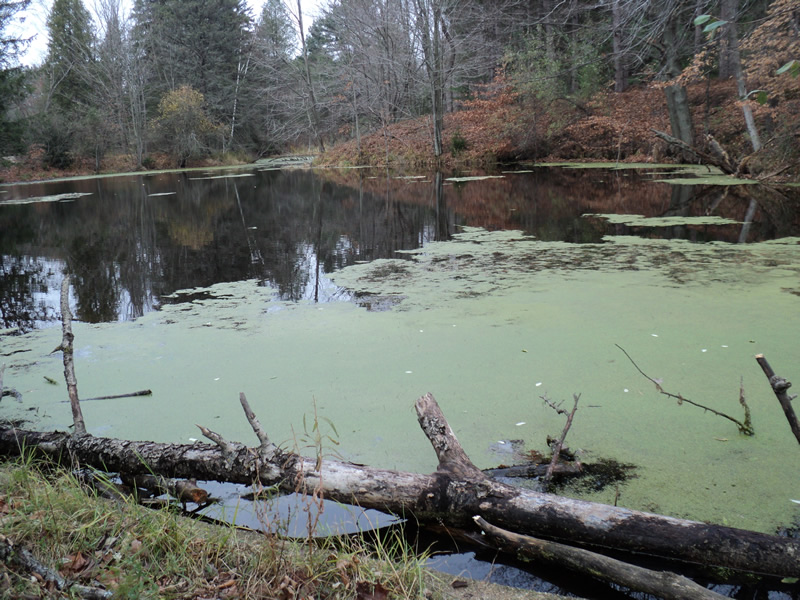
Upstream Conditions
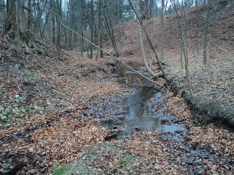
Downstream Conditions
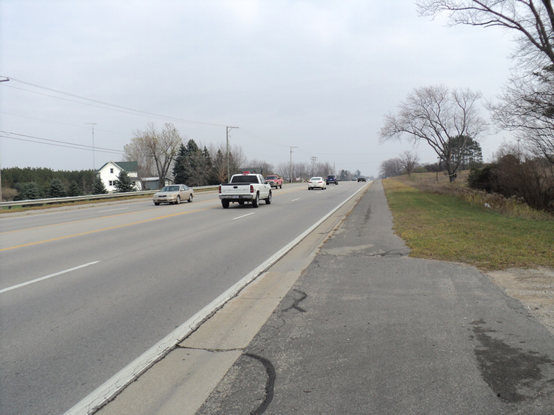
Road Approach - Left
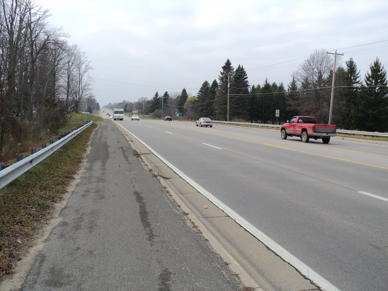
Road Approach - Right
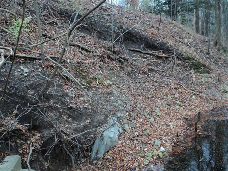
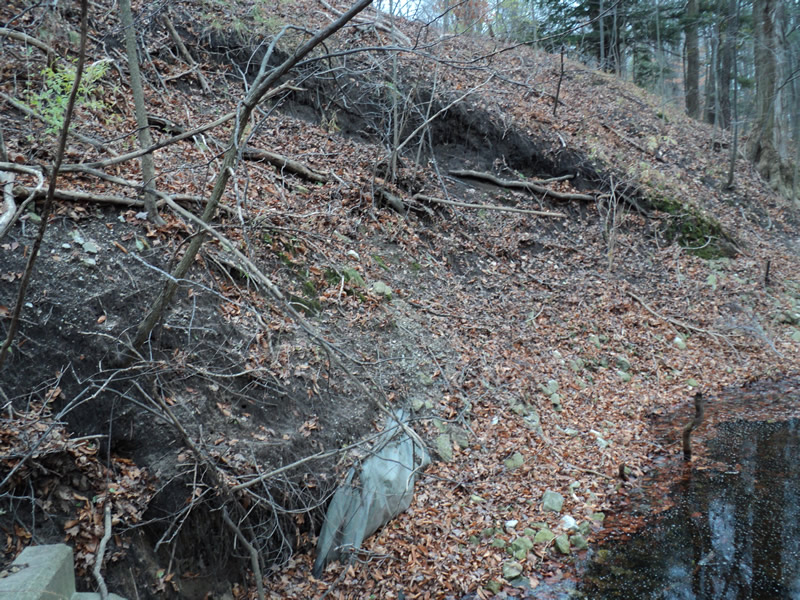
Erosion
Erosion
Erosion

Erosion
Crossing Information
Type of Crossing: culvert(s)
Number of Structures: 1
Structure Shape: Round
Inlet Type: Other
Outlet Type: Outlet Apron
Structure Material: Concrete
Structure Substrate: None
General Conditions: Poor
Structure Interior: smooth
Dimensions of Structure: Length 240 ft.
, Width 3 ft.
, Height 3 ft.
Structure Inlet
Water Depth: 0.1 ft.
Water Velocity*: 3 ft./sec.
Structure Outlet
Water Depth: 0.5 ft.
Water Velocity*: 0.1 ft./sec.
*Water Velocities were measured at the Surface
(with Meter)
Additional Comments
Inlet is an open top concrete box drain that drains a large pond upstream. Pond size and inlet water measurements are estimated.
Stream Information
Stream Flow: Less than 1/2 Bankfull
Upstream Pond: Length 300 ft.
, Width 300 ft.
, Depth 5 ft.
Riffle Information
Water Depth: 0.2 ft.
Bankfull Width: 10 ft.
Wetted Width: 3 ft.
Water Velocity: 0.3 ft./sec.
(Measured with Meter)
Dominant Substrate: Gravel
Road Information
Paved
Federal Road
Road Condition: Good
Road Width at Culvert: 68 ft.
Location of Low Point: Other
Runoff Path: Roadway
Embankments
Upstream
Fill Depth: 28 ft.
Slope: 1:1
Downstream
Fill Depth: 32 ft.
Slope: 1:1
Approaches
Left Approach
Length: 300 ft.
Slope: 1% to 5%
Vegetation: Heavy
LS Factor: 0.46
Erosion: 0.3102 tons/year
Right Approach
Length: 300 ft.
Slope: Less Than 1%
Vegetation: Heavy
LS Factor: 0.05
Erosion: 0.0337 tons/year
Erosion Information
Total Erosion at Crossing: 1.8351 tons/year
Extent of Erosion: Severe
Location of Erosion | Erosion Dimensions | Eroded Material | Material Eroded | Total Erosion | ||
facing downstream | Length | Width | Depth | Reaching Stream? | (tons/year) | |
Right Upstream Embankment |
12 ft. |
6 ft. |
3 ft. |
no |
Loam |
0.6336 |
Left Upstream Embankment |
8 ft. |
2 ft. |
2 ft. |
no |
Loam |
0.2816 |
Left Downstream Streambank |
10 ft. |
10 ft. |
1 ft. |
yes |
Sandy Loam |
0.192 |
Right Downstream Streambank |
20 ft. |
20 ft. |
1 ft. |
yes |
Sandy Loam |
0.384 |
Summary Information
Erosion is an area of concern for this site.
A future visit to this site is recommended.
Erosion and very dangerous inlet.
�