Road Stream Crossing Site Mu-002
Muskegon River Watershed, Haymarsh Creek
Nelson Rd
Enterprise Twp,
Missaukee County
Information collected by:
Site Location
GPS Coordinates: 44.41224
, -84.97365
T23N
R5W
Sec 6
Owned by State
Structure is NOT Perched
Total Erosion: 0.3274 tons/year
Severity: Moderate
Year Inventoried: 2014
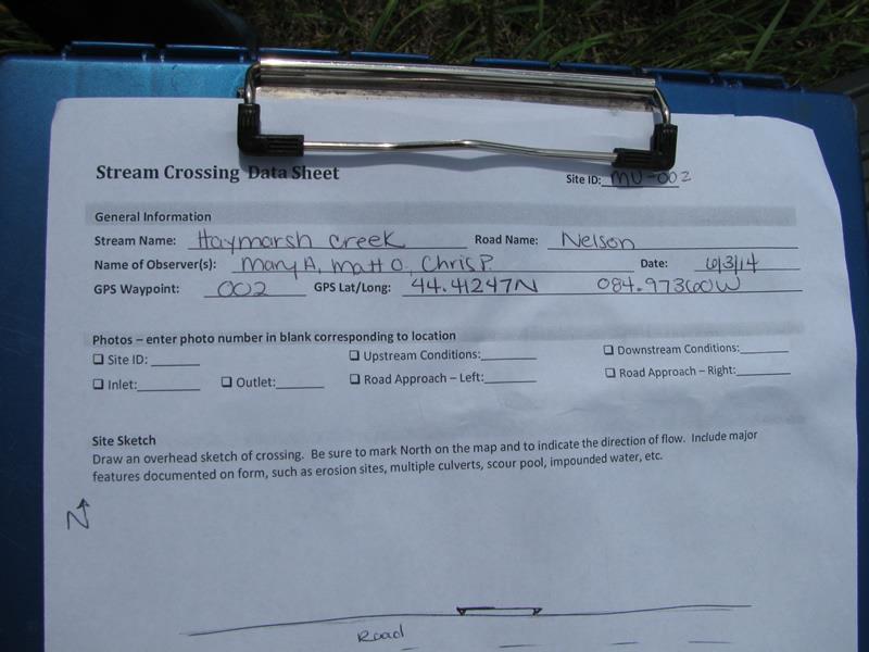
Site ID
Inlet
Outlet

Upstream Conditions
Downstream Conditions
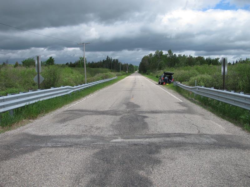
Road Approach - Left
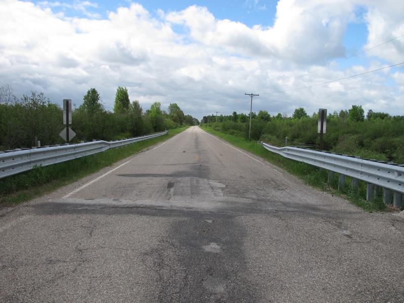
Road Approach - Right
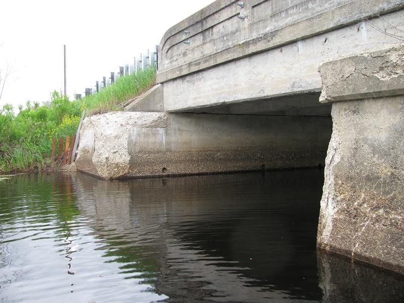
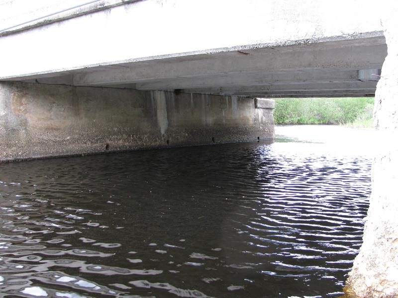
Crossing Information
Type of Crossing: culvert(s)
Number of Structures: 1
Structure Shape: Open Bottom Square/Rectangle
Inlet Type: Other
Outlet Type: At Stream Grade
Structure Material: Concrete
Structure Substrate: Sand
General Conditions: Fair
Structure Interior: smooth
Dimensions of Structure: Length 28 ft.
, Width 19 ft.
, Height 11 ft.
Structure is NOT Perched
Structure Inlet
Water Depth: 5.5 ft.
Embedded Depth of Structure: 0 ft.
Water Velocity*: 0.2 ft./sec.
Structure Outlet
Water Depth: 5.5 ft.
Embedded Depth of Structure: 0 ft.
Water Velocity*: 0.2 ft./sec.
*Water Velocities were measured at the Surface
(with Meter)
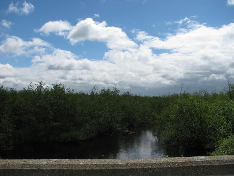
Stream Information
Stream Flow: Less than Bankfull
Upstream Pond: Length 60 ft.
, Width 90 ft.
, Depth 6 ft.
Riffle Information
Water Depth: 3.5 ft.
Bankfull Width: 37 ft.
Wetted Width: 32 ft.
Water Velocity: 0.2 ft./sec.
(Measured with Meter)
Dominant Substrate: Sand
Road Information
Paved
County Road
Road Condition: Fair
Road Width at Culvert: 25 ft.
Location of Low Point: Other
Runoff Path: Roadway
Fill Depth: 0 ft.
Slope: Vertical
Fill Depth: 0 ft.
Slope: Vertical
Approaches
Left Approach
Length: 300 ft.
Slope: Less Than 1%
Vegetation: Heavy
LS Factor: 0.05
Erosion: 0.0124 tons/year
Right Approach
Length: 0 ft.
Slope: Less Than 1%
Vegetation: Heavy
LS Factor: 0.05
Erosion: 0 tons/year
Erosion Information
Total Erosion at Crossing: 0.3274 tons/year
Extent of Erosion: Moderate
Notes:
Crumbling abutment.
Location of Erosion | Erosion Dimensions | Eroded Material | Material Eroded | Total Erosion | ||
facing downstream | Length | Width | Depth | Reaching Stream? | (tons/year) | |
Right Upstream Embankment |
4 ft. |
6 ft. |
6 ft. |
yes |
Gravel |
0.168 |
Left Downstream Embankment |
3 ft. |
5 ft. |
3 ft. |
yes |
Gravel |
0.063 |
Left Upstream Embankment |
2 ft. |
6 ft. |
6 ft. |
yes |
Gravel |
0.084 |
Summary Information
Erosion is an area of concern for this site.
�