Road Stream Crossing Site Mu-006
Muskegon River Watershed, West Branch Muskegon River
M-55
Enterprise Twp,
Missaukee County
Information collected by:
Site Location
GPS Coordinates: 44.3359
, -84.92167
T23N
R5W
Sec 33
Owned by Private
Structure is NOT Perched
Total Erosion: 0.0372 tons/year
Severity: Moderate
Year Inventoried: 2014
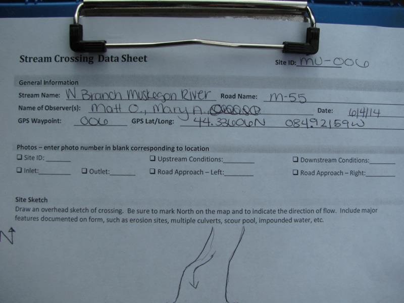
Site ID
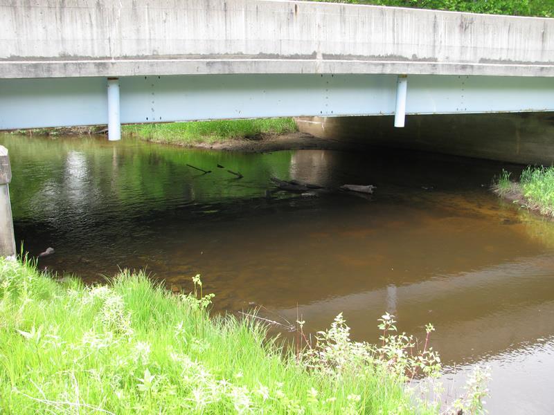
Inlet
Outlet
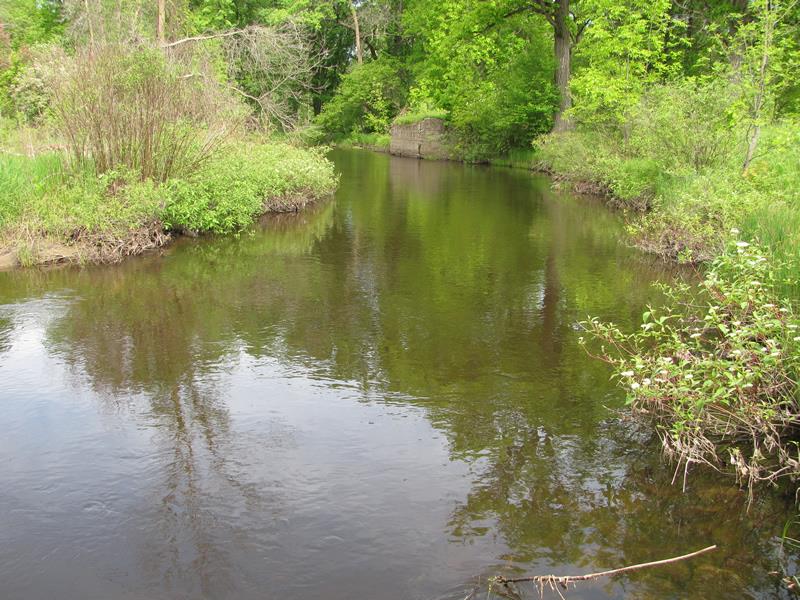
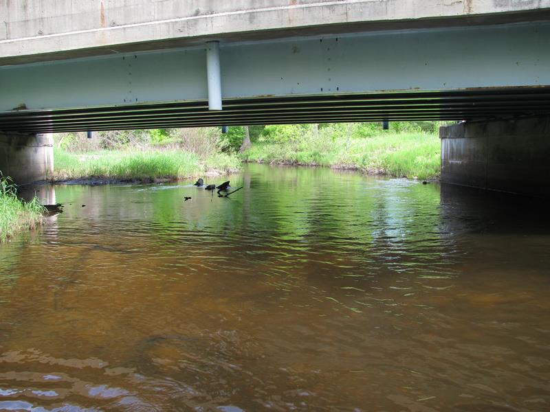
Upstream Conditions

Downstream Conditions
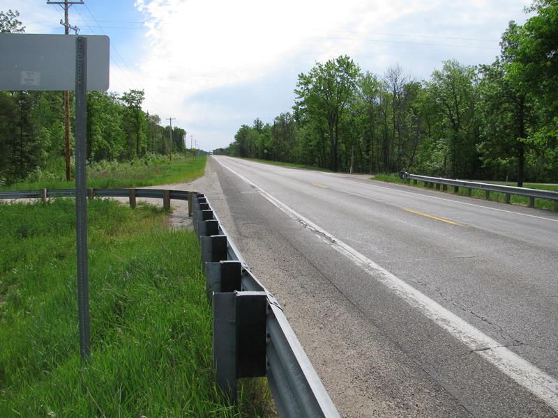
Road Approach - Left
Road Approach - Right
Other
Crossing Information
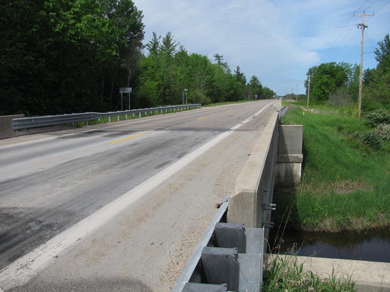
Type of Crossing: Bridge
Structure Shape: Open Bottom Square/Rectangle
Inlet Type: Other
Outlet Type: At Stream Grade
Structure Material: Concrete
Structure Substrate: Gravel
General Conditions: Good
Structure Interior: smooth
Dimensions of Structure: Length 36 ft.
, Width 56 ft.
, Height 8 ft.
Structure is NOT Perched
Structure Inlet
Water Depth: 1.5 ft.
Embedded Depth of Structure: 0 ft.
Water Velocity*: 2.2 ft./sec.
Structure Outlet
Water Depth: 1.4 ft.
Embedded Depth of Structure: 0 ft.
Water Velocity*: 1.5 ft./sec.
*Water Velocities were measured 1 ft. below Surface
(with Meter)
Stream Information
Stream Flow: Less than Bankfull
Scour Pool: Length 0 ft.
, Width 0 ft.
, Depth 0 ft.
Upstream Pond: Length 0 ft.
, Width 0 ft.
, Depth 0 ft.
Riffle Information
Water Depth: 1.4 ft.
Bankfull Width: 41.5 ft.
Wetted Width: 33.2 ft.
Water Velocity: 1.7 ft./sec.
(Measured with Meter)
Dominant Substrate: Gravel
Road Information
Paved
State Road
Road Condition: Good
Road Width at Culvert: 36 ft.
Location of Low Point: At Stream
Runoff Path: Roadway
Fill Depth: 0 ft.
Slope: Vertical
Fill Depth: 0 ft.
Slope: Vertical
Approaches
Left Approach
Length: 500 ft.
Slope: Less Than 1%
Vegetation: Heavy
LS Factor: 0.05
Erosion: 0.0298 tons/year
Right Approach
Length: 125 ft.
Slope: Less Than 1%
Vegetation: Heavy
LS Factor: 0.05
Erosion: 0.0074 tons/year
Erosion Information
Total Erosion at Crossing: 0.0372 tons/year
Extent of Erosion: Stabilized
Notes:
Eroding under bridge on right upstream side. Stabilized from high water event.
Location of Erosion | Erosion Dimensions | Eroded Material | Material Eroded | Total Erosion | ||
facing downstream | Length | Width | Depth | Reaching Stream? | (tons/year) | |
Right Upstream Embankment |
36 ft. |
11 ft. |
1.5 ft. |
yes |
Sand |
0 |
Summary Information
Erosion is an area of concern for this site.
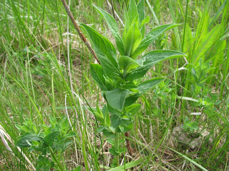
These non-native species were observerd at this site: purple loosestrife, 9 plants localized on left upstream streambank
�