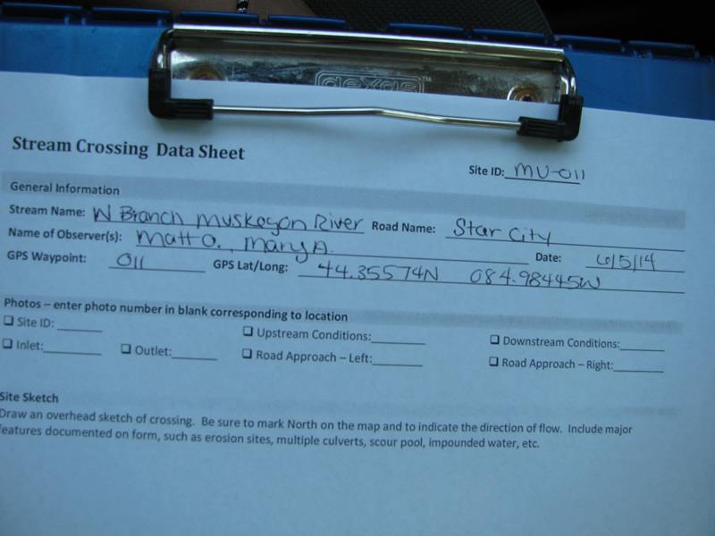
Road Stream Crossing Site Mu-011
Muskegon River Watershed, West Branch Muskegon River
Star City
West Branch Twp,
Missaukee County
Information collected by:
Site Location
GPS Coordinates: 44.35498
, -84.98465
T23N
R6W
Sec 25
Owned by Private
Structure is NOT Perched
Total Erosion: 0.4373 tons/year
Severity: Minor
Year Inventoried: 2014
Site ID
Inlet
Outlet
Upstream Conditions
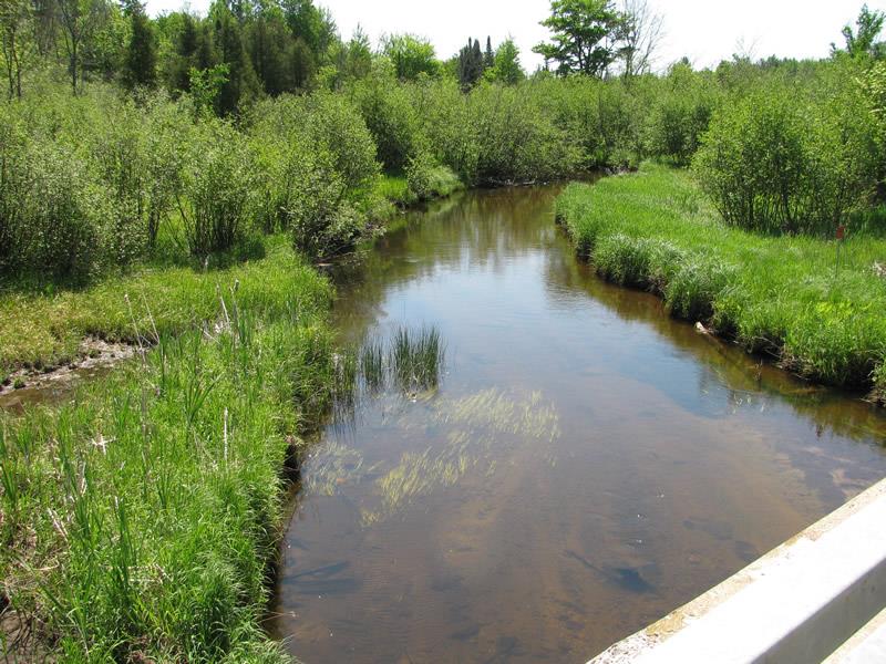
Downstream Conditions
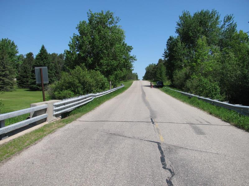
Road Approach - Left
Road Approach - Right
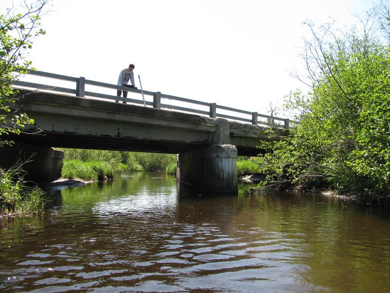
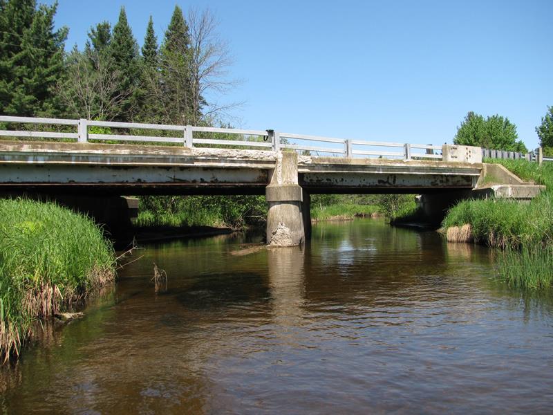
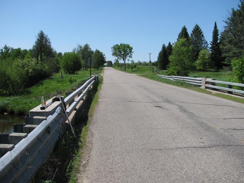
Crossing Information
Type of Crossing: Bridge
Structure Shape: Open Bottom Square/Rectangle
Inlet Type: Wingwall 30-70 Degree
Outlet Type: At Stream Grade
Structure Material: Concrete
Structure Substrate: Sand
General Conditions: Poor
Multiple Culverts/Spans | ||||
Culvert/Span | Width | Length | Height | Material |
1 |
32 ft. |
35 ft. |
8.1 ft. |
Concrete |
2 |
32 ft. |
30 ft. |
6.6 ft. |
Concrete |
Structure Interior: smooth
Dimensions of Structure: Length 65 ft.
, Width 32 ft.
, Height 8.1 ft.
Structure is NOT Perched
Structure Inlet
Water Depth: 2.2 ft.
Embedded Depth of Structure: 0 ft.
Water Velocity*: 1.2 ft./sec.
Structure Outlet
Water Depth: 2.1 ft.
Embedded Depth of Structure: 0 ft.
Water Velocity*: 1.3 ft./sec.
*Water Velocities were measured 1 ft. below Surface
(with Meter)
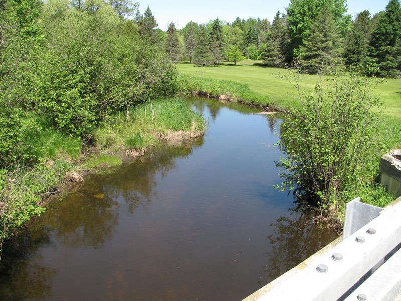
Stream Information
Stream Flow: Less than Bankfull
Riffle Information
Water Depth: 1.2 ft.
Bankfull Width: 28 ft.
Wetted Width: 25.5 ft.
Water Velocity: 1.5 ft./sec.
(Measured with Meter)
Dominant Substrate: Sand
Road Information
Paved
County Road
Road Condition: Good
Road Width at Culvert: 22 ft.
Location of Low Point: At Stream
Runoff Path: Roadway
Fill Depth: 0 ft.
Slope: Vertical
Fill Depth: 0 ft.
Slope: Vertical
Approaches
Left Approach
Length: 430 ft.
Slope: 1% to 5%
Vegetation: Heavy
LS Factor: 0.486
Erosion: 0.152 tons/year
Right Approach
Length: 710 ft.
Slope: 1% to 5%
Vegetation: Heavy
LS Factor: 0.537
Erosion: 0.277 tons/year
Erosion Information
Total Erosion at Crossing: 0.4373 tons/year
Extent of Erosion: Minor
Notes:
Minor undercutting at bend.
Location of Erosion | Erosion Dimensions | Eroded Material | Material Eroded | Total Erosion | ||
facing downstream | Length | Width | Depth | Reaching Stream? | (tons/year) | |
Left Upstream Streambank |
5 ft. |
2 ft. |
1.5 ft. |
yes |
Sand |
0.0083 |
Summary Information
Erosion is an area of concern for this site.
�