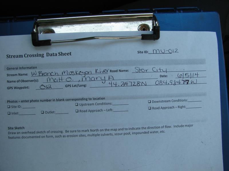
Road Stream Crossing Site Mu-012
Muskegon River Watershed, West Branch Muskegon River
Star City
West Branch Twp,
Missaukee County
Information collected by:
Site Location
GPS Coordinates: 44.34736
, -84.98481
T23N
R6W
Sec 36
Owned by Private
Structure is NOT Perched
Total Erosion: 0.2915 tons/year
Severity: Moderate
Year Inventoried: 2014
Site ID
Inlet
Outlet
Upstream Conditions
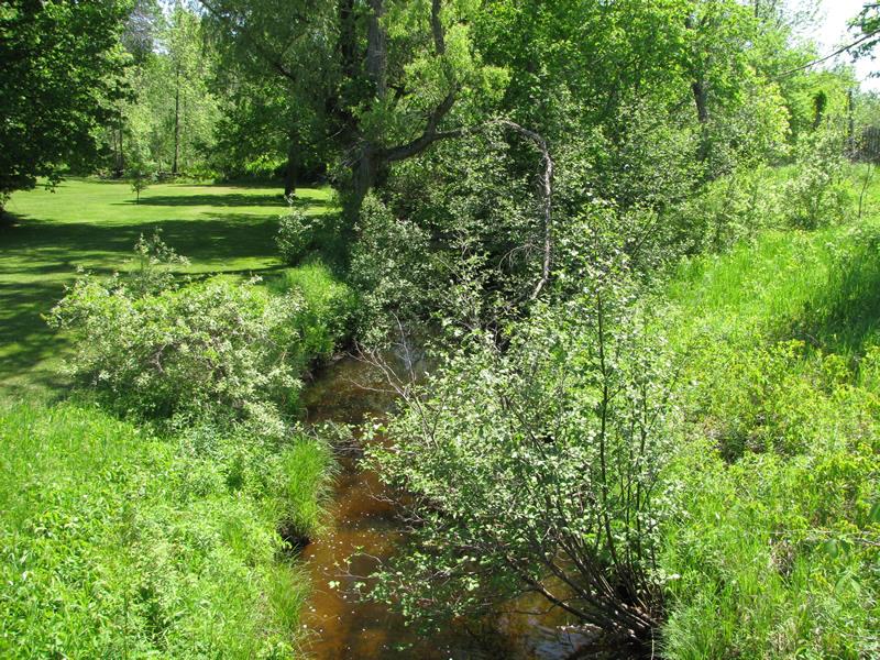
Downstream Conditions
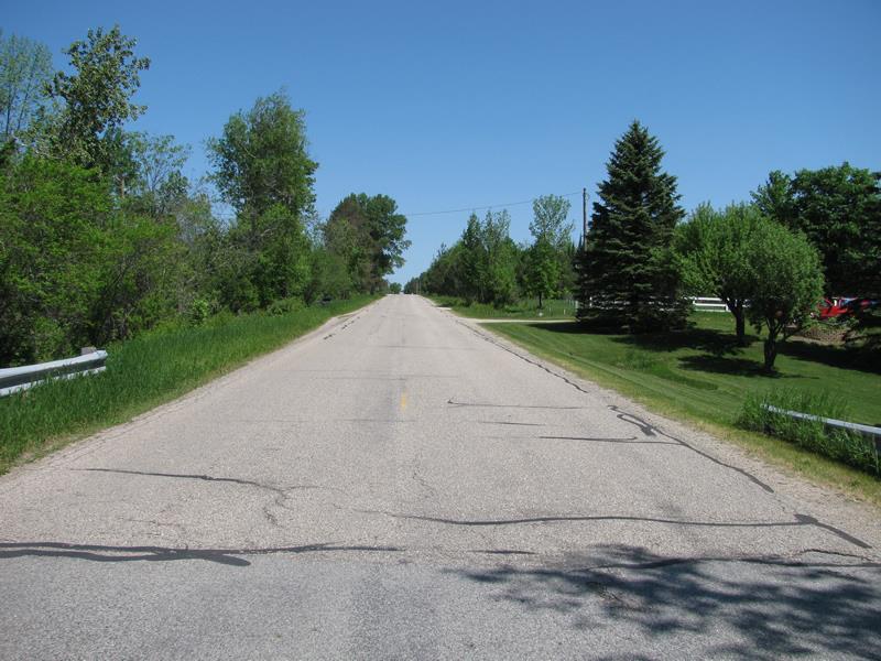
Road Approach - Left

Road Approach - Right
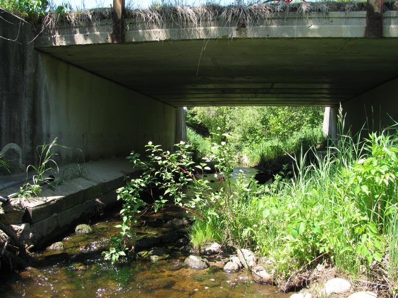
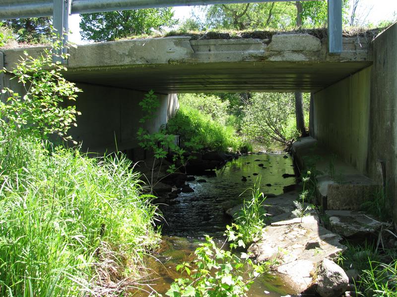
Crossing Information
Type of Crossing: culvert(s)
Number of Structures: 1
Structure Shape: Open Bottom Square/Rectangle
Inlet Type: Other
Outlet Type: At Stream Grade
Structure Material: Concrete
Structure Substrate: Rock
General Conditions: Poor
Structure Interior: smooth
Dimensions of Structure: Length 30 ft.
, Width 17 ft.
, Height 7.6 ft.
Structure is NOT Perched
Structure Inlet
Water Depth: 0.6 ft.
Embedded Depth of Structure: 0 ft.
Water Velocity*: 1.3 ft./sec.
Structure Outlet
Water Depth: 0.4 ft.
Embedded Depth of Structure: 0 ft.
Water Velocity*: 1.2 ft./sec.
*Water Velocities were measured at the Surface
(with Meter)
Additional Comments
12.6 ft wide concrete embankment under culvert, right upstream inlet extra 3.5 ft concrete.
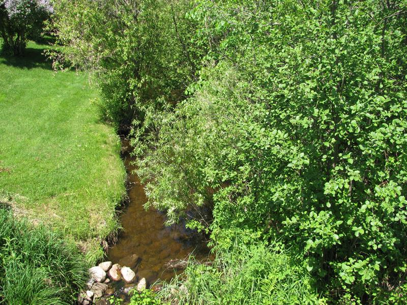
Stream Information
Stream Flow: Less than Bankfull
Riffle Information
Water Depth: 1 ft.
Bankfull Width: 12 ft.
Wetted Width: 10.5 ft.
Water Velocity: 0.2 ft./sec.
(Measured with Meter)
Dominant Substrate: Clay
Road Information
Paved
County Road
Road Condition: Fair
Road Width at Culvert: 22 ft.
Location of Low Point: At Stream
Runoff Path: Roadway
Fill Depth: 0 ft.
Slope: Vertical
Fill Depth: 0 ft.
Slope: Vertical
Approaches
Left Approach
Length: 250 ft.
Slope: 1% to 5%
Vegetation: Heavy
LS Factor: 0.44
Erosion: 0.08 tons/year
Right Approach
Length: 100 ft.
Slope: Less Than 1%
Vegetation: Heavy
LS Factor: 0.05
Erosion: 0.0036 tons/year
Erosion Information
Total Erosion at Crossing: 0.2915 tons/year
Extent of Erosion: Moderate
Location of Erosion | Erosion Dimensions | Eroded Material | Material Eroded | Total Erosion | ||
facing downstream | Length | Width | Depth | Reaching Stream? | (tons/year) | |
Right Upstream Streambank |
9 ft. |
2 ft. |
3 ft. |
yes |
Sand |
0.2079 |
Summary Information
Erosion is an area of concern for this site.
A future visit to this site is recommended.
Very poor structure conditions.
�