Road Stream Crossing Site Mu-020
Muskegon River Watershed, Butterfield Creek
Van Dermullen Rd
Reeder Twp,
Missaukee County
Information collected by:
Site Location
GPS Coordinates: 44.30684
, -85.13509
T22N
R7W
Sec 14
Owned by Private
Structure is NOT Perched
Total Erosion: 0.3947 tons/year
Severity: Minor
Year Inventoried: 2014
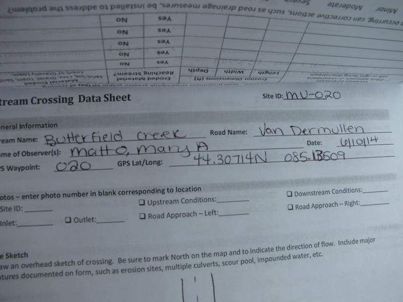
Site ID
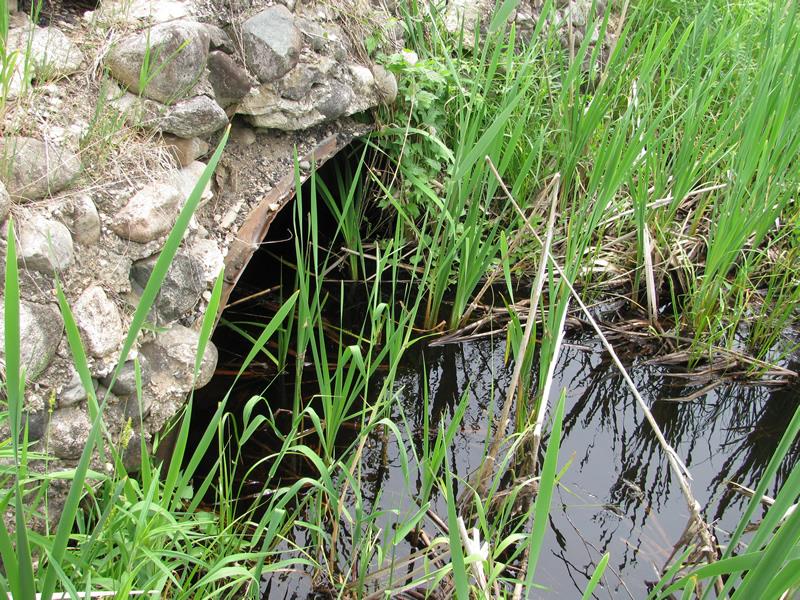
Inlet
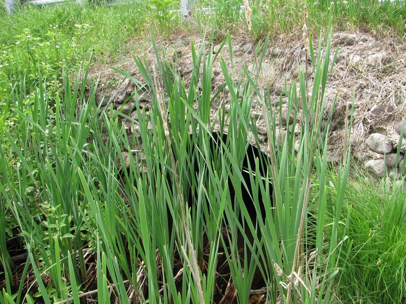
Outlet
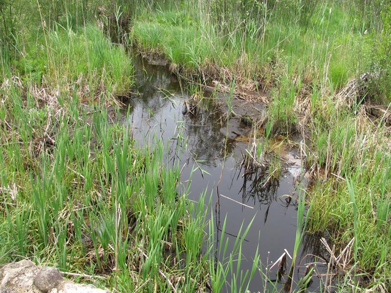
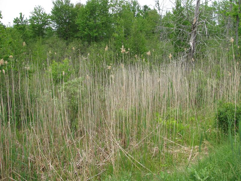
Upstream Conditions
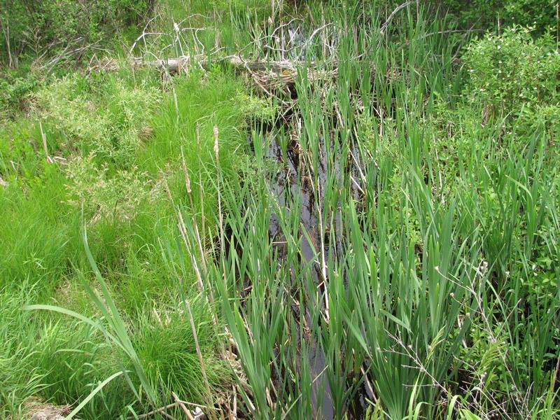
Downstream Conditions
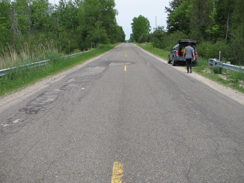
Road Approach - Left
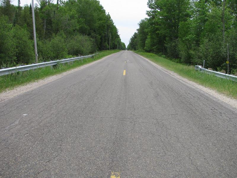
Road Approach - Right
Other
Crossing Information
Type of Crossing: culvert(s)
Number of Structures: 1
Structure Shape: Ellipse
Inlet Type: Headwall
Outlet Type: At Stream Grade
Structure Material: Metal
Structure Substrate: Mixture
General Conditions: Fair
Structure Interior: corrugated
Dimensions of Structure: Length 45 ft.
, Width 6 ft.
, Height 3.8 ft.
Structure is NOT Perched
Structure Inlet
Water Depth: 0.8 ft.
Embedded Depth of Structure: 0.3 ft.
Water Velocity*: 0.2 ft./sec.
Structure Outlet
Water Depth: 1 ft.
Embedded Depth of Structure: 0.3 ft.
Water Velocity*: 0.3 ft./sec.
*Water Velocities were measured 0.4 ft. below Surface
(with Meter)
Stream Information
Stream Flow: Less than Bankfull
Scour Pool: Length 0 ft.
, Width 0 ft.
, Depth 0 ft.
Upstream Pond: Length 0 ft.
, Width 0 ft.
, Depth 0 ft.
Riffle Information
Water Depth: 0.6 ft.
Bankfull Width: 6 ft.
Wetted Width: 4.5 ft.
Water Velocity: 0.7 ft./sec.
(Measured with Meter)
Dominant Substrate: Sand
Road Information
Paved
County Road
Road Condition: Good
Road Width at Culvert: 29 ft.
Location of Low Point: At Stream
Runoff Path: Roadway
Embankments
Upstream
Fill Depth: 3.3 ft.
Slope: More than 1:2
Downstream
Fill Depth: 2.6 ft.
Slope: More than 1:2
Approaches
Left Approach
Length: 700 ft.
Slope: 1% to 5%
Vegetation: Heavy
LS Factor: 0.535
Erosion: 0.359 tons/year
Right Approach
Length: 745 ft.
Slope: Less Than 1%
Vegetation: Heavy
LS Factor: 0.05
Erosion: 0.0357 tons/year
Erosion Information
Total Erosion at Crossing: 0.3947 tons/year
Extent of Erosion: Moderate
Summary Information
Erosion is an area of concern for this site.
�