Road Stream Crossing Site PM_N002
Pere Marquette River Watershed, Little South Branch
Walnut Ave
Home Twp,
Newaygo County
Information collected by:
Site Location
GPS Coordinates: 43.79178
, -85.76118
T16N
R12W
Sec 8
Owned by Private
Fish Passability 0.9
Total Erosion: 8.4204 tons/year
Severity: Severe
Year Inventoried: 2014
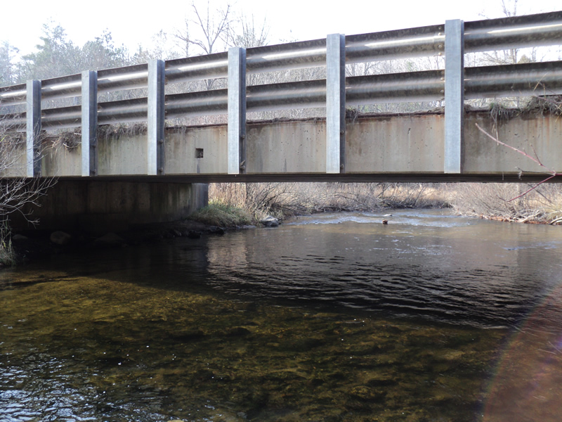
Inlet
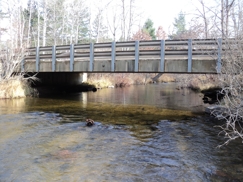
Outlet
Upstream Conditions
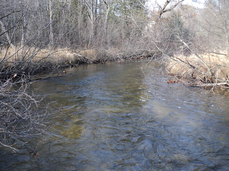
Downstream Conditions
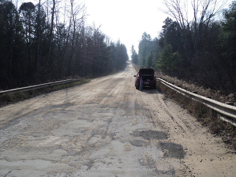
Road Approach - Left
Road Approach - Right
Crossing Information
Type of Crossing: Bridge
Structure Shape: Open Bottom Square/Rectangle
Inlet Type: Wingwall 30-70 Degree
Outlet Type: At Stream Grade
Structure Material: Concrete
Structure Substrate: Mixture
General Conditions: Good
Structure Interior: smooth
Dimensions of Structure: Length 29 ft.
, Width 52 ft.
, Height 6 ft.
Structure Inlet
Water Depth: 1.6 ft.
Water Velocity*: 1.9 ft./sec.
Structure Outlet
Water Depth: 1.1 ft.
Water Velocity*: 1.8 ft./sec.
*Water Velocities were measured 1 ft. below Surface
(with Meter)
Stream Information
Stream Flow: Bankfull
Riffle Information
Water Depth: 0.9 ft.
Bankfull Width: 42 ft.
Wetted Width: 42 ft.
Water Velocity: 2.5 ft./sec.
(Measured with Meter)
Dominant Substrate: Sand
Road Information
Gravel
County Road
Road Condition: Good
Road Width at Culvert: 29 ft.
Location of Low Point: Other
Runoff Path: Roadway
Slope: Vertical
Slope: Vertical
Approaches
Left Approach
Length: 600 ft.
Slope: 6% to 10%
Vegetation: Heavy
LS Factor: 1.74
Erosion: 8.3405 tons/year
Right Approach
Length: 200 ft.
Slope: Less Than 1%
Vegetation: Heavy
LS Factor: 0.05
Erosion: 0.0799 tons/year
Erosion Information
Total Erosion at Crossing: 8.4204 tons/year
Summary Information
Fish Passability 0.9
�