Road Stream Crossing Site PM_N015
Pere Marquette River Watershed, Big South Branch Pere Marquette
Dickinson Ave
Troy Twp,
Newaygo County
Information collected by:
Site Location
GPS Coordinates: 43.78474
, -86.01877
T16N
R14W
Sec 18
Owned by Private
Total Erosion: 0.1783 tons/year
Severity: Moderate
Year Inventoried: 2014
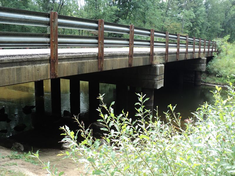
Outlet
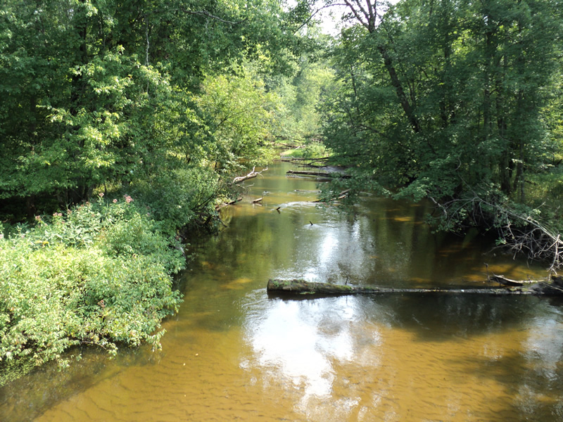
Upstream Conditions
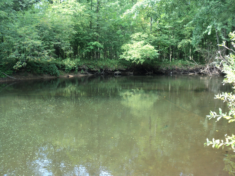
Downstream Conditions
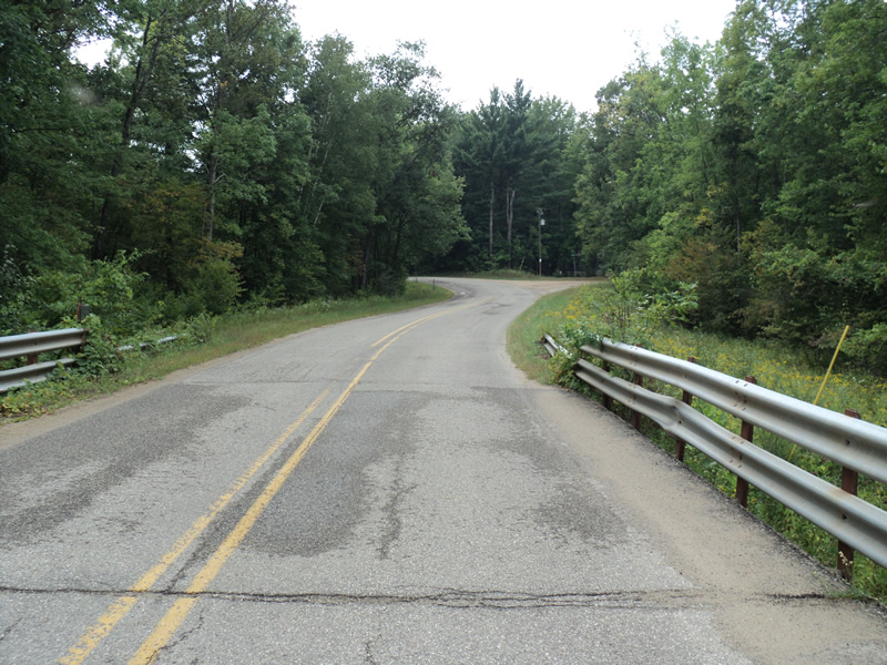
Road Approach - Left
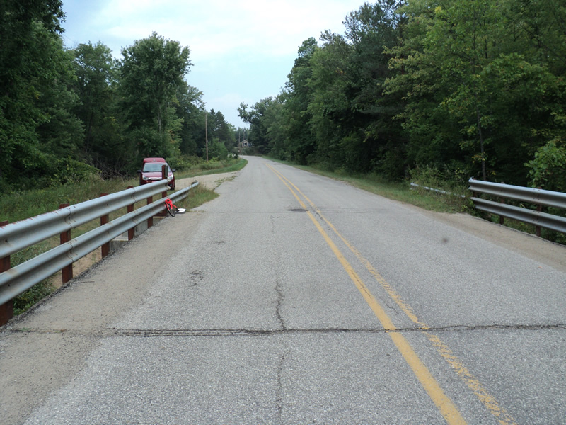
Road Approach - Right
Crossing Information
Type of Crossing: Bridge
Structure Shape: Open Bottom Square/Rectangle
Inlet Type: Projecting
Outlet Type: At Stream Grade
Structure Material: Concrete
Structure Substrate: Mixture
General Conditions: Fair
Structure Interior: smooth
Dimensions of Structure: Length 27 ft.
, Width 100 ft.
, Height 10 ft.
Structure Inlet
Water Depth: 1.3 ft.
Water Velocity*: 1.2 ft./sec.
Structure Outlet
Water Depth: 1.1 ft.
Water Velocity*: 2.1 ft./sec.
*Water Velocities were measured 1.2 ft. below Surface
(with Meter)
Stream Information
Stream Flow: Less than Bankfull
Riffle Information
Water Depth: 1.1 ft.
Bankfull Width: 61 ft.
Wetted Width: 56 ft.
Water Velocity: 1 ft./sec.
(Measured with Meter)
Dominant Substrate: Sand
Road Information
Paved
County Road
Road Condition: Good
Road Width at Culvert: 27 ft.
Location of Low Point: Other
Runoff Path: Ditch
Slope: Vertical
Slope: Vertical
Approaches
Left Approach
Length: 300 ft.
Slope: 1% to 5%
Vegetation: Heavy
LS Factor: 0.46
Erosion: 0.1232 tons/year
Right Approach
Length: 200 ft.
Slope: Less Than 1%
Vegetation: Heavy
LS Factor: 0.05
Erosion: 0.0089 tons/year
Erosion Information
Total Erosion at Crossing: 0.1783 tons/year
Extent of Erosion: Moderate
Notes:
social trail and erosion under bridge
Location of Erosion | Erosion Dimensions | Eroded Material | Material Eroded | Total Erosion | ||
facing downstream | Length | Width | Depth | Reaching Stream? | (tons/year) | |
Right Upstream Streambank |
30 ft. |
3 ft. |
0.1 ft. |
yes |
Sand |
0.0231 |
Right Upstream Streambank |
30 ft. |
2 ft. |
0.1 ft. |
yes |
Sand |
0.0231 |
Summary Information
Erosion is an area of concern for this site.
�