Road Stream Crossing Site PM_N024
Pere Marquette River Watershed, Big South Branch Pere Marquette
10 Mile Rd
Beaver Twp,
Newaygo County
Information collected by:
Site Location
GPS Coordinates: 43.69845
, -85.94594
T15N
R14W
Sec 11
Owned by Private
Federal
Federal
Fish Passability 0.9
Total Erosion: 1.1536 tons/year
Severity: Moderate
Year Inventoried: 2014
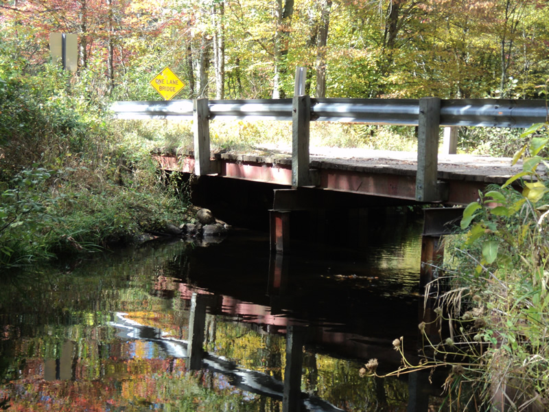
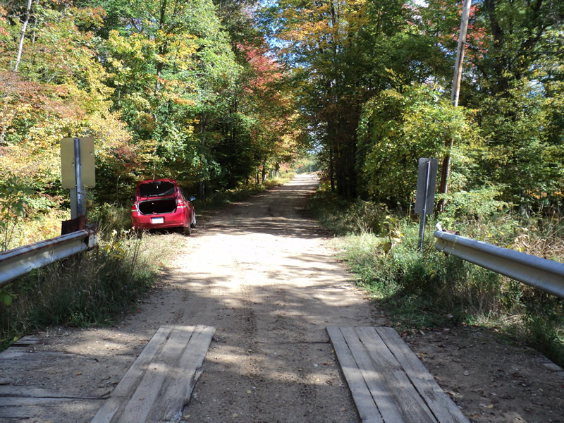
Inlet
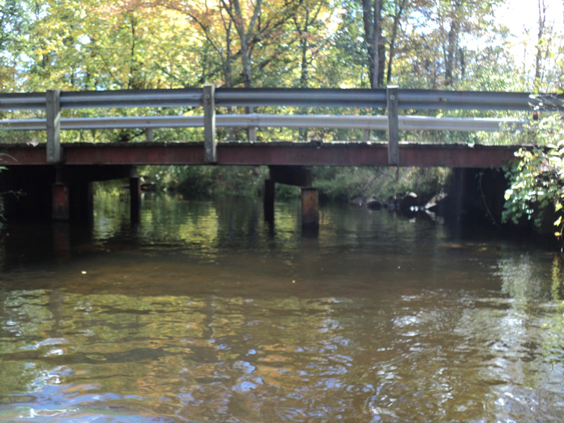
Outlet
Upstream Conditions
Downstream Conditions
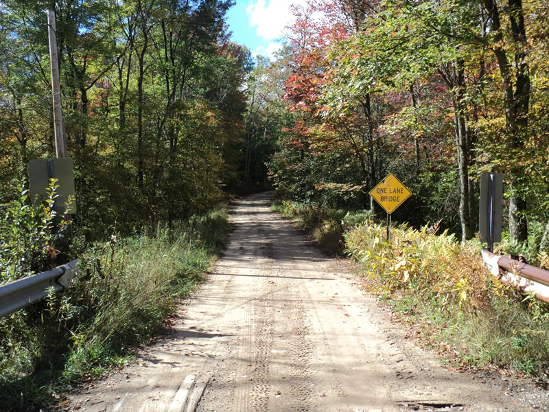
Road Approach - Left
Road Approach - Right
Crossing Information
Type of Crossing: Bridge
Structure Shape: Open Bottom Square/Rectangle
Inlet Type: Projecting
Outlet Type: At Stream Grade
Structure Material: Metal
Structure Substrate: Mixture
General Conditions: Poor
Dimensions of Structure: Length 16 ft.
, Width 36 ft.
, Height 6 ft.
Structure Inlet
Water Depth: 2.5 ft.
Water Velocity*: 0.4 ft./sec.
Structure Outlet
Water Depth: 2.7 ft.
Water Velocity*: 0.5 ft./sec.
*Water Velocities were measured 2.5 ft. below Surface
(with Meter)
Stream Information
Stream Flow: Bankfull
Riffle Information
Water Depth: 1.9 ft.
Bankfull Width: 22 ft.
Wetted Width: 22 ft.
Water Velocity: 0.8 ft./sec.
(Measured with Meter)
Dominant Substrate: Sand
Road Information
Gravel
County Road
(Seasonal)
Road Condition: Good
Road Width at Culvert: 16 ft.
Location of Low Point: At Stream
Runoff Path: Roadway
Approaches
Left Approach
Length: 250 ft.
Slope: 1% to 5%
Vegetation: Heavy
LS Factor: 0.44
Erosion: 0.4848 tons/year
Right Approach
Length: 300 ft.
Slope: 1% to 5%
Vegetation: Heavy
LS Factor: 0.46
Erosion: 0.6083 tons/year
Erosion Information
Total Erosion at Crossing: 1.1536 tons/year
Extent of Erosion: Minor
Location of Erosion | Erosion Dimensions | Eroded Material | Material Eroded | Total Erosion | ||
facing downstream | Length | Width | Depth | Reaching Stream? | (tons/year) | |
Right Approach |
300 ft. |
2 ft. |
0.1 ft. |
yes |
Sand |
0.033 |
Left Approach |
250 ft. |
2 ft. |
0.1 ft. |
yes |
Sand |
0.0275 |
Summary Information
Fish Passability 0.9
�