Road Stream Crossing Site PM_N029
Pere Marquette River Watershed, McDuffee Creek
12 Mile Rd
Monroe Twp,
Newaygo County
Information collected by:
Site Location
GPS Coordinates: 43.7280788790763
, -85.7090093940496
T15N
R12W
Sec 2
Owned by Private
Total Erosion: 0.1292 tons/year
Severity: Moderate
Year Inventoried: 2014
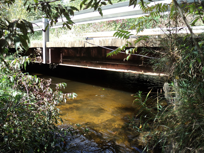
Outlet
Downstream Conditions
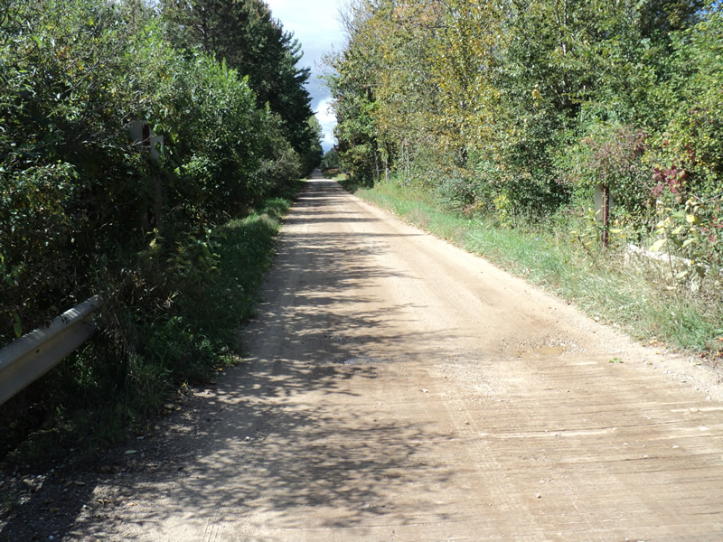
Road Approach - Left
Road Approach - Right
Crossing Information
Type of Crossing: Bridge
Structure Shape: Open Bottom Square/Rectangle
Inlet Type: Projecting
Outlet Type: At Stream Grade
Structure Material: Concrete
Structure Substrate: Mixture
General Conditions: Good
Structure Interior: smooth
Dimensions of Structure: Length 20 ft.
, Width 36 ft.
, Height 5 ft.
Structure Inlet
Water Depth: 1.2 ft.
Water Velocity*: 1.7 ft./sec.
Structure Outlet
Water Depth: 1.4 ft.
Water Velocity*: 1 ft./sec.
(with Float Test)
Additional Comments
wood surface, metal frame, concrete foundation
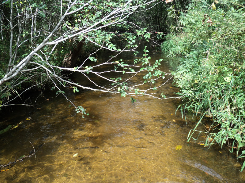
Stream Information
Stream Flow: Bankfull
Riffle Information
Water Depth: 0.8 ft.
Bankfull Width: 13 ft.
Wetted Width: 13 ft.
Water Velocity: 0.9 ft./sec.
(Measured with Meter)
Dominant Substrate: Sand
Road Information
Gravel
County Road
Road Condition: Good
Road Width at Culvert: 18 ft.
Location of Low Point: Other
Runoff Path: Roadway
Slope: Vertical
Slope: Vertical
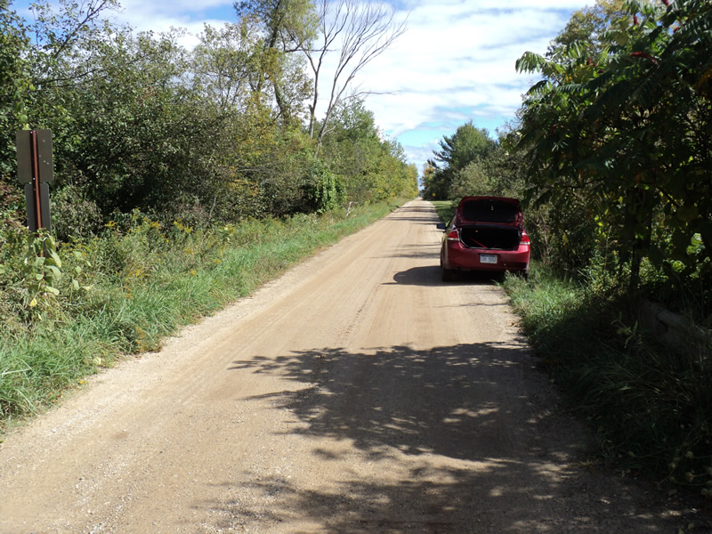
Approaches
Left Approach
Length: 200 ft.
Slope: Less Than 1%
Vegetation: Heavy
LS Factor: 0.05
Erosion: 0.0496 tons/year
Right Approach
Length: 200 ft.
Slope: Less Than 1%
Vegetation: Partial
LS Factor: 0.05
Erosion: 0.0496 tons/year
Erosion Information
Total Erosion at Crossing: 0.1292 tons/year
Extent of Erosion: Minor
Location of Erosion | Erosion Dimensions | Eroded Material | Material Eroded | Total Erosion | ||
facing downstream | Length | Width | Depth | Reaching Stream? | (tons/year) | |
Right Approach |
200 ft. |
1 ft. |
0.1 ft. |
yes |
Gravel |
0.02 |
Left Approach |
100 ft. |
1 ft. |
0.1 ft. |
yes |
Gravel |
0.01 |
Summary Information
Erosion is an area of concern for this site.
�