Road Stream Crossing Site PM_N036
Pere Marquette River Watershed, McDuffee Creek tributary
12 Mile Rd
Home Twp,
Newaygo County
Information collected by:
Site Location
GPS Coordinates: 43.72826
, -85.68783
T16N
R12W
Sec 36
Owned by Private
Fish Passability 0.9
Total Erosion: 0.1817 tons/year
Severity: Moderate
Year Inventoried: 2014
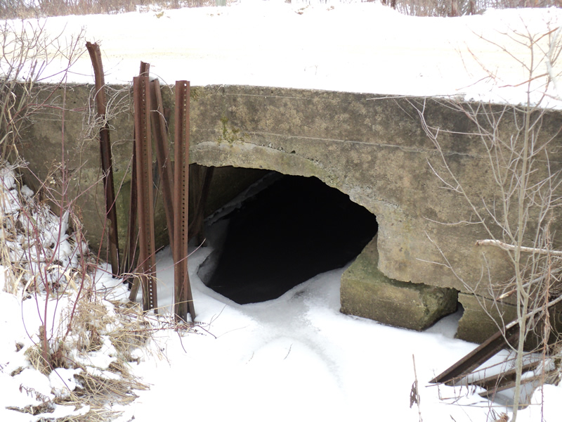
Inlet
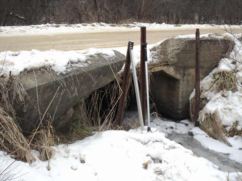
Outlet
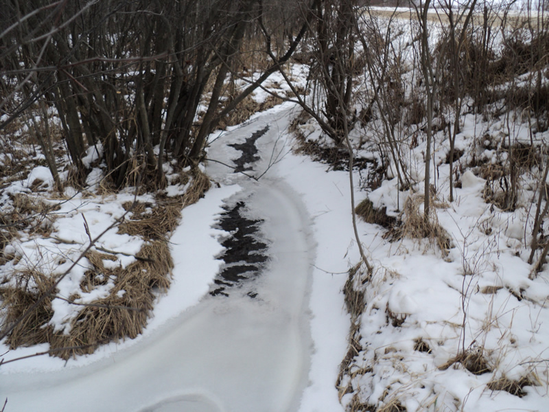
Upstream Conditions
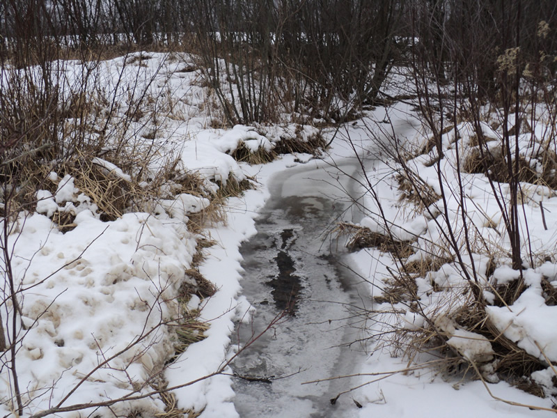
Downstream Conditions
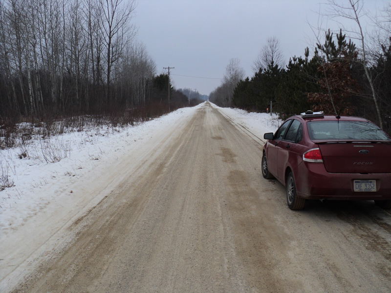
Road Approach - Left
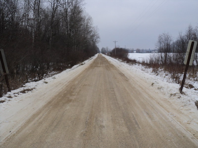
Road Approach - Right
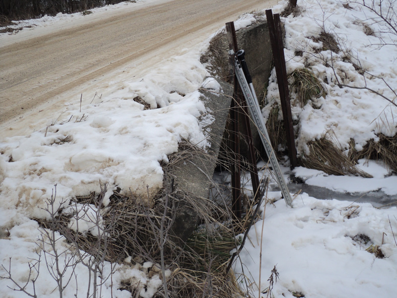
Erosion
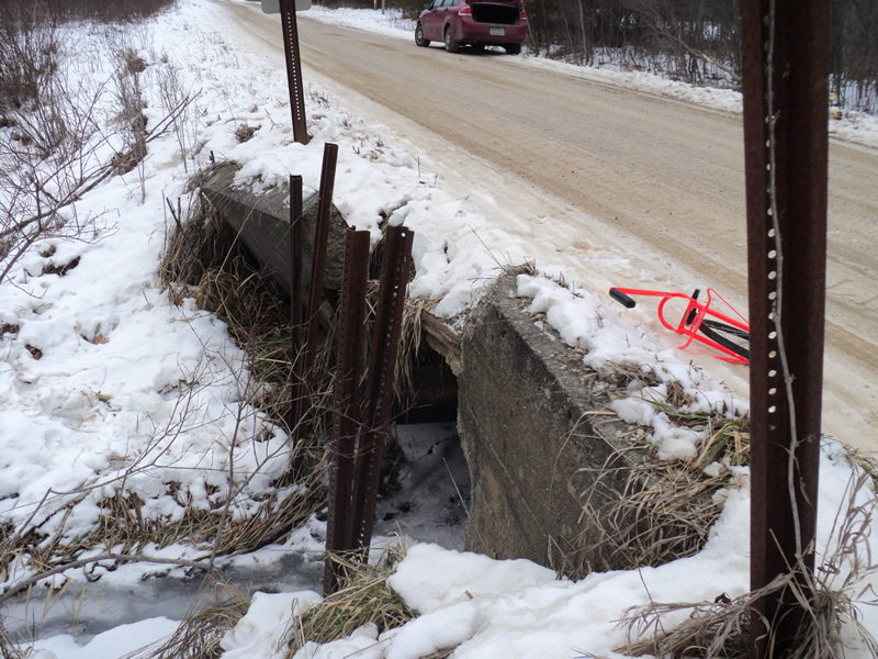
Erosion
Crossing Information
Type of Crossing: culvert(s)
Number of Structures: 1
Structure Shape: Open Bottom Square/Rectangle
Inlet Type: Projecting
Outlet Type: At Stream Grade
Structure Material: Concrete
Structure Substrate: Mixture
General Conditions: Poor
Structure Interior: smooth
Dimensions of Structure: Length 19 ft.
, Width 6 ft.
, Height 4 ft.
Structure Inlet
Water Depth: 0.6 ft.
Water Velocity*: 0.6 ft./sec.
Structure Outlet
Water Depth: 0.6 ft.
Water Velocity*: 0.9 ft./sec.
*Water Velocities were measured 0.6 ft. below Surface
(with Meter)
Additional Comments
concrete culvert and headwall are falling apart badly
Stream Information
Stream Flow: Less than Bankfull
Riffle Information
Water Depth: 0.3 ft.
Bankfull Width: 4.5 ft.
Wetted Width: 4 ft.
Water Velocity: 0.9 ft./sec.
(Measured with Meter)
Dominant Substrate: Gravel
Road Information
Gravel
County Road
Road Condition: Good
Road Width at Culvert: 17 ft.
Location of Low Point: Other
Runoff Path: Roadway
Embankments
Upstream
Fill Depth: 1 ft.
Slope: Vertical
Downstream
Fill Depth: 1 ft.
Slope: Vertical
Approaches
Left Approach
Length: 200 ft.
Slope: Less Than 1%
Vegetation: Heavy
LS Factor: 0.05
Erosion: 0.0468 tons/year
Right Approach
Length: 200 ft.
Slope: Less Than 1%
Vegetation: Heavy
LS Factor: 0.05
Erosion: 0.0468 tons/year
Erosion Information
Total Erosion at Crossing: 0.1817 tons/year
Extent of Erosion: Severe
Location of Erosion | Erosion Dimensions | Eroded Material | Material Eroded | Total Erosion | ||
facing downstream | Length | Width | Depth | Reaching Stream? | (tons/year) | |
Right Downstream Embankment |
5 ft. |
10 ft. |
1 ft. |
yes |
Loam |
0.088 |
Summary Information
Fish Passability 0.9
A future visit to this site is recommended. bad condition of culvert and headwall-see pics
�