Road Stream Crossing Site C05
Carp River Watershed, Carp River
East Gill Rd
Carp Lake Twp,
Emmet County
Information collected by:
Site Location
GPS Coordinates: 45.694494
, -84.804739
T38N
R4W
Sec 9
Owned by Private
Structure is NOT Perched
Total Erosion: 0.0825 tons/year
Severity: Restored
Year Inventoried: 2019
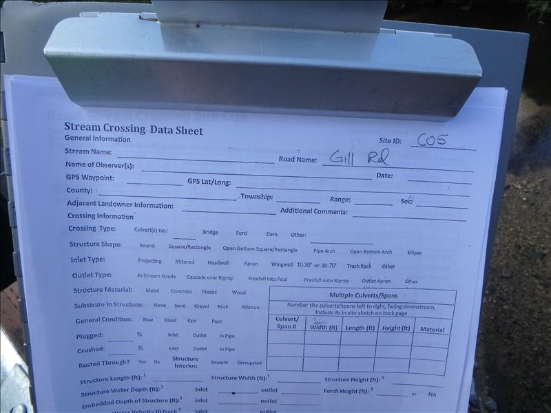
Site ID
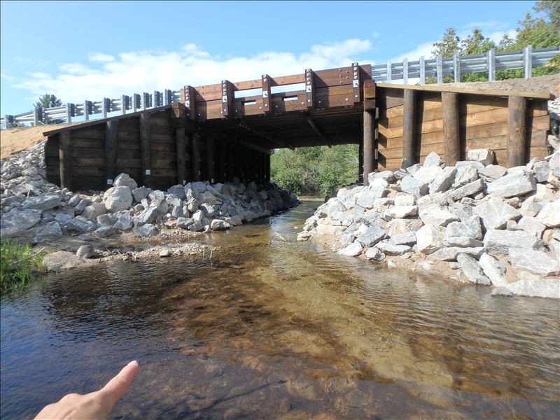
Inlet
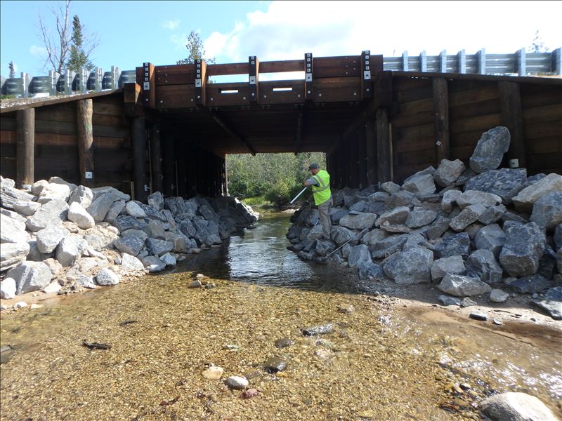
Outlet
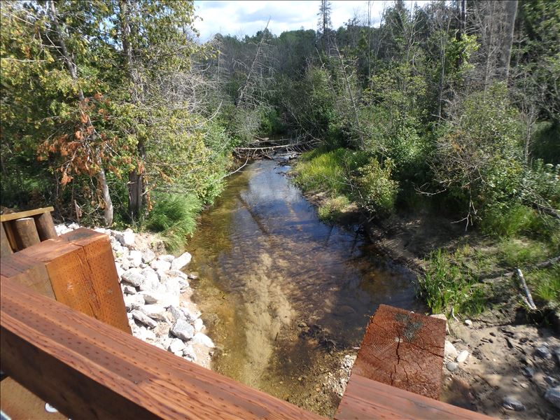
Upstream Conditions
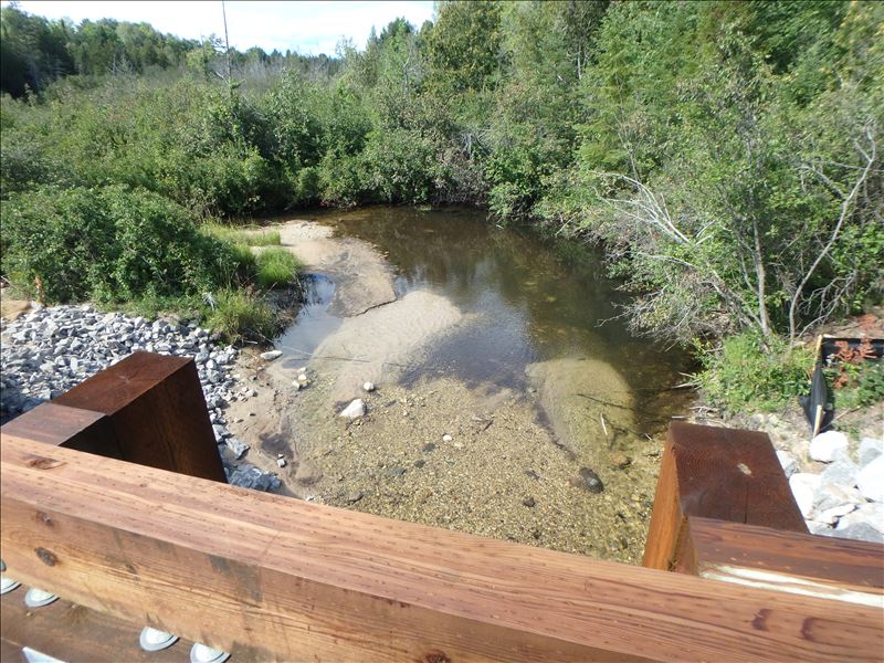
Downstream Conditions
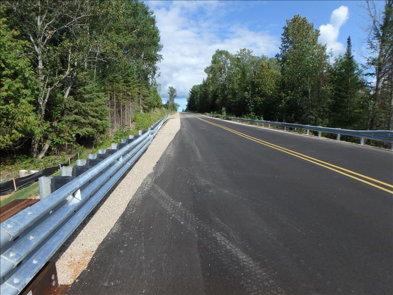
Road Approach - Left
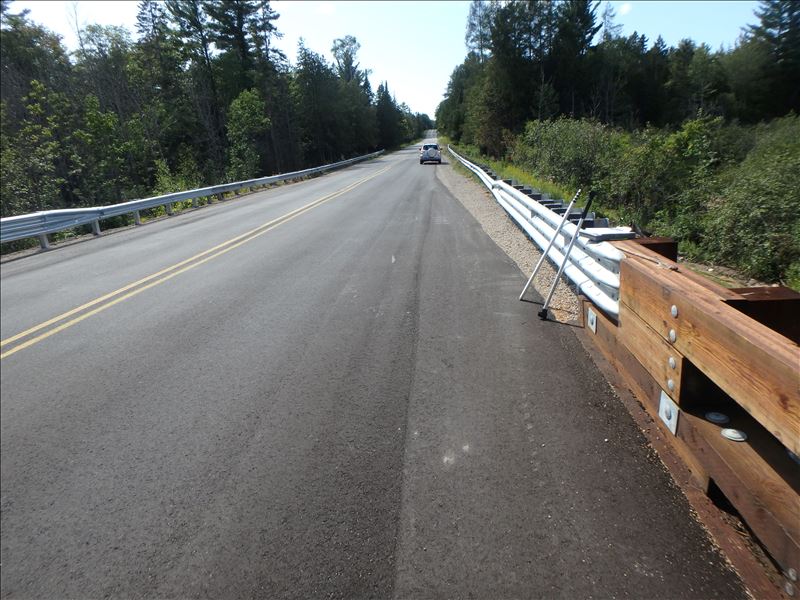
Road Approach - Right
Crossing Information
Type of Crossing: Bridge
Structure Shape: Open Bottom Square/Rectangle
Inlet Type: Wingwall 10-30 Degree
Outlet Type: At Stream Grade
Structure Material: Wood
Structure Substrate: Gravel
General Conditions: New
Structure Interior: smooth
Dimensions of Structure: Length 36.5 ft.
, Width 22 ft.
, Height 12.4 ft.
Structure is NOT Perched
Structure Inlet
Water Depth: 0.9 ft.
Embedded Depth of Structure: 0 ft.
Water Velocity*: 0.7 ft./sec.
Structure Outlet
Water Depth: 0.8 ft.
Embedded Depth of Structure: 0 ft.
Water Velocity*: 0.9 ft./sec.
*Water Velocities were measured at the Surface
(with Meter)
Stream Information
Stream Flow: Less than 1/2 Bankfull
Riffle Information
Water Depth: 0.2 ft.
Bankfull Width: 15 ft.
Wetted Width: 12 ft.
Water Velocity: 0.5 ft./sec.
(Measured with Meter)
Dominant Substrate: Gravel
Road Information
Paved
County Road
Road Condition: Good
Road Width at Culvert: 34.5 ft.
Location of Low Point: Other
Runoff Path: Ditch
Fill Depth: 0 ft.
Slope: Vertical
Fill Depth: 0 ft.
Slope: Vertical
Approaches
Left Approach
Length: 150 ft.
Slope: Less Than 1%
Vegetation: Partial
LS Factor: 0.05
Erosion: 0 tons/year
Right Approach
Length: 500 ft.
Slope: 1% to 5%
Vegetation: Partial
LS Factor: 0.48
Erosion: 0.0825 tons/year
Erosion Information
Total Erosion at Crossing: 0.0825 tons/year
Extent of Erosion: Moderate
Summary Information
Fish Passage is an area of concern for this site.
�