Road Stream Crossing Site C06
Carp River Watershed, Carp River
Oliver Rd
Wawatam Twp,
Emmet County
Information collected by:
Site Location
GPS Coordinates: 45.72391
, -84.83041
T39N
R4W
Sec 32
Owned by Private
Structure is NOT Perched
Total Erosion: 0.3795 tons/year
Severity: Restored
Year Inventoried: 2014
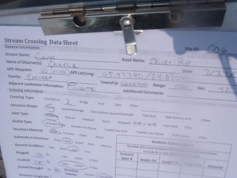
Site ID
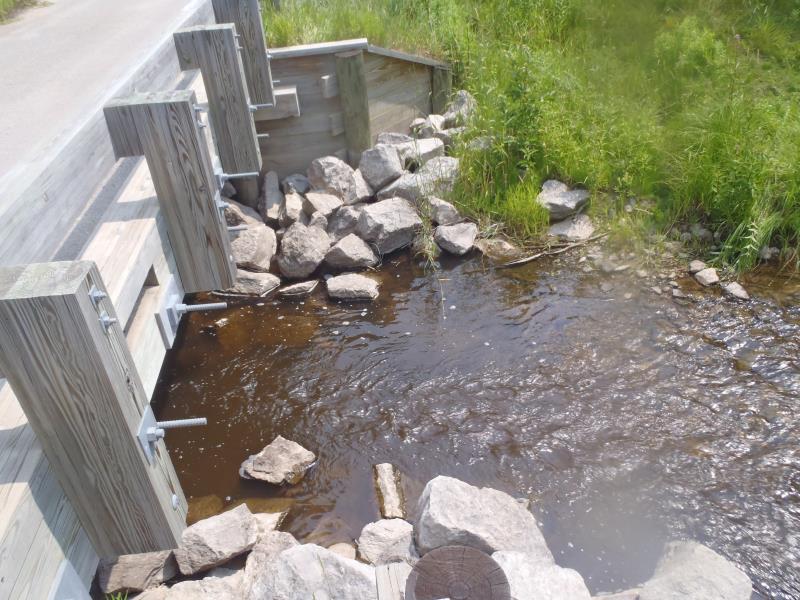
Inlet
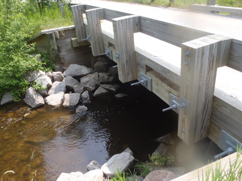
Outlet
Upstream Conditions
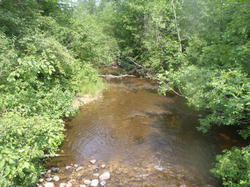
Downstream Conditions
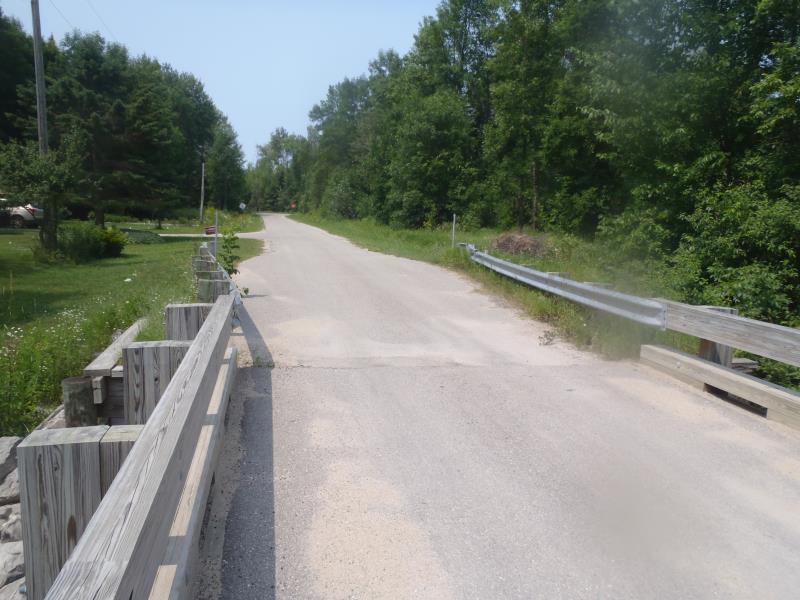
Road Approach - Left
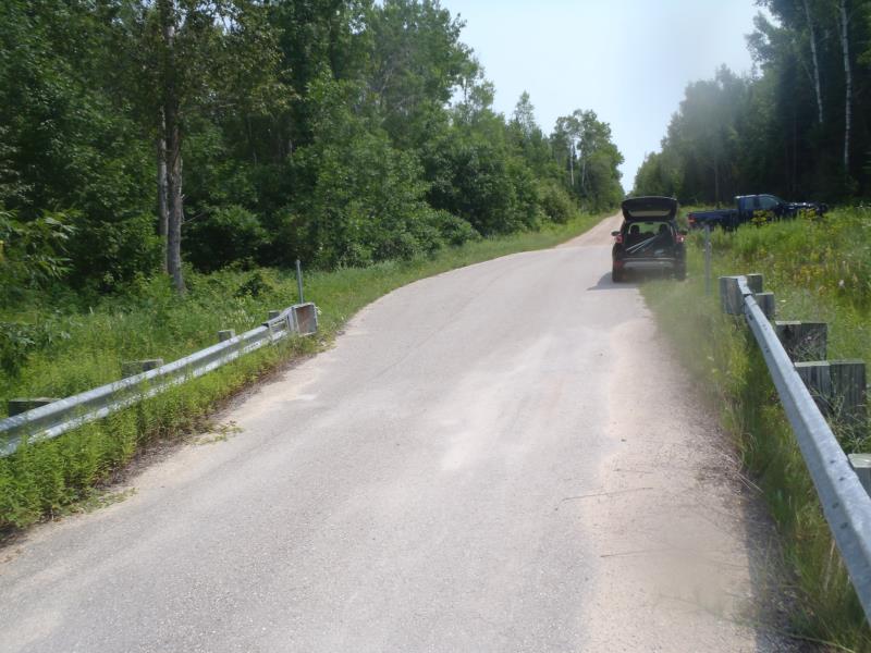
Road Approach - Right
Crossing Information
Type of Crossing: Bridge
Structure Shape: Open Bottom Square/Rectangle
Inlet Type: Other
Outlet Type: At Stream Grade
Structure Material: Wood
Structure Substrate: Sand
General Conditions: Good
Structure Interior: smooth
Dimensions of Structure: Length 14 ft.
, Width 30 ft.
, Height 8 ft.
Structure is NOT Perched
Structure Inlet
Water Depth: 4 ft.
Embedded Depth of Structure: 0 ft.
Water Velocity*: 3 ft./sec.
Structure Outlet
Water Depth: 4 ft.
Embedded Depth of Structure: 0 ft.
Water Velocity*: 2.6 ft./sec.
*Water Velocities were measured 0.3 ft. below Surface
(with Meter)
Stream Information
Stream Flow: Less than Bankfull
Scour Pool: Length 0 ft.
, Width 0 ft.
, Depth 0 ft.
Upstream Pond: Length 0 ft.
, Width 0 ft.
, Depth 0 ft.
Riffle Information
Water Depth: 0.5 ft.
Bankfull Width: 25 ft.
Wetted Width: 18 ft.
Water Velocity: 2 ft./sec.
(Measured with Meter)
Dominant Substrate: Gravel
Road Information
Paved
County Road
(Seasonal)
Road Condition: Fair
Road Width at Culvert: 14 ft.
Location of Low Point: At Stream
Runoff Path: Roadway
Fill Depth: 0 ft.
Slope: Vertical
Fill Depth: 0 ft.
Slope: Vertical
Approaches
Left Approach
Length: 500 ft.
Slope: 1% to 5%
Vegetation: Heavy
LS Factor: 0.5
Erosion: 0.1157 tons/year
Right Approach
Length: 1000 ft.
Slope: 1% to 5%
Vegetation: Heavy
LS Factor: 0.57
Erosion: 0.2638 tons/year
Erosion Information
Total Erosion at Crossing: 0.3795 tons/year
Extent of Erosion: Moderate
Summary Information
Erosion is an area of concern for this site.
�