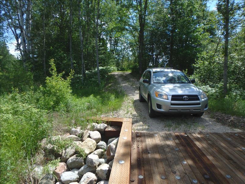
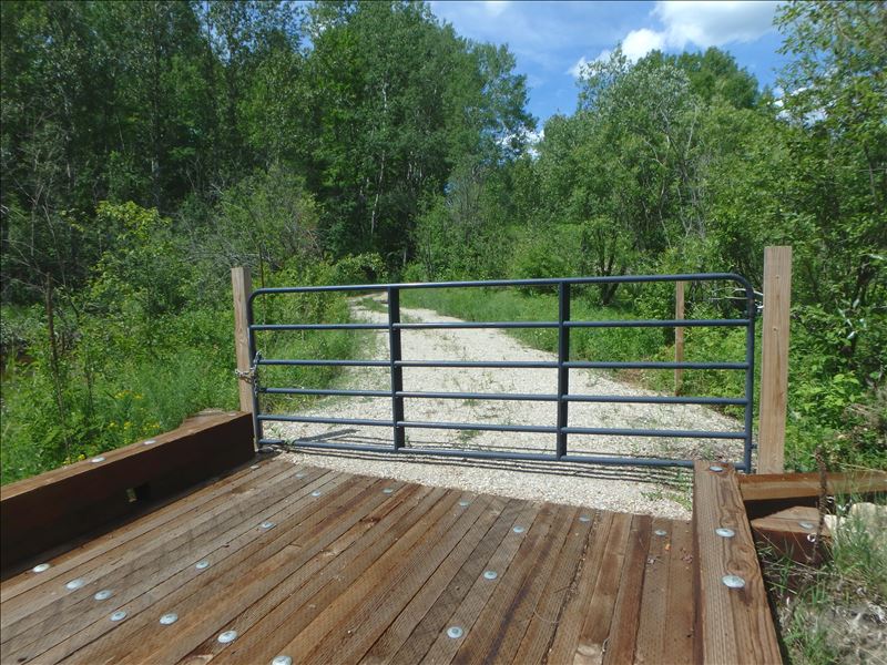
Road Stream Crossing Site E25
Maple River Watershed, East Branch Maple River
Pipeline Rd
Emmet County
Information collected by:
Site Location
GPS Coordinates: 45.53479
, -84.7675
T36N
R4W
Sec 11
Owned by Private
Structure is NOT Perched
Total Erosion: 0.2486 tons/year
Severity: Restored
Year Inventoried: 2021
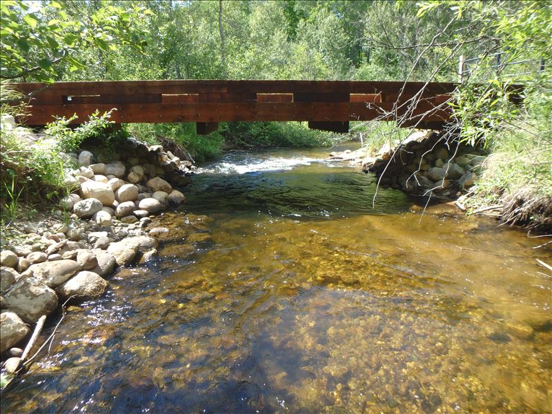
Inlet
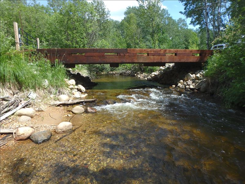
Outlet
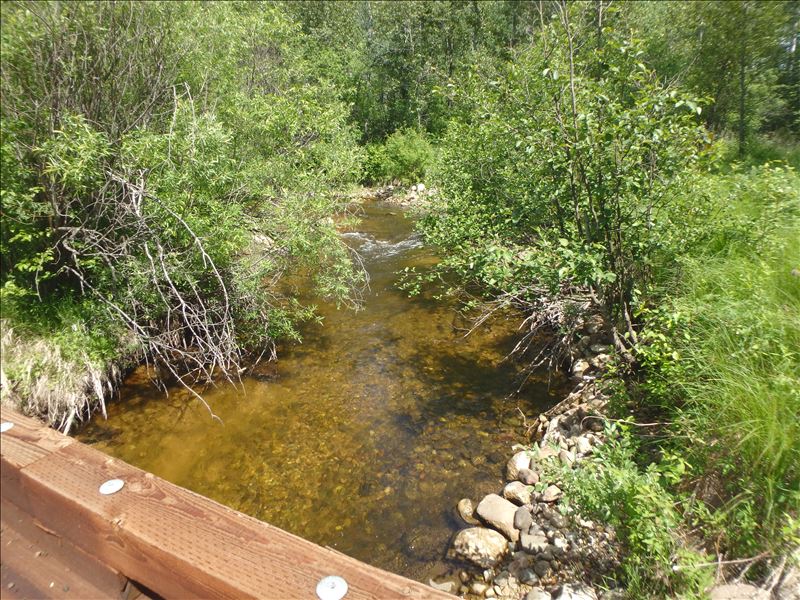
Upstream Conditions
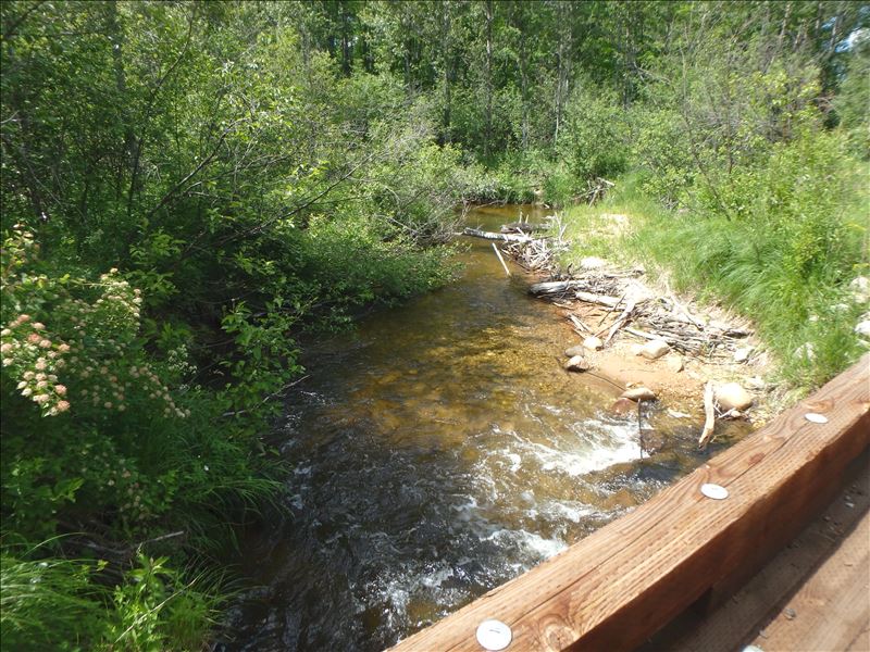
Downstream Conditions
Road Approach - Left
Road Approach - Right
Crossing Information
Type of Crossing: Bridge
Structure Shape: Open Bottom Square/Rectangle
Inlet Type: Wingwall 30-70 Degree
Outlet Type: At Stream Grade
Structure Material: Wood
Structure Substrate: Rock
General Conditions: New
Structure Interior: corrugated
Dimensions of Structure: Length 11.5 ft.
, Width 33 ft.
, Height 6 ft.
Structure is NOT Perched
Structure Inlet
Water Depth: 1.8 ft.
Embedded Depth of Structure: 0 ft.
Water Velocity*: 2.2 ft./sec.
Structure Outlet
Water Depth: 1 ft.
Embedded Depth of Structure: 0 ft.
Water Velocity*: 2.6 ft./sec.
*Water Velocities were measured 1.6 ft. below Surface
(with Meter)
Stream Information
Stream Flow: Less than 1/2 Bankfull
Upstream Pond: Length 0 ft.
, Width 0 ft.
, Depth 0 ft.
Riffle Information
Water Depth: 0.7 ft.
Bankfull Width: 21.5 ft.
Wetted Width: 19.2 ft.
Water Velocity: 2.4 ft./sec.
(Measured with Meter)
Dominant Substrate: Gravel
Road Information
Gravel
Private Road
(Seasonal)
Road Condition: Poor
Road Width at Culvert: 9 ft.
Location of Low Point: Other
Runoff Path: Ditch
Fill Depth: 0 ft.
Slope: Vertical
Fill Depth: 0 ft.
Slope: Vertical
Approaches
Left Approach
Length: 100 ft.
Slope: 6% to 10%
Vegetation: Heavy
LS Factor: 0.99
Erosion: 0.2455 tons/year
Right Approach
Length: 25 ft.
Slope: Less Than 1%
Vegetation: Heavy
LS Factor: 0.05
Erosion: 0.0031 tons/year
Erosion Information
Total Erosion at Crossing: 0.2486 tons/year
Extent of Erosion: Stabilized
Summary Information
�