Road Stream Crossing Site MAN_KA_010
Big Manistee River Watershed, Unknown (tributary to North Branch Manistee)
Grass Lake Rd
Excelsior Twp,
Kalkaska County
Information collected by:
Site Location
GPS Coordinates: 44.73904
, -84.98558
T27N
R6W
Sec 13
Owned by State
Structure is NOT Perched
Total Erosion: 3.5257 tons/year
Severity: Severe
Year Inventoried: 2014
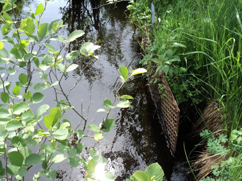
Inlet
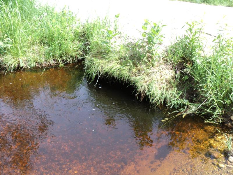
Outlet
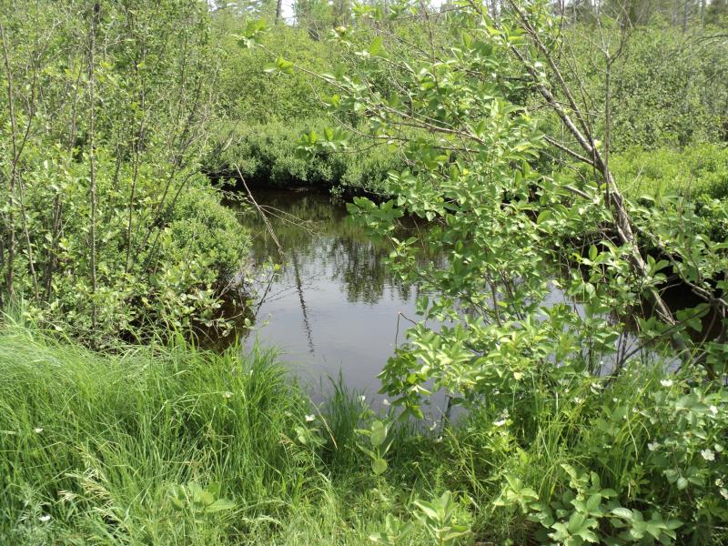
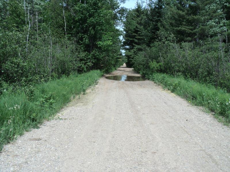
Upstream Conditions
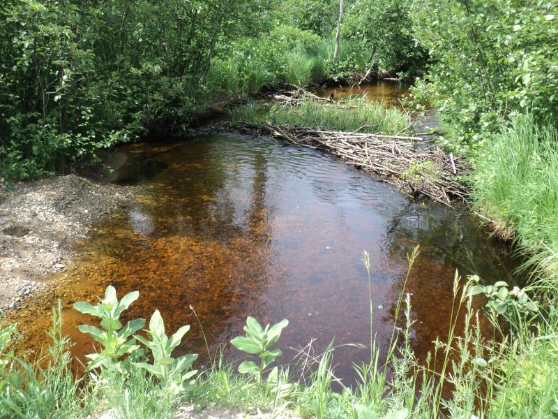
Downstream Conditions
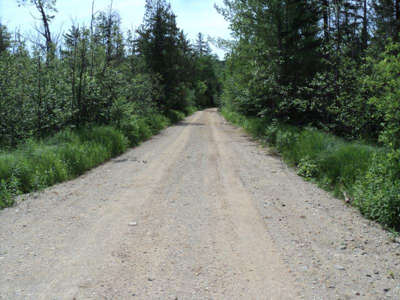
Road Approach - Left
Road Approach - Right
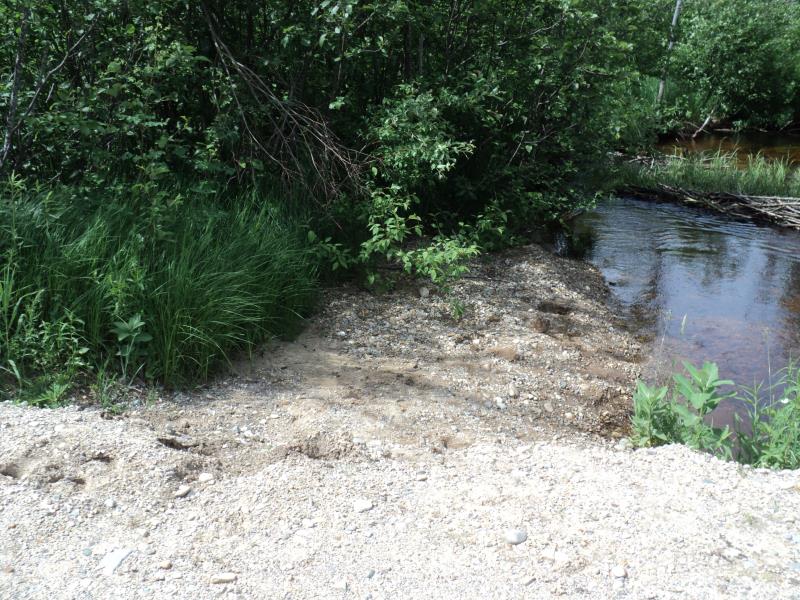
Erosion
Crossing Information
Type of Crossing: culvert(s)
Number of Structures: 1
Structure Shape: Pipe Arch
Inlet Type: Trash Rack
Outlet Type: At Stream Grade
Structure Material: Metal
Structure Substrate: Mixture
General Conditions: Poor
Structure Interior: corrugated
Dimensions of Structure: Length 24 ft.
, Width 5 ft.
, Height 3 ft.
Percentage Plugged:
Inlet: 51% to 75%
Outlet: 0%
In Pipe: 0%
Structure is NOT Perched
Structure Inlet
Water Depth: 2.5 ft.
Embedded Depth of Structure: 0.2 ft.
Water Velocity*: 2.7 ft./sec.
Structure Outlet
Water Depth: 2.2 ft.
Embedded Depth of Structure: 0.2 ft.
Water Velocity*: 0.9 ft./sec.
*Water Velocities were measured 0.6 ft. below Surface
(with Meter)
Stream Information
Stream Flow: Less than Bankfull
Scour Pool: Length 20 ft.
, Width 14 ft.
, Depth 1.6 ft.
Upstream Pond: Length 0 ft.
, Width 0 ft.
, Depth 0 ft.
Riffle Information
Water Depth: 0.9 ft.
Bankfull Width: 16 ft.
Wetted Width: 13 ft.
Water Velocity: 1.1 ft./sec.
(Measured with Meter)
Dominant Substrate: Organics
Road Information
Gravel
Other Road
(Seasonal)
Road Condition: Fair
Road Width at Culvert: 17 ft.
Location of Low Point: At Stream
Runoff Path: Roadway
Embankments
Upstream
Fill Depth: 0.8 ft.
Slope: More than 1:2
Downstream
Fill Depth: 1.2 ft.
Slope: 1:2
Approaches
Left Approach
Length: 300 ft.
Slope: 1% to 5%
Vegetation: Heavy
LS Factor: 0.46
Erosion: 0.6463 tons/year
Right Approach
Length: 1000 ft.
Slope: 1% to 5%
Vegetation: Heavy
LS Factor: 0.57
Erosion: 2.6694 tons/year
Erosion Information
Total Erosion at Crossing: 3.5257 tons/year
Extent of Erosion: Moderate
Erosion is occurring and corrective actions can be installed to address the problem.
Notes:
Embankment erosion from roadway, minor bank stabilization would fix issue.
Location of Erosion | Erosion Dimensions | Eroded Material | Material Eroded | Total Erosion | ||
facing downstream | Length | Width | Depth | Reaching Stream? | (tons/year) | |
Left Downstream Embankment |
15 ft. |
15 ft. |
2 ft. |
yes |
Gravelly Loam |
0.21 |
Summary Information
Fish Passage is an area of concern for this site.
Yes, possibly for fish passage.
A future visit to this site is recommended.
Yes, clear inlet trash rack of vegetation.
�