Road Stream Crossing Site MAN_KA_024
Big Manistee River Watershed, Pierson Creek
Spencer Rd
Oliver Twp,
Kalkaska County
Information collected by:
Site Location
GPS Coordinates: 44.64122
, -85.08806
T26N
R6W
Sec 18
Owned by Private
Perch Height: 1 ft.
Total Erosion: 0.5716 tons/year
Severity: Severe
Year Inventoried: 2014
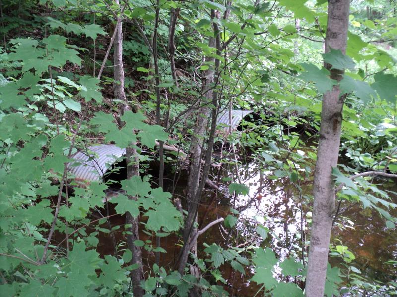
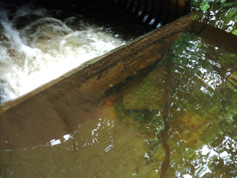
Inlet
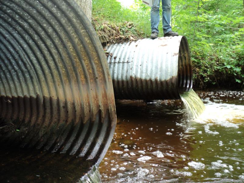
Outlet
Upstream Conditions
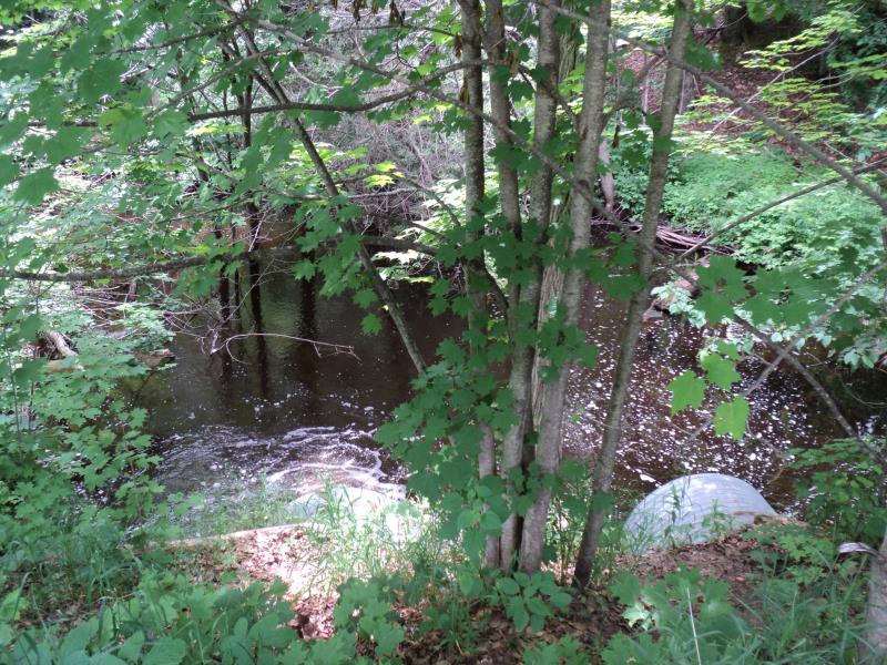
Downstream Conditions
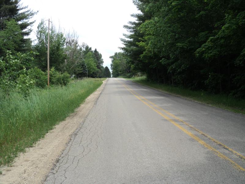
Road Approach - Left
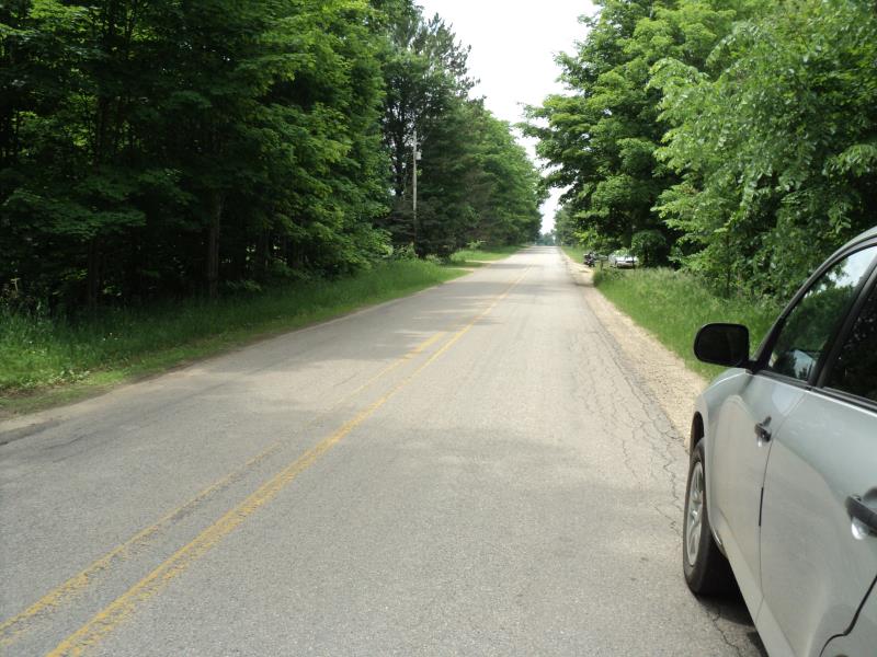
Road Approach - Right
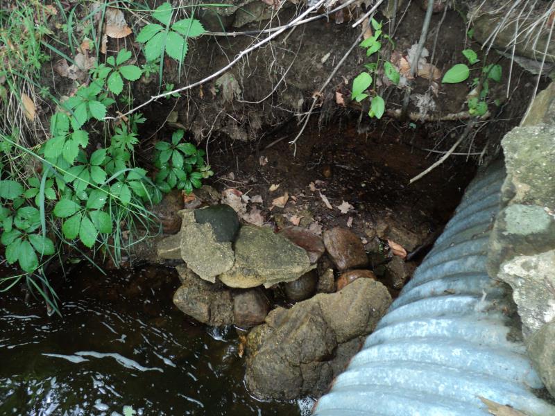
Erosion
Other
Other
Crossing Information
Type of Crossing: culvert(s)
Number of Structures: 2
Structure Shape: Pipe Arch
Inlet Type: Projecting
Outlet Type: Freefall into Pool
Structure Material: Metal
Structure Substrate: None
General Conditions: Good
Multiple Culverts/Spans | ||||
Culvert/Span | Width | Length | Height | Material |
2 |
4 ft. |
75 ft. |
3 ft. |
Metal |
Structure Interior: corrugated
Dimensions of Structure: Length 75 ft.
, Width 4 ft.
, Height 3 ft.
Percentage Plugged:
Inlet: 1% to 25%
Outlet: 0%
In Pipe: 0%
Perch Height: 1 ft.
Structure Inlet
Water Depth: 1.3 ft.
Embedded Depth of Structure: 0 ft.
Water Velocity*: 2.6 ft./sec.
Structure Outlet
Water Depth: 0.4 ft.
Embedded Depth of Structure: 0 ft.
Water Velocity*: 4.8 ft./sec.
*Water Velocities were measured 1 ft. below Surface
(with Meter)
Additional Comments
Large perch and scour pool over 4 feet deep. No Riffle data available- unable to access.
Stream Information
Stream Flow: Bankfull
Scour Pool: Length 40 ft.
, Width 40 ft.
, Depth 3 ft.
Upstream Pond: Length 0 ft.
, Width 0 ft.
, Depth 0 ft.
Riffle Information
Water Depth: 0 ft.
Bankfull Width: 0 ft.
Wetted Width: 0 ft.
Water Velocity: 0 ft./sec.
(Measured with Meter)
Dominant Substrate: Organics
Road Information
Paved
County Road
Road Condition: Fair
Road Width at Culvert: 24 ft.
Location of Low Point: At Stream
Runoff Path: Roadway
Embankments
Upstream
Fill Depth: 8 ft.
Slope: More than 1:2
Downstream
Fill Depth: 8 ft.
Slope: More than 1:2
Approaches
Left Approach
Length: 550 ft.
Slope: 1% to 5%
Vegetation: Heavy
LS Factor: 0.51
Erosion: 0.2225 tons/year
Right Approach
Length: 800 ft.
Slope: 1% to 5%
Vegetation: Heavy
LS Factor: 0.55
Erosion: 0.3491 tons/year
Erosion Information
Total Erosion at Crossing: 0.5716 tons/year
Extent of Erosion: Moderate
Summary Information
Fish Passage is an area of concern for this site.
Yes, fish passage.
A future visit to this site is recommended.
Yes, to look at replacing.
�