Road Stream Crossing Site MAN_KA_041
Big Manistee River Watershed, Big Cannon Creek
Military Rd
Garfield Twp,
Kalkaska County
Information collected by:
Site Location
GPS Coordinates: 44.58343
, -85.07324
T25N
R6W
Sec 5
Owned by Private
Total Erosion: 0.3951 tons/year
Severity: Restored
Year Inventoried: 2021
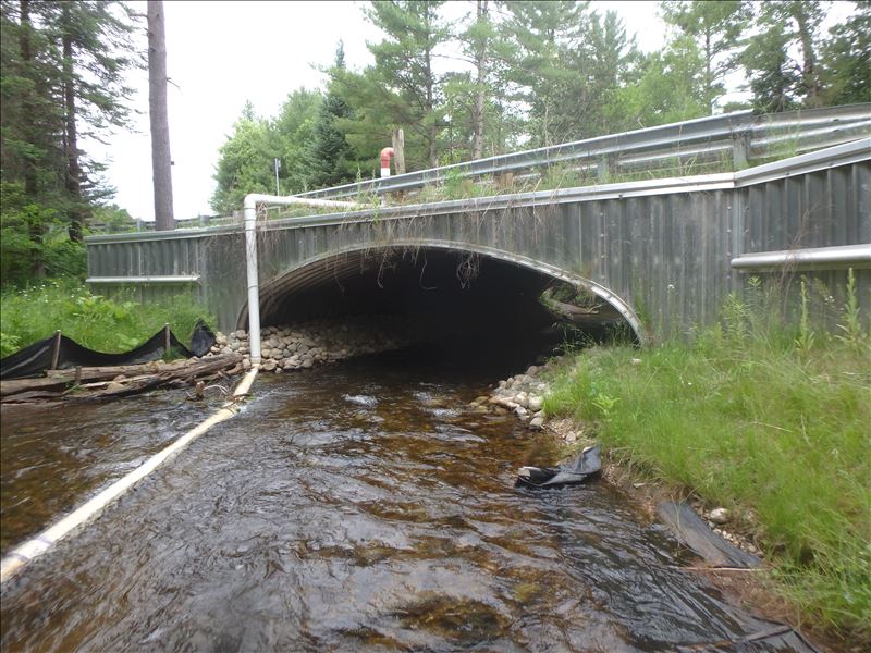
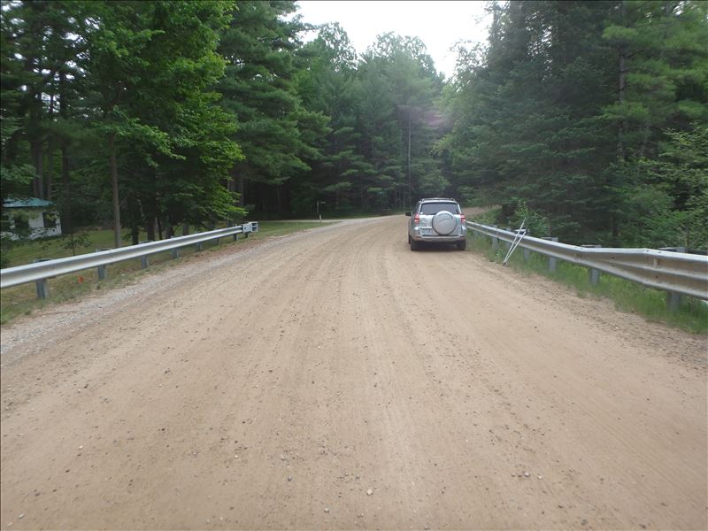
Inlet
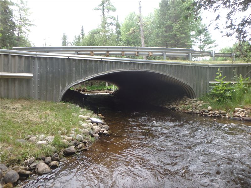
Outlet
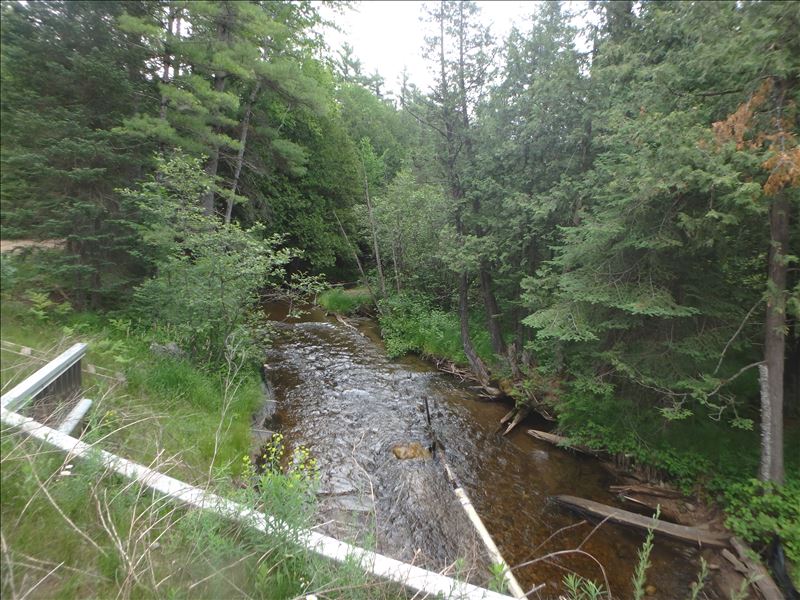
Upstream Conditions
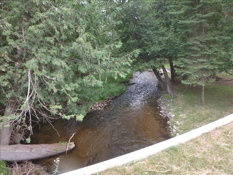
Downstream Conditions
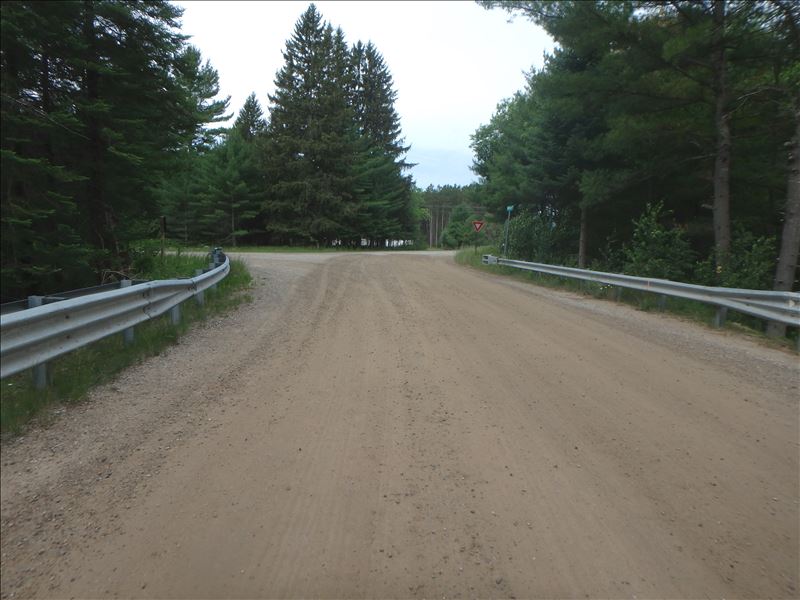
Road Approach - Left
Road Approach - Right
Crossing Information
Type of Crossing: culvert(s)
Number of Structures: 1
Structure Shape: Open Bottom Arch
Inlet Type: Wingwall 30-70 Degree
Outlet Type: At Stream Grade
Structure Material: Metal
Structure Substrate: Mixture
General Conditions: New
Structure Interior: corrugated
Dimensions of Structure: Length 50 ft.
, Width 23 ft.
, Height 7.7 ft.
Structure Inlet
Water Depth: 1.4 ft.
Embedded Depth of Structure: 0 ft.
Water Velocity*: 2.4 ft./sec.
Structure Outlet
Water Depth: 1.2 ft.
Embedded Depth of Structure: 0 ft.
Water Velocity*: 2.5 ft./sec.
*Water Velocities were measured 1.2 ft. below Surface
(with Meter)
Stream Information
Stream Flow: Less than 1/2 Bankfull
Upstream Pond: Length 0 ft.
, Width 0 ft.
, Depth 0 ft.
Riffle Information
Water Depth: 0.7 ft.
Bankfull Width: 26 ft.
Wetted Width: 23 ft.
Water Velocity: 1.7 ft./sec.
(Measured with Meter)
Dominant Substrate: Gravel
Road Information
Gravel
County Road
Road Condition: Good
Road Width at Culvert: 31 ft.
Location of Low Point: Other
Runoff Path: Ditch
Embankments
Upstream
Fill Depth: 1.8 ft.
Slope: Vertical
Downstream
Fill Depth: 1.8 ft.
Slope: Vertical
Approaches
Left Approach
Length: 150 ft.
Slope: 1% to 5%
Vegetation: Heavy
LS Factor: 0.4
Erosion: 0.5124 tons/year
Right Approach
Length: 25 ft.
Slope: Less Than 1%
Vegetation: Heavy
LS Factor: 0.05
Erosion: 0.0107 tons/year
Erosion Information
Total Erosion at Crossing: 0.3951 tons/year
Extent of Erosion: Stabilized
Summary Information
Erosion is an area of concern for this site.
�