Road Stream Crossing Site MAN_KA_045
Big Manistee River Watershed, Little Cannon Creek
Beaver Dam Rd
Garfield Twp,
Kalkaska County
Information collected by:
Site Location
GPS Coordinates: 44.53422
, -85.08293
T25N
R6W
Sec 30
Owned by State
Fish Passability 0
Structure is NOT Perched
Total Erosion: 0.2369 tons/year
Severity: Severe
Year Inventoried: 2014
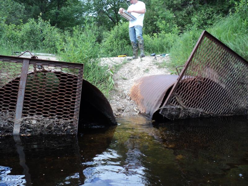
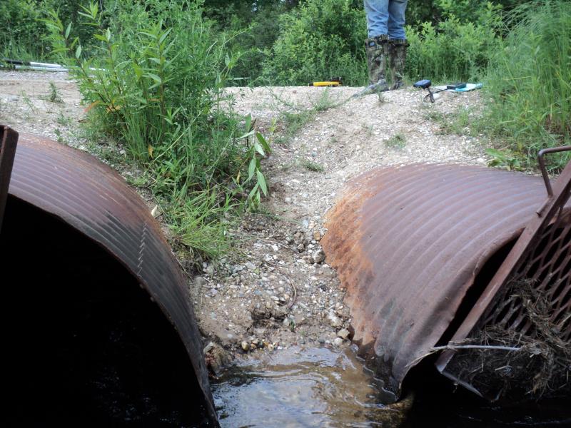
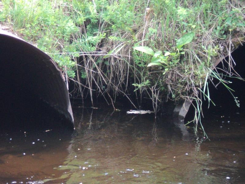
Inlet
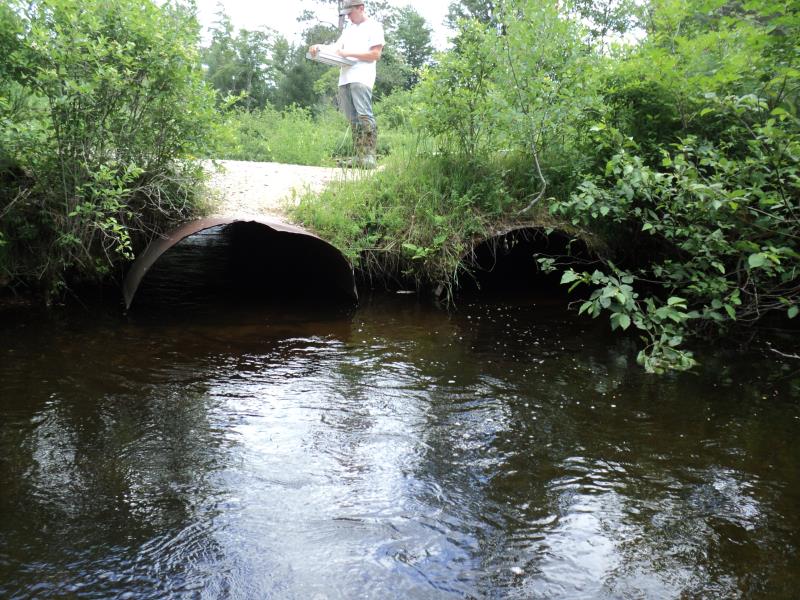
Outlet
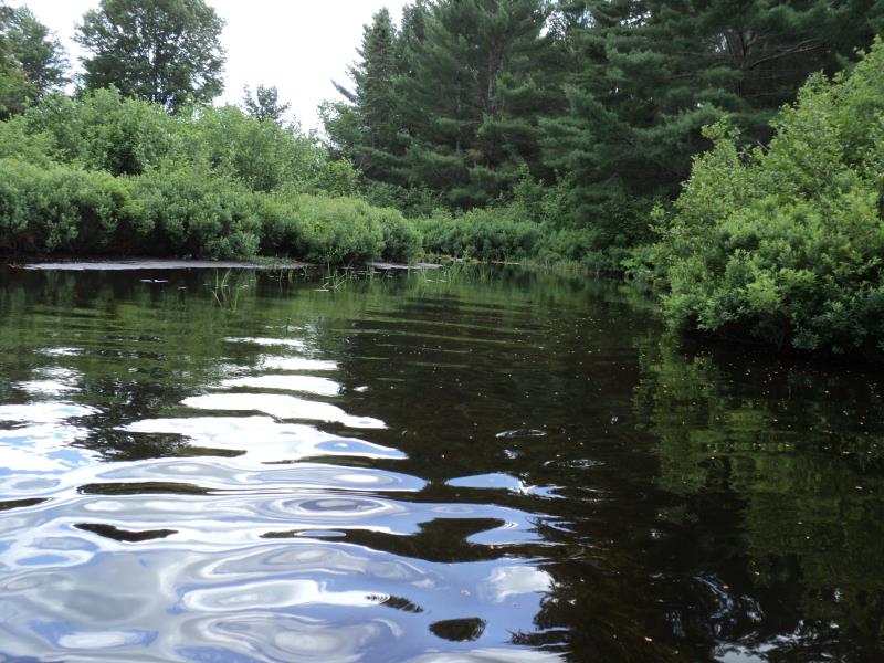
Upstream Conditions
Downstream Conditions
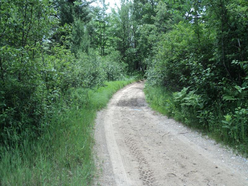
Road Approach - Left
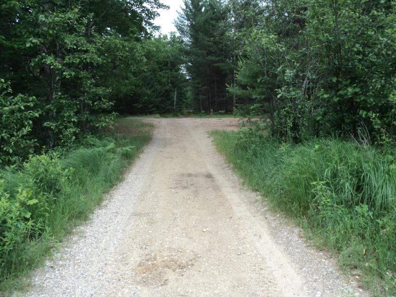
Road Approach - Right
Erosion
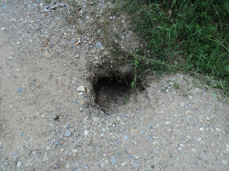
Erosion
Erosion
Other
Crossing Information
Type of Crossing: culvert(s)
Number of Structures: 2
Structure Shape: Pipe Arch
Inlet Type: Trash Rack
Outlet Type: At Stream Grade
Structure Material: Metal
Structure Substrate: None
General Conditions: Fair
Multiple Culverts/Spans | ||||
Culvert/Span | Width | Length | Height | Material |
2 |
4.8 ft. |
20 ft. |
3 ft. |
Metal |
Structure Interior: corrugated
Dimensions of Structure: Length 20 ft.
, Width 4.8 ft.
, Height 3 ft.
Structure is NOT Perched
Structure Inlet
Water Depth: 0.9 ft.
Embedded Depth of Structure: 0 ft.
Water Velocity*: 3.6 ft./sec.
Structure Outlet
Water Depth: 1.5 ft.
Embedded Depth of Structure: 0 ft.
Water Velocity*: 1 ft./sec.
*Water Velocities were measured 0.7 ft. below Surface
(with Meter)
Additional Comments
Little to no fill above culvert, old exposed culvert pipe to the right facing downstream.
Stream Information
Stream Flow: Bankfull
Scour Pool: Length 0 ft.
, Width 0 ft.
, Depth 0 ft.
Upstream Pond: Length 0 ft.
, Width 0 ft.
, Depth 0 ft.
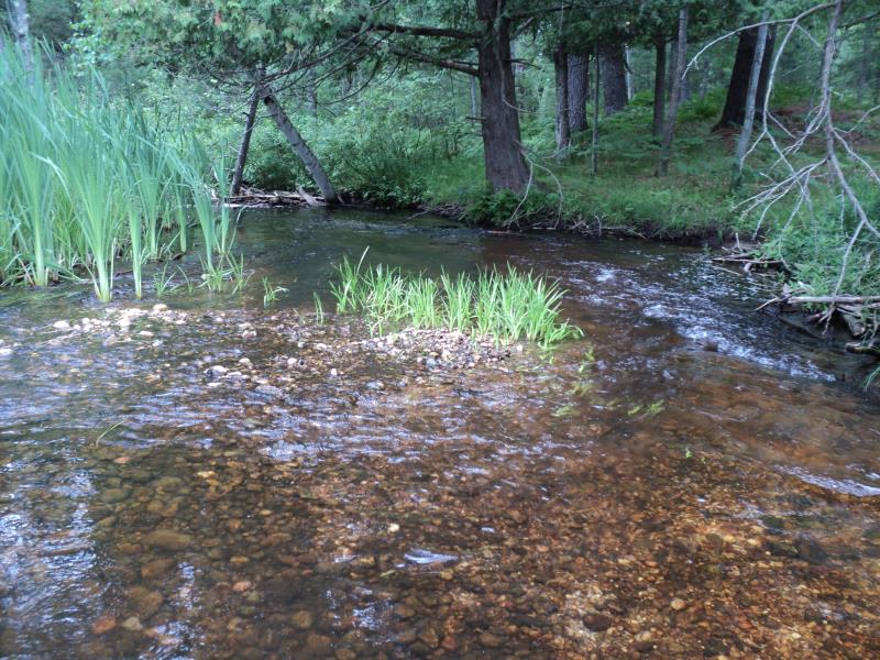
Riffle Information
Water Depth: 1.6 ft.
Bankfull Width: 16 ft.
Wetted Width: 16 ft.
Water Velocity: 0.9 ft./sec.
(Measured with Meter)
Dominant Substrate: Gravel
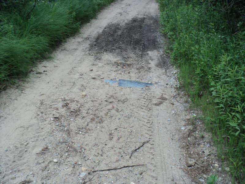
Road Information
Sand
Other Road
(Seasonal)
Road Condition: Poor
Road Width at Culvert: 9 ft.
Location of Low Point: Other
Runoff Path: Roadway
Embankments
Upstream
Fill Depth: 0.9 ft.
Slope: More than 1:2
Downstream
Fill Depth: 0.9 ft.
Slope: More than 1:2
Approaches
Left Approach
Length: 0 ft.
Slope: Less Than 1%
Vegetation: Heavy
LS Factor: 0.05
Erosion: 0 tons/year
Right Approach
Length: 135 ft.
Slope: 1% to 5%
Vegetation: Heavy
LS Factor: 0.394
Erosion: 0.1319 tons/year
Erosion Information
Total Erosion at Crossing: 0.2369 tons/year
Extent of Erosion: Moderate
Location of Erosion | Erosion Dimensions | Eroded Material | Material Eroded | Total Erosion | ||
facing downstream | Length | Width | Depth | Reaching Stream? | (tons/year) | |
Right Downstream Embankment |
2 ft. |
1.5 ft. |
1.5 ft. |
yes |
Gravel |
0.021 |
Right Upstream Embankment |
6 ft. |
1.5 ft. |
2 ft. |
yes |
Gravel |
0.084 |
Summary Information
Fish Passability 0
Erosion is an area of concern for this site.
Yes, erosion.
A future visit to this site is recommended. Yes, check on erosion.
�