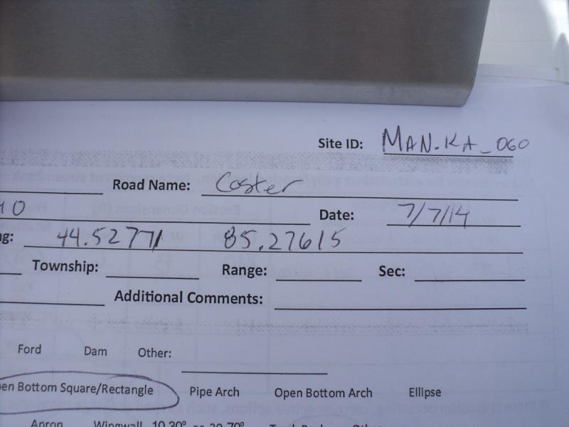
Road Stream Crossing Site MAN_KA_060
Big Manistee River Watershed, Manistee River
Coster Rd
Springfield Twp,
Kalkaska County
Information collected by:
Site Location
GPS Coordinates: 44.52731
, -85.27594
T25N
R8W
Sec 28
Owned by State
Structure is NOT Perched
Total Erosion: 10.0175 tons/year
Severity: Severe
Year Inventoried: 2014
Site ID

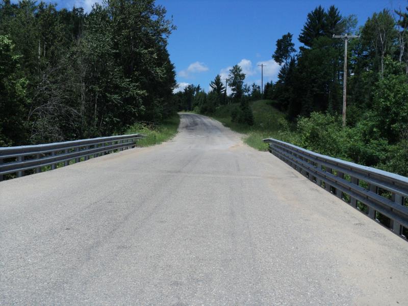
Inlet
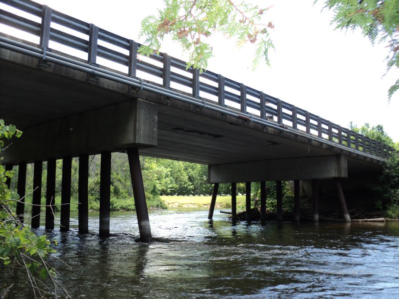
Outlet
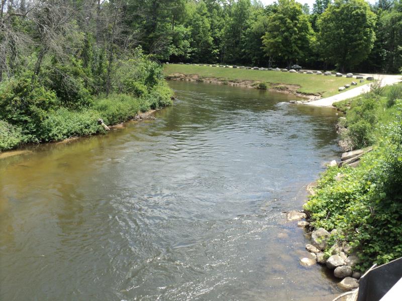
Upstream Conditions
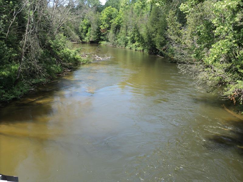
Downstream Conditions
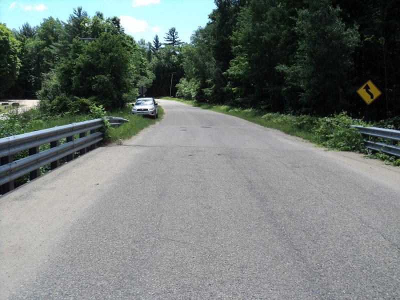
Road Approach - Left
Road Approach - Right
Erosion
Crossing Information
Type of Crossing: Bridge
Structure Shape: Open Bottom Square/Rectangle
Inlet Type: Other
Outlet Type: At Stream Grade
Structure Material: Concrete
Structure Substrate: Mixture
General Conditions: Fair
Structure Interior: smooth
Dimensions of Structure: Length 30 ft.
, Width 132 ft.
, Height 17 ft.
Structure is NOT Perched
Structure Inlet
Water Depth: 5.5 ft.
Embedded Depth of Structure: 0 ft.
Water Velocity*: 4 ft./sec.
Structure Outlet
Water Depth: 6 ft.
Embedded Depth of Structure: 0 ft.
Water Velocity*: 4 ft./sec.
*Water Velocities were measured 1 ft. below Surface
(with Meter)
Stream Information
Stream Flow: Less than Bankfull
Scour Pool: Length 0 ft.
, Width 0 ft.
, Depth 0 ft.
Upstream Pond: Length 0 ft.
, Width 0 ft.
, Depth 0 ft.
Riffle Information
Water Depth: 5 ft.
Bankfull Width: 130 ft.
Wetted Width: 115 ft.
Water Velocity: 3 ft./sec.
(Measured with Meter)
Dominant Substrate: Cobble
Road Information
Paved
County Road
Road Condition: Poor
Road Width at Culvert: 30 ft.
Location of Low Point: Other
Runoff Path: Ditch
Fill Depth: 0 ft.
Slope: Vertical
Fill Depth: 0 ft.
Slope: Vertical
Approaches
Left Approach
Length: 0 ft.
Slope: Less Than 1%
Vegetation: Partial
LS Factor: 0.05
Erosion: 0 tons/year
Right Approach
Length: 610 ft.
Slope: 1% to 5%
Vegetation: Heavy
LS Factor: 0.522
Erosion: 0.3155 tons/year
Erosion Information
Total Erosion at Crossing: 10.0175 tons/year
Extent of Erosion: Moderate
Location of Erosion | Erosion Dimensions | Eroded Material | Material Eroded | Total Erosion | ||
facing downstream | Length | Width | Depth | Reaching Stream? | (tons/year) | |
Left Upstream Streambank |
210 ft. |
8 ft. |
6 ft. |
yes |
Sand |
9.702 |
Summary Information
Erosion is an area of concern for this site.
These non-native species were observerd at this site: Purple Loosestrife
�