Road Stream Crossing Site MAN_MA_006
Big Manistee River Watershed, Unknown (tributary to Manistee River)
Upper River Rd
Marilla Twp,
Manistee County
Information collected by:
Site Location
GPS Coordinates: 44.34972
, -85.84672
T23N
R13W
Sec 35
Owned by Federal
Fish Passability 0
Perch Height: 0.4 ft.
Total Erosion: 2.1595 tons/year
Severity: Severe
Year Inventoried: 2014
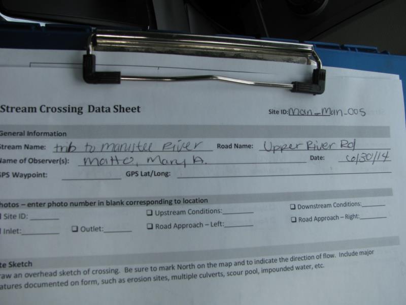
Site ID
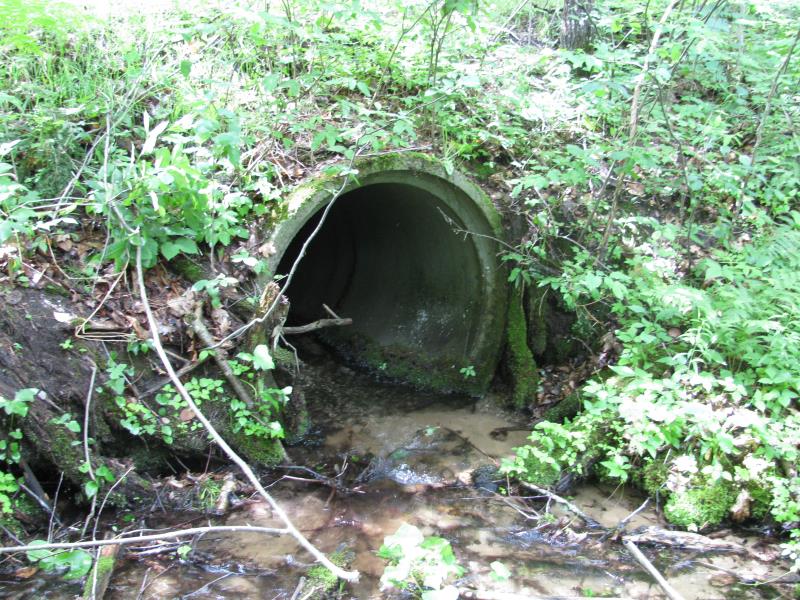
Inlet
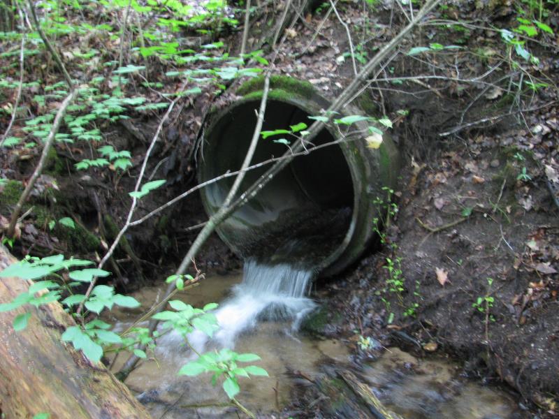
Outlet
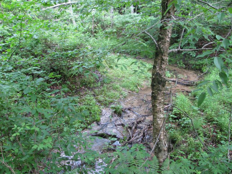
Upstream Conditions
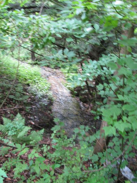
Downstream Conditions
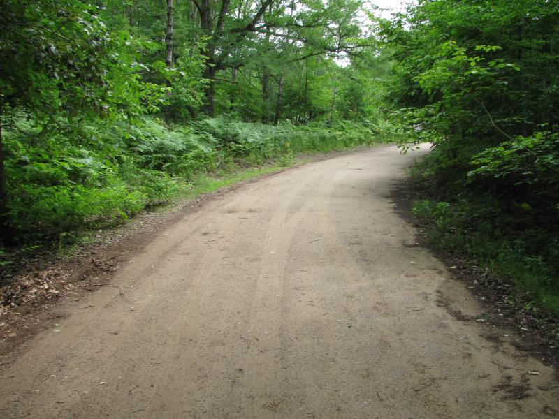
Road Approach - Left
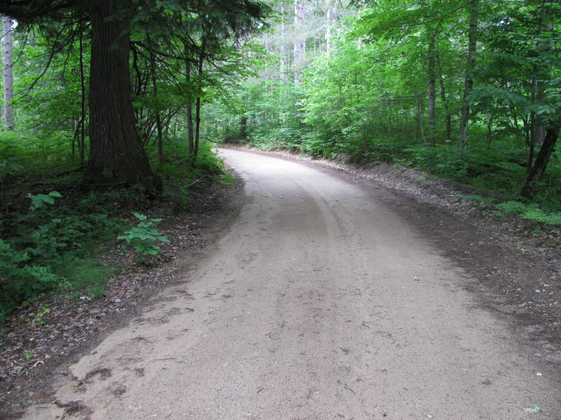
Road Approach - Right
Crossing Information
Type of Crossing: culvert(s)
Number of Structures: 1
Structure Shape: Round
Inlet Type: Projecting
Outlet Type: Freefall into Pool
Structure Material: Concrete
Structure Substrate: Gravel
General Conditions: Fair
Structure Interior: smooth
Dimensions of Structure: Length 35.5 ft.
, Width 4 ft.
, Height 4 ft.
Perch Height: 0.4 ft.
Structure Inlet
Water Depth: 0.4 ft.
Embedded Depth of Structure: 0 ft.
Water Velocity*: 0.7 ft./sec.
Structure Outlet
Water Depth: 0.6 ft.
Embedded Depth of Structure: 0 ft.
Water Velocity*: 4.5 ft./sec.
*Water Velocities were measured 0.3 ft. below Surface
(with Meter)
Stream Information
Stream Flow: Less than Bankfull
Scour Pool: Length 6.5 ft.
, Width 7 ft.
, Depth 1 ft.
Upstream Pond: Length 0 ft.
, Width 0 ft.
, Depth 0 ft.
Riffle Information
Water Depth: 0.2 ft.
Bankfull Width: 9.6 ft.
Wetted Width: 5.2 ft.
Water Velocity: 2 ft./sec.
(Measured with Meter)
Dominant Substrate: Bedrock
Road Information
Gravel
County Road
(Seasonal)
Road Condition: Good
Road Width at Culvert: 15.5 ft.
Location of Low Point: Other
Runoff Path: Roadway
Embankments
Upstream
Fill Depth: 2 ft.
Slope: More than 1:2
Downstream
Fill Depth: 4.3 ft.
Slope: More than 1:2
Approaches
Left Approach
Length: 80 ft.
Slope: 1% to 5%
Vegetation: Heavy
LS Factor: 0.364
Erosion: 0.1243 tons/year
Right Approach
Length: 0 ft.
Slope: Less Than 1%
Vegetation: Heavy
LS Factor: 0.05
Erosion: 0 tons/year
Erosion Information
Total Erosion at Crossing: 2.1595 tons/year
Extent of Erosion: Severe
Erosion is occurring and corrective actions can be installed to address the problem.
Notes: Left erosion wraps around behind outlet.
Location of Erosion | Erosion Dimensions | Eroded Material | Material Eroded | Total Erosion | ||
facing downstream | Length | Width | Depth | Reaching Stream? | (tons/year) | |
Right Downstream Streambank |
10 ft. |
1.5 ft. |
4 ft. |
yes |
Sandy Loam |
0.768 |
Left Downstream Streambank |
12 ft. |
3 ft. |
5.5 ft. |
yes |
Sandy Loam |
1.2672 |
Summary Information
Fish Passability 0
Fish Passage is an area of concern for this site.
Perched culvert with high velocities, erosion surrounding scour pool.
�