Road Stream Crossing Site MAN_MA_008
Big Manistee River Watershed, Woodpecker Creek
Upper River Rd
Marilla Twp,
Manistee County
Information collected by:
Site Location
GPS Coordinates: 44.36627
, -85.83019
T23N
R13W
Sec 35
Owned by Private
Structure is NOT Perched
Total Erosion: 1.018 tons/year
Severity: Severe
Year Inventoried: 2014
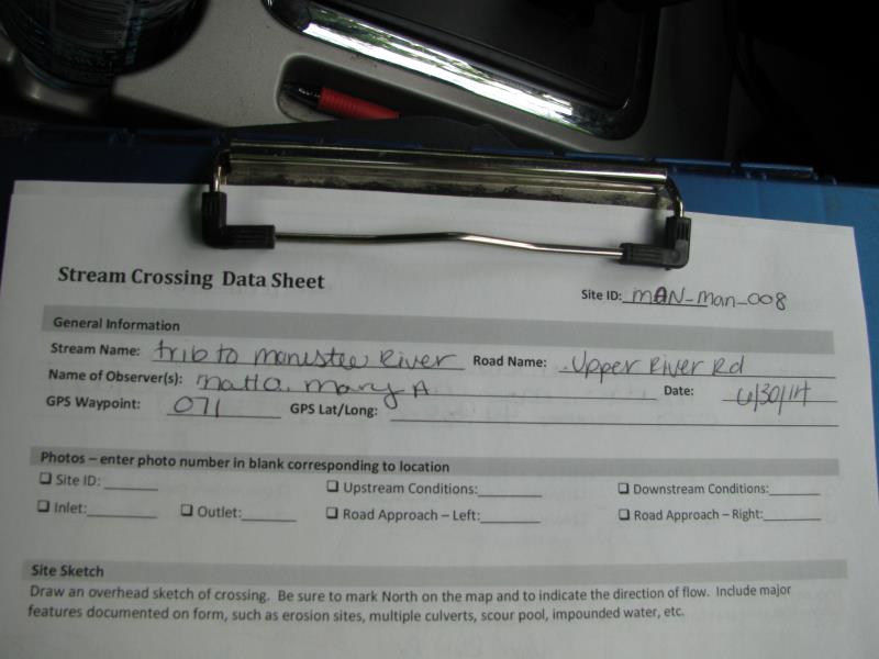
Site ID
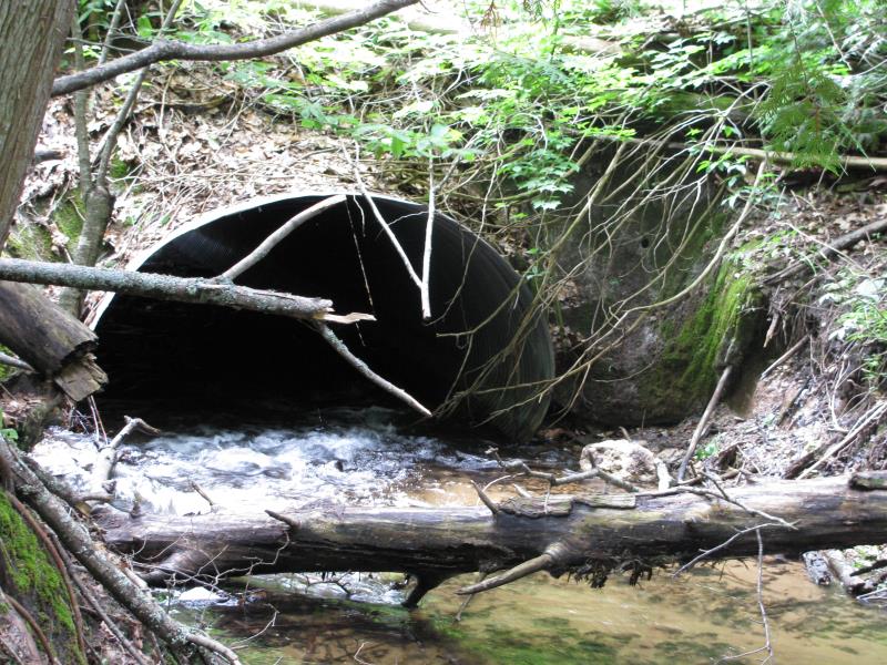
Inlet
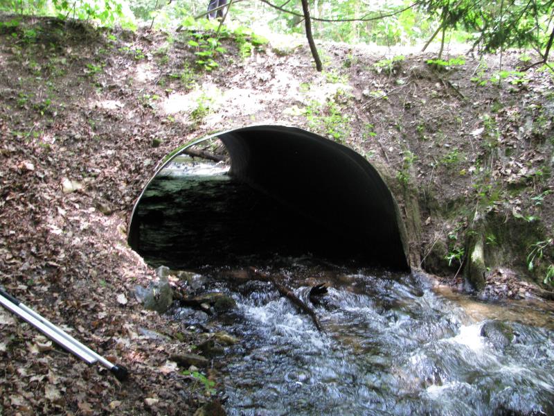
Outlet
Upstream Conditions
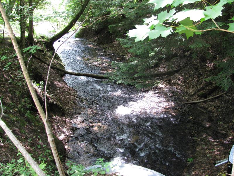
Downstream Conditions
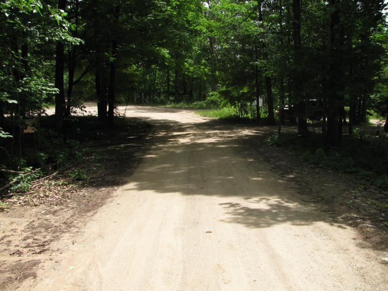
Road Approach - Left
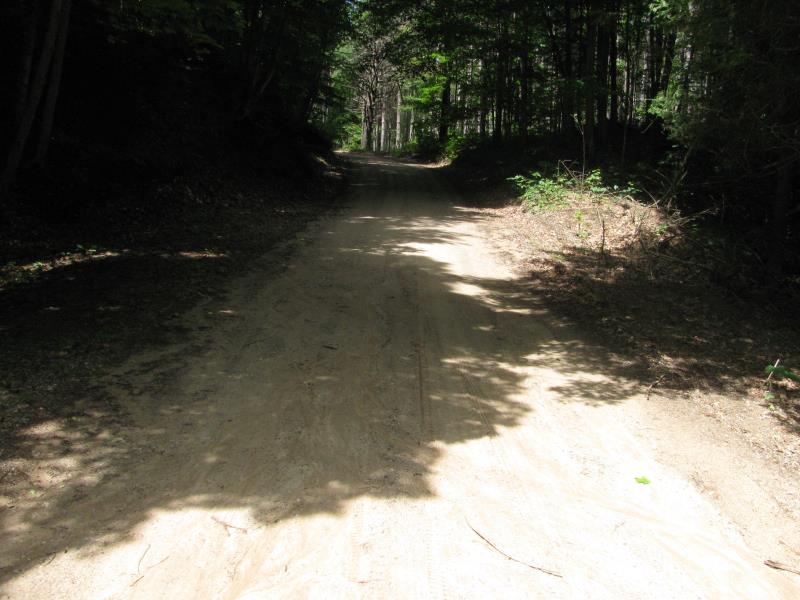
Road Approach - Right
Crossing Information
Type of Crossing: culvert(s)
Number of Structures: 1
Structure Shape: Pipe Arch
Inlet Type: Other
Outlet Type: At Stream Grade
Structure Material: Metal
Structure Substrate: Mixture
General Conditions: Fair
Structure Interior: corrugated
Dimensions of Structure: Length 38 ft.
, Width 9.5 ft.
, Height 5.5 ft.
Structure is NOT Perched
Structure Inlet
Water Depth: 0.6 ft.
Embedded Depth of Structure: 0 ft.
Water Velocity*: 4.4 ft./sec.
Structure Outlet
Water Depth: 0.7 ft.
Embedded Depth of Structure: 0 ft.
Water Velocity*: 3.3 ft./sec.
*Water Velocities were measured 0.4 ft. below Surface
(with Meter)
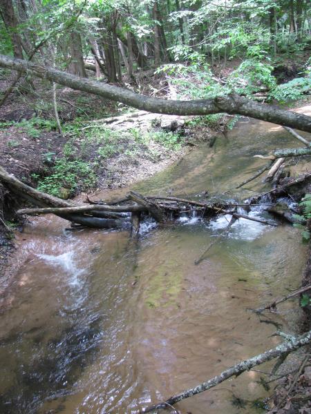
Stream Information
Stream Flow: Less than Bankfull
Scour Pool: Length 0 ft.
, Width 0 ft.
, Depth 0 ft.
Upstream Pond: Length 0 ft.
, Width 0 ft.
, Depth 0 ft.
Riffle Information
Water Depth: 0.6 ft.
Bankfull Width: 22.3 ft.
Wetted Width: 15.2 ft.
Water Velocity: 2.6 ft./sec.
(Measured with Meter)
Dominant Substrate: Gravel
Road Information
Gravel
County Road
(Seasonal)
Road Condition: Good
Road Width at Culvert: 13 ft.
Location of Low Point: At Stream
Runoff Path: Roadway
Embankments
Upstream
Fill Depth: 2.5 ft.
Slope: More than 1:2
Downstream
Fill Depth: 4.7 ft.
Slope: More than 1:2
Approaches
Left Approach
Length: 0 ft.
Slope: Less Than 1%
Vegetation: Heavy
LS Factor: 0.05
Erosion: 0 tons/year
Right Approach
Length: 160 ft.
Slope: 1% to 5%
Vegetation: Heavy
LS Factor: 0.406
Erosion: 0.2326 tons/year
Erosion Information
Total Erosion at Crossing: 1.018 tons/year
Extent of Erosion: Moderate
Erosion is occurring and corrective actions can be installed to address the problem.
Notes:
Previous stabilized erosion from very high water also present downstream.
Location of Erosion | Erosion Dimensions | Eroded Material | Material Eroded | Total Erosion | ||
facing downstream | Length | Width | Depth | Reaching Stream? | (tons/year) | |
Left Downstream Streambank |
25 ft. |
1 ft. |
2 ft. |
yes |
Sandy Loam |
0.336 |
Right Upstream Streambank |
10 ft. |
1 ft. |
3 ft. |
yes |
Clay |
0.147 |
Right Upstream Streambank |
15 ft. |
1.5 ft. |
3 ft. |
yes |
Sandy Loam |
0.3024 |
Summary Information
Erosion is an area of concern for this site.
�