Road Stream Crossing Site MAN_MA_025
Big Manistee River Watershed, Unknown (tributary to Sickle Creek)
Coates Hwy
Brown Twp,
Manistee County
Information collected by:
Site Location
GPS Coordinates: 44.30866
, -86.1659
T22N
R15W
Sec 18
Owned by Private
Fish Passability 0
Perch Height: 3.6 ft.
Total Erosion: 0.2962 tons/year
Severity: Severe
Year Inventoried: 2014
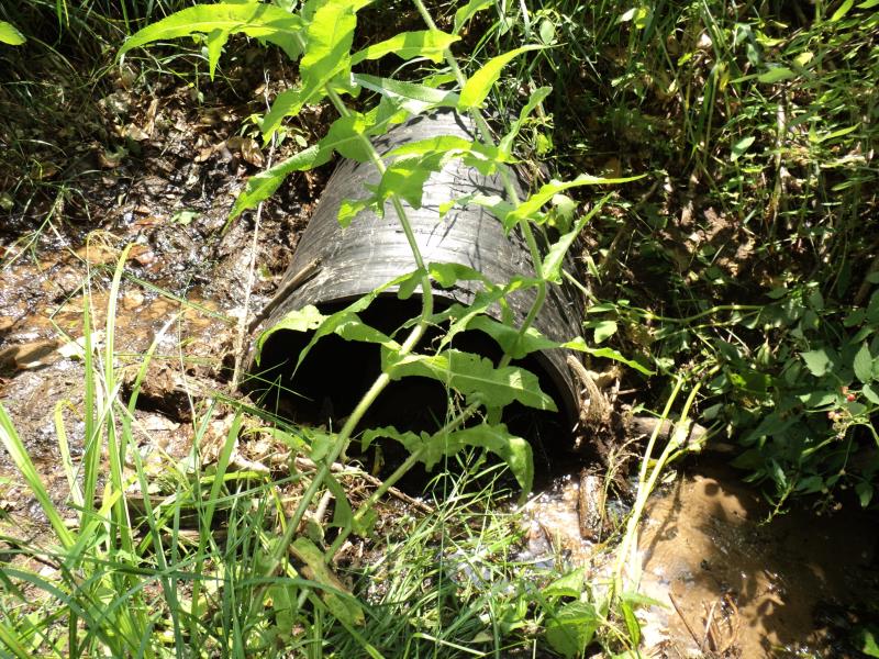
Inlet
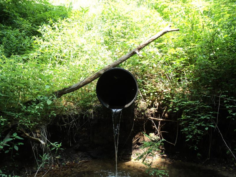
Outlet
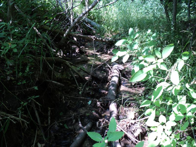
Upstream Conditions
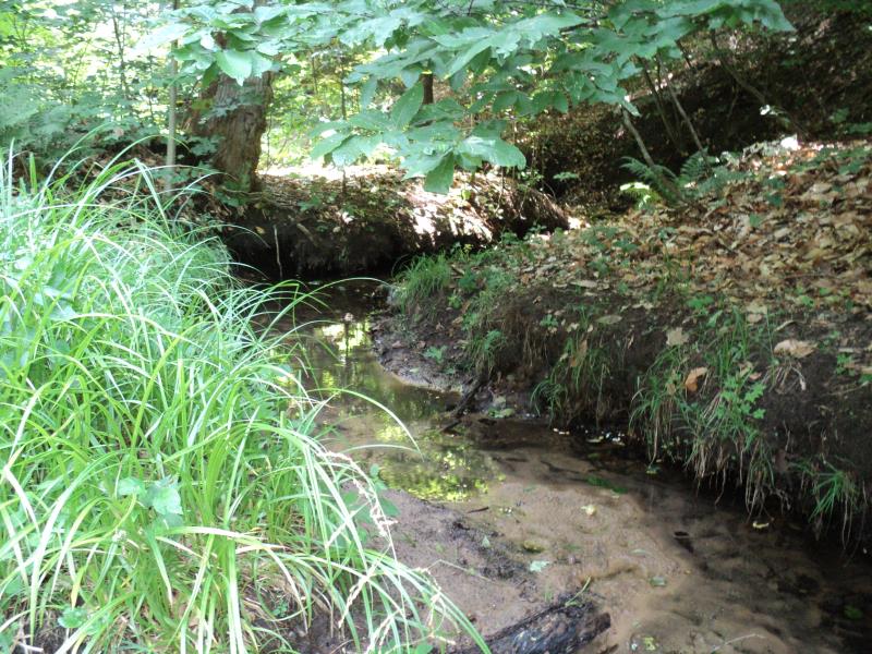
Downstream Conditions
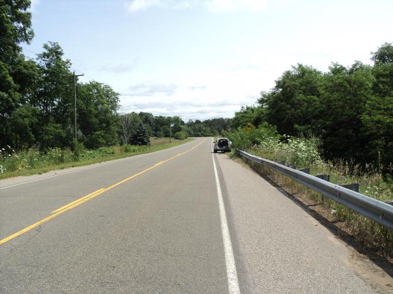
Road Approach - Left
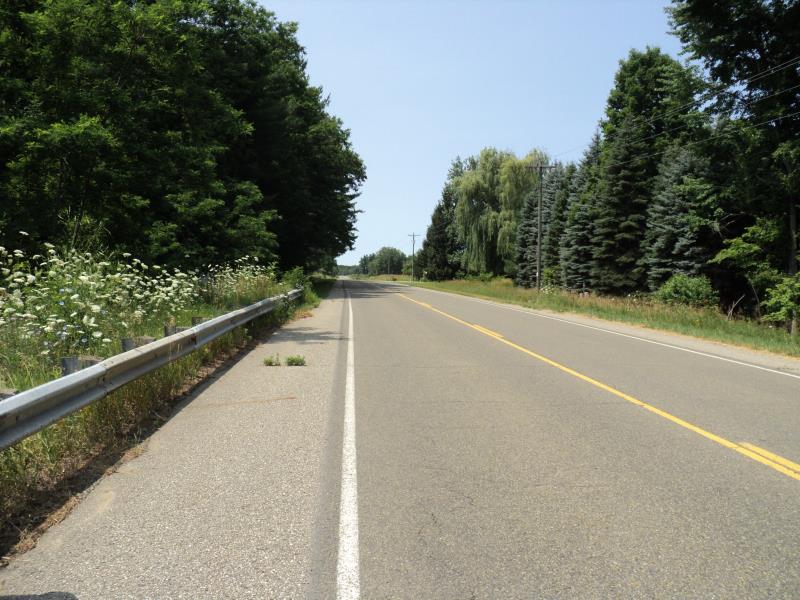
Road Approach - Right
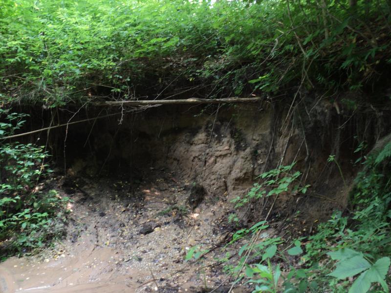
Erosion
Crossing Information
Type of Crossing: culvert(s)
Number of Structures: 1
Structure Shape: Round
Inlet Type: Projecting
Outlet Type: Freefall into Pool
Structure Material: Plastic
Structure Substrate: Sand
General Conditions: Fair
Structure Interior: corrugated
Dimensions of Structure: Length 120 ft.
, Width 2 ft.
, Height 2 ft.
Percentage Plugged:
Inlet: 1% to 25%
Outlet: 0%
In Pipe: 0%
Perch Height: 3.6 ft.
Structure Inlet
Water Depth: 0.1 ft.
Embedded Depth of Structure: 1 ft.
Water Velocity*: 0.6 ft./sec.
Structure Outlet
Water Depth: 0.1 ft.
Embedded Depth of Structure: 0 ft.
Water Velocity*: 4.1 ft./sec.
*Water Velocities were measured at the Surface
(with Meter)
Stream Information
Stream Flow: Less than Bankfull
Scour Pool: Length 9 ft.
, Width 9 ft.
, Depth 1.8 ft.
Upstream Pond: Length 0 ft.
, Width 0 ft.
, Depth 0 ft.
Riffle Information
Water Depth: 0.2 ft.
Bankfull Width: 8 ft.
Wetted Width: 5 ft.
Water Velocity: 0.6 ft./sec.
(Measured with Meter)
Dominant Substrate: Gravel
Road Information
Paved
County Road
Road Condition: Good
Road Width at Culvert: 35 ft.
Location of Low Point: Other
Runoff Path: Roadway
Embankments
Upstream
Fill Depth: 20 ft.
Slope: More than 1:2
Downstream
Fill Depth: 20 ft.
Slope: More than 1:2
Approaches
Left Approach
Length: 0 ft.
Slope: Less Than 1%
Vegetation: Heavy
LS Factor: 0.05
Erosion: 0 tons/year
Right Approach
Length: 510 ft.
Slope: 1% to 5%
Vegetation: Heavy
LS Factor: 0.502
Erosion: 0.2962 tons/year
Erosion Information
Total Erosion at Crossing: 0.2962 tons/year
Location of Erosion | Erosion Dimensions | Eroded Material | Material Eroded | Total Erosion | ||
facing downstream | Length | Width | Depth | Reaching Stream? | (tons/year) | |
Left Downstream Embankment |
14.3 ft. |
10.2 ft. |
5.3 ft. |
yes |
Sandy Loam |
|
Summary Information
Fish Passability 0
Erosion is an area of concern for this site.
Yes, erosion.
�