Road Stream Crossing Site P019
Pine River Watershed, Unknown (tributary to Pine River)
Gilbert/Belvins St
Leroy Twp,
Osceola County
Information collected by:
Site Location
GPS Coordinates: 44.03777
, -85.45111
T19N
R10W
Sec 13
Owned by Local Government
Private
Private
Fish Passability 1
Structure is NOT Perched
Total Erosion: 0.7671 tons/year
Severity: Moderate
Year Inventoried: 2014
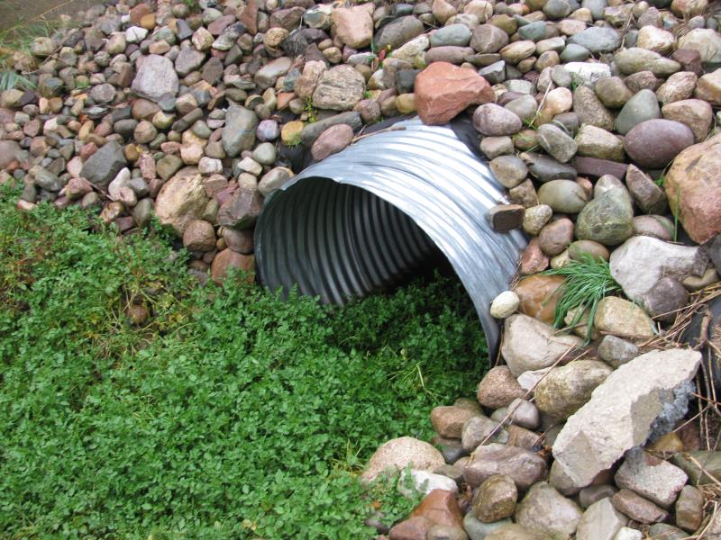
Inlet
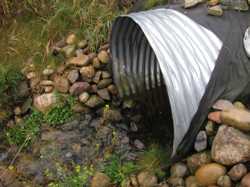
Outlet
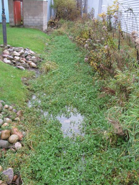
Upstream Conditions
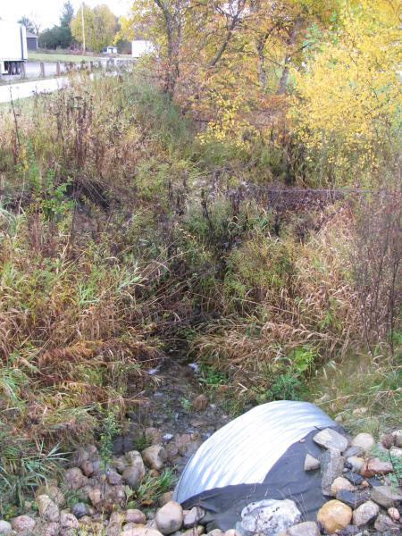
Downstream Conditions
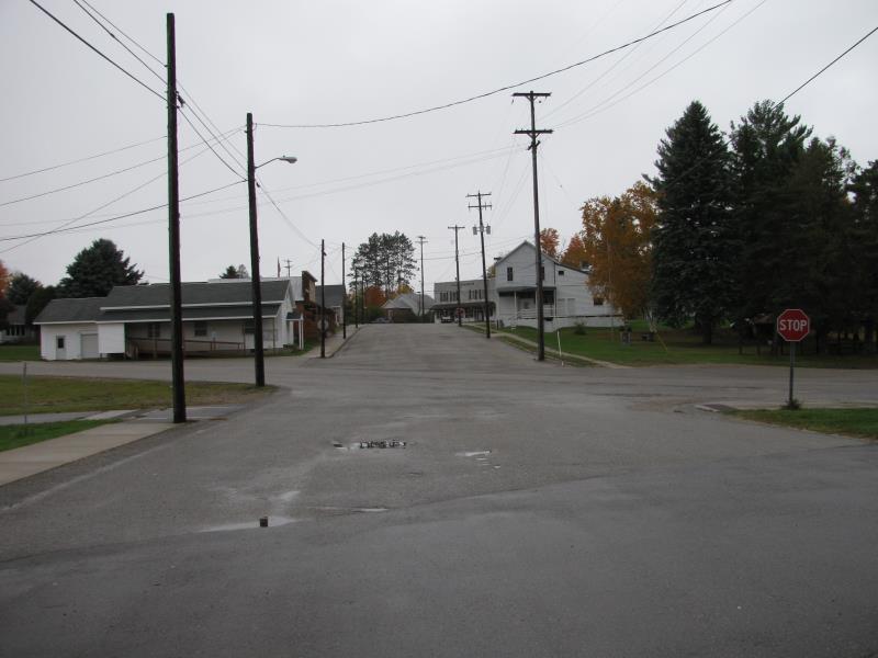
Road Approach - Left
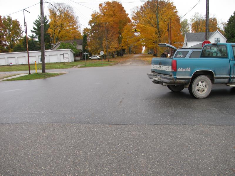
Road Approach - Right
Crossing Information
Type of Crossing: culvert(s)
Number of Structures: 1
Structure Shape: Round
Inlet Type: Projecting
Outlet Type: Cascade over Riprap
Structure Material: Metal
Structure Substrate: Sand
General Conditions: New
Structure Interior: corrugated
Dimensions of Structure: Length 175 ft.
, Width 4 ft.
, Height 4 ft.
Structure is NOT Perched
Structure Inlet
Water Depth: 0.3 ft.
Embedded Depth of Structure: 0 ft.
Water Velocity*: 0.8 ft./sec.
Structure Outlet
Water Depth: 0.4 ft.
Embedded Depth of Structure: 0.1 ft.
Water Velocity*: 1.3 ft./sec.
*Water Velocities were measured 0.3 ft. below Surface
(with Meter)
Additional Comments
Storm drains on Gilbert & Belvins empty directly into culvert, oil from road runoff seen draining into storm drains.
Stream Information
Stream Flow: Less than Bankfull
Scour Pool: Length 0 ft.
, Width 0 ft.
, Depth 0 ft.
Upstream Pond: Length 0 ft.
, Width 0 ft.
, Depth 0 ft.
Riffle Information
Water Depth: 0.3 ft.
Bankfull Width: 7 ft.
Wetted Width: 4 ft.
Water Velocity: 0.7 ft./sec.
(Measured with Meter)
Dominant Substrate: Gravel
Road Information
Paved
Town Road
Road Condition: Good
Road Width at Culvert: 30 ft.
Location of Low Point: At Stream
Runoff Path: Roadway
Embankments
Upstream
Fill Depth: 2.1 ft.
Slope: More than 1:2
Downstream
Fill Depth: 2.4 ft.
Slope: More than 1:2
Approaches
Left Approach
Length: 500 ft.
Slope: 1% to 5%
Vegetation: Partial
LS Factor: 0.64
Erosion: 0.3174 tons/year
Right Approach
Length: 500 ft.
Slope: 1% to 5%
Vegetation: Partial
LS Factor: 0.64
Erosion: 0.3174 tons/year
Erosion Information
Total Erosion at Crossing: 0.7671 tons/year
Extent of Erosion: Moderate
Erosion is occurring and corrective actions can be installed to address the problem.
Location of Erosion | Erosion Dimensions | Eroded Material | Material Eroded | Total Erosion | ||
facing downstream | Length | Width | Depth | Reaching Stream? | (tons/year) | |
Right Downstream Embankment |
2 ft. |
2 ft. |
3.7 ft. |
yes |
Gravelly Loam |
0.0518 |
Left Downstream Streambank |
3 ft. |
11 ft. |
4 ft. |
yes |
Sandy Loam |
0.0806 |
Summary Information
Fish Passability 1
A future visit to this site is recommended. Yes, to monitor erosion and storm runoff drains.
�