Road Stream Crossing Site P034(NORTH)
Pine River Watershed, Rose Lake outlet
US-131 North Bound
Burdell Twp,
Osceola County
Information collected by:
Site Location
GPS Coordinates: 44.11623
, -85.47002
T20N
R10W
Sec 23
Owned by Private
Fish Passability 0.5
Structure is NOT Perched
Total Erosion: 0.6407 tons/year
Severity: Moderate
Year Inventoried: 2014
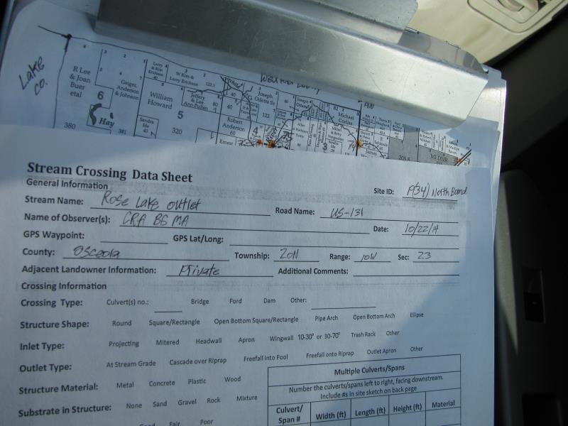
Site ID
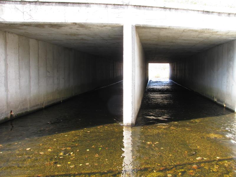
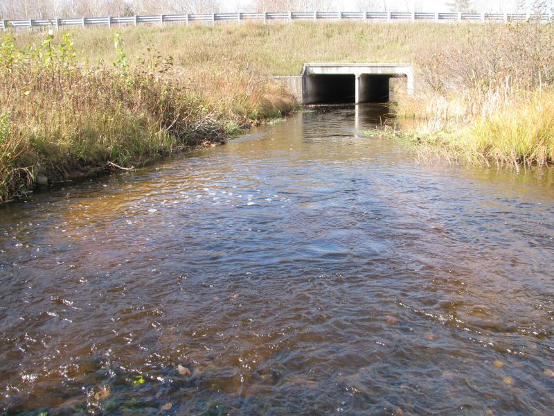
Inlet
Outlet
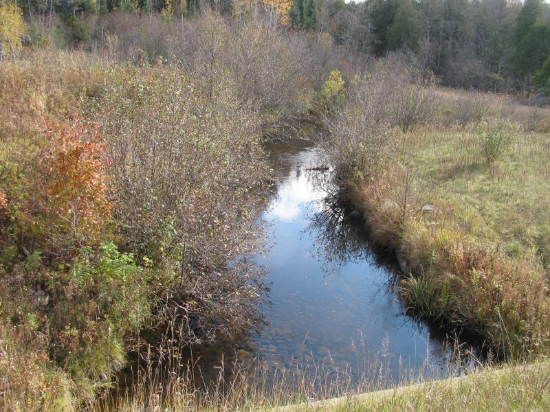
Upstream Conditions
Downstream Conditions
Road Approach - Left
Road Approach - Right
Crossing Information
Type of Crossing: culvert(s)
Number of Structures: 2
Structure Shape: Square/Rectangle
Inlet Type: Wingwall 30-70 Degree
Outlet Type: At Stream Grade
Structure Material: Concrete
Structure Substrate: None
General Conditions: Good
Multiple Culverts/Spans | ||||
Culvert/Span | Width | Length | Height | Material |
2 |
10 ft. |
95 ft. |
7.8 ft. |
Concrete |
Structure Interior: smooth
Dimensions of Structure: Length 95 ft.
, Width 10 ft.
, Height 7.8 ft.
Structure is NOT Perched
Structure Inlet
Water Depth: 0.4 ft.
Embedded Depth of Structure: 0 ft.
Water Velocity*: 2.2 ft./sec.
Structure Outlet
Water Depth: 0.4 ft.
Embedded Depth of Structure: 0 ft.
Water Velocity*: 1.8 ft./sec.
*Water Velocities were measured 0.3 ft. below Surface
(with Meter)
Stream Information
Stream Flow: Less than Bankfull
Scour Pool: Length 15 ft.
, Width 20 ft.
, Depth 3 ft.
Upstream Pond: Length 0 ft.
, Width 0 ft.
, Depth 0 ft.
Riffle Information
Water Depth: 1 ft.
Bankfull Width: 29 ft.
Wetted Width: 22 ft.
Water Velocity: 1.6 ft./sec.
(Measured with Meter)
Dominant Substrate: Gravel
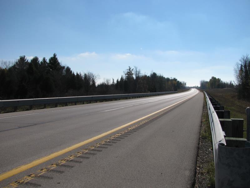
Road Information
Paved
State Road
Road Condition: Good
Road Width at Culvert: 40 ft.
Location of Low Point: At Stream
Runoff Path: Roadway
Embankments
Upstream
Fill Depth: 6 ft.
Slope: More than 1:2
Downstream
Fill Depth: 6 ft.
Slope: More than 1:2
Approaches
Left Approach
Length: 700 ft.
Slope: 1% to 5%
Vegetation: Heavy
LS Factor: 0.535
Erosion: 0.4952 tons/year
Right Approach
Length: 250 ft.
Slope: 1% to 5%
Vegetation: Heavy
LS Factor: 0.44
Erosion: 0.1455 tons/year
Erosion Information
Total Erosion at Crossing: 0.6407 tons/year
Summary Information
Fish Passability 0.5
�