Road Stream Crossing Site P037
Pine River Watershed, Big Beaver Creek
210th Ave
Leroy Twp,
Osceola County
Information collected by:
Site Location
GPS Coordinates: 44.04047
, -85.50357
T19N
R10W
Sec 16
Owned by Private
Fish Passability 0.5
Structure is NOT Perched
Total Erosion: 0 tons/year
Severity: Moderate
Year Inventoried: 2014
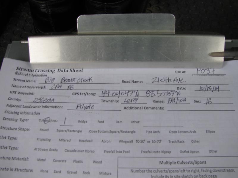
Site ID
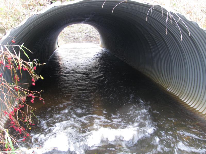
Inlet
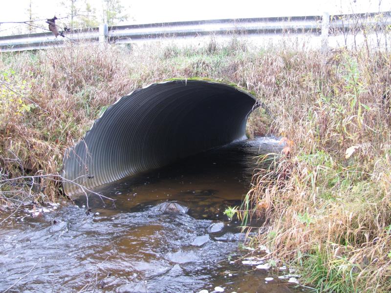
Outlet
Upstream Conditions
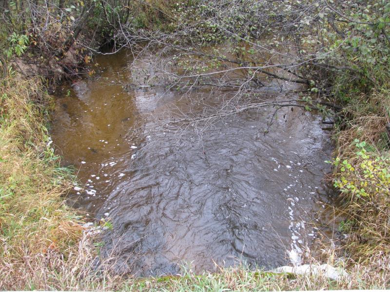
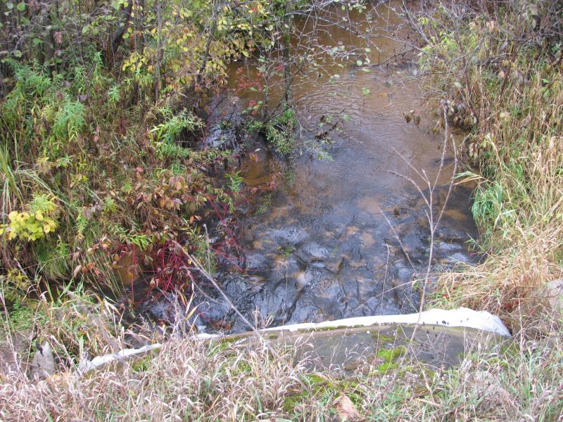
Downstream Conditions
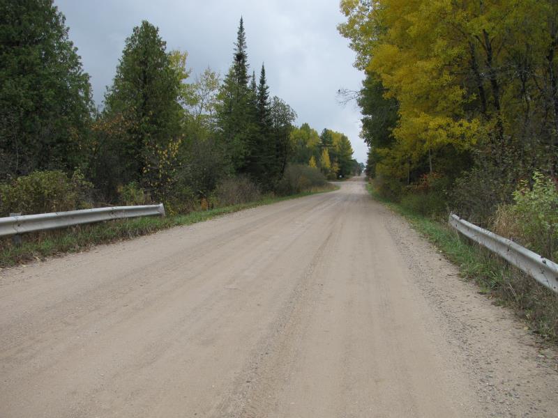
Road Approach - Left
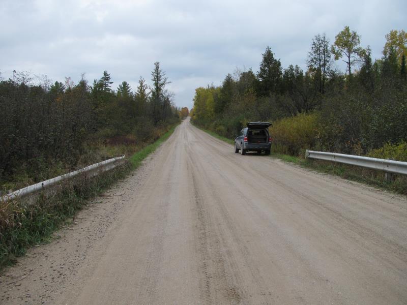
Road Approach - Right
Crossing Information
Type of Crossing: culvert(s)
Number of Structures: 3
Structure Shape: Pipe Arch
Inlet Type: Mitered
Outlet Type: At Stream Grade
Structure Material: Metal
Structure Substrate: Sand
General Conditions: Good
Multiple Culverts/Spans | ||||
Culvert/Span | Width | Length | Height | Material |
2 |
2.5 ft. |
30 ft. |
2.5 ft. |
Metal |
3 |
2.5 ft. |
30 ft. |
2.5 ft. |
Metal |
Structure Interior: corrugated
Dimensions of Structure: Length 45 ft.
, Width 9.5 ft.
, Height 6 ft.
Structure is NOT Perched
Structure Inlet
Water Depth: 1.1 ft.
Embedded Depth of Structure: 0 ft.
Water Velocity*: 2.7 ft./sec.
Structure Outlet
Water Depth: 1.4 ft.
Embedded Depth of Structure: 0 ft.
Water Velocity*: 2.3 ft./sec.
*Water Velocities were measured 0.7 ft. below Surface
(with Meter)
Additional Comments
2 smaller culverts for high water times.
Stream Information
Stream Flow: Less than Bankfull
Scour Pool: Length 22 ft.
, Width 22 ft.
, Depth 3.5 ft.
Upstream Pond: Length 0 ft.
, Width 0 ft.
, Depth 0 ft.
Riffle Information
Water Depth: 1.2 ft.
Bankfull Width: 18 ft.
Wetted Width: 16 ft.
Water Velocity: 1.8 ft./sec.
(Measured with Meter)
Dominant Substrate: Sand
Road Information
Gravel
County Road
Road Condition: Good
Road Width at Culvert: 23 ft.
Location of Low Point: Other
Runoff Path: Ditch
Embankments
Upstream
Fill Depth: 2 ft.
Slope: More than 1:2
Downstream
Fill Depth: 1.5 ft.
Slope: 1:2
Approaches
Left Approach
Length: 0 ft.
Slope: Less Than 1%
Vegetation: Heavy
LS Factor: 0.05
Erosion: 0 tons/year
Right Approach
Length: 0 ft.
Slope: Less Than 1%
Vegetation: Heavy
LS Factor: 0.05
Erosion: 0 tons/year
Erosion Information
Total Erosion at Crossing: 0 tons/year
Extent of Erosion: Minor
Notes: Some erosion/slump observed along roadway guardrails.
Summary Information
Fish Passability 0.5
�