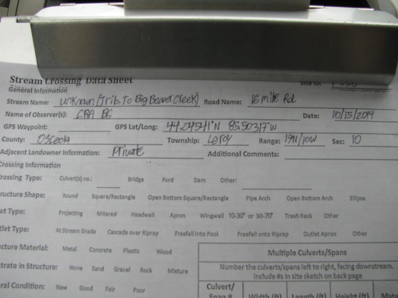
Road Stream Crossing Site P038
Pine River Watershed, Unknown (tributary to Big Beaver Creek)
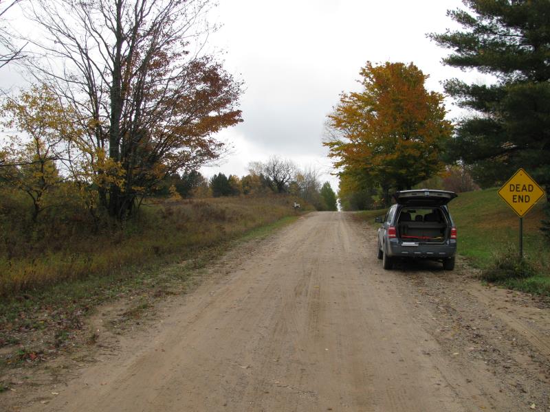
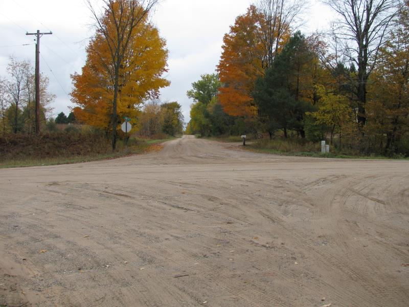
16 Mile Rd
Leroy Twp,
Osceola County
Information collected by:
Site Location
GPS Coordinates: 44.04541
, -85.50317
T19N
R10W
Sec 10
Owned by Private
Fish Passability 1
Structure is NOT Perched
Total Erosion: 0.9003 tons/year
Severity: Minor
Year Inventoried: 2014
Site ID
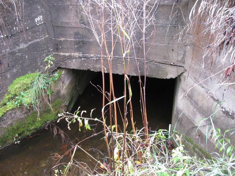
Inlet
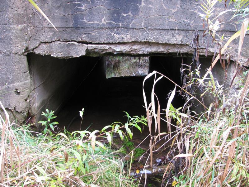
Outlet
Upstream Conditions
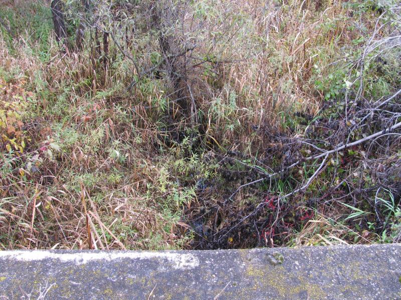
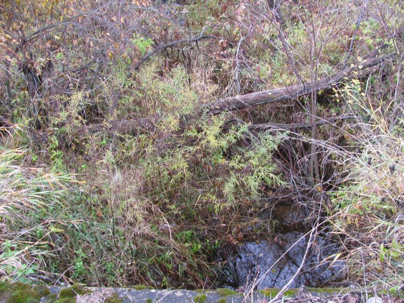
Downstream Conditions
Road Approach - Left
Road Approach - Right
Crossing Information
Type of Crossing: culvert(s)
Number of Structures: 1
Structure Shape: Open Bottom Square/Rectangle
Inlet Type: Wingwall 30-70 Degree
Outlet Type: At Stream Grade
Structure Material: Concrete
Structure Substrate: Sand
General Conditions: Poor
Structure Interior: smooth
Dimensions of Structure: Length 35 ft.
, Width 5 ft.
, Height 3 ft.
Structure is NOT Perched
Structure Inlet
Water Depth: 1.1 ft.
Embedded Depth of Structure: 0 ft.
Water Velocity*: 0.2 ft./sec.
Structure Outlet
Water Depth: 0.4 ft.
Embedded Depth of Structure: 0 ft.
Water Velocity*: 1 ft./sec.
*Water Velocities were measured 0.3 ft. below Surface
(with Meter)
Additional Comments
Large amounts of roadway gravel washing into stream.
Stream Information
Stream Flow: Less than Bankfull
Scour Pool: Length 0 ft.
, Width 0 ft.
, Depth 0 ft.
Upstream Pond: Length 0 ft.
, Width 0 ft.
, Depth 0 ft.
Riffle Information
Water Depth: 1 ft.
Bankfull Width: 8 ft.
Wetted Width: 6 ft.
Water Velocity: 0.4 ft./sec.
(Measured with Meter)
Dominant Substrate: Organics
Road Information
Gravel
County Road
Road Condition: Fair
Road Width at Culvert: 19 ft.
Location of Low Point: At Stream
Runoff Path: Roadway
Embankments
Upstream
Fill Depth: 2 ft.
Slope: Vertical
Downstream
Fill Depth: 2 ft.
Slope: Vertical
Approaches
Left Approach
Length: 200 ft.
Slope: 1% to 5%
Vegetation: Heavy
LS Factor: 0.43
Erosion: 0.4501 tons/year
Right Approach
Length: 200 ft.
Slope: 1% to 5%
Vegetation: Heavy
LS Factor: 0.43
Erosion: 0.4501 tons/year
Erosion Information
Total Erosion at Crossing: 0.9003 tons/year
Summary Information
Fish Passability 1
Erosion is an area of concern for this site.
Yes, structure is crumbing and abutement walls are cracked severely.
A future visit to this site is recommended. Yes, to look at replacing.
�