Road Stream Crossing Site P042
Pine River Watershed, Little Beaver Creek
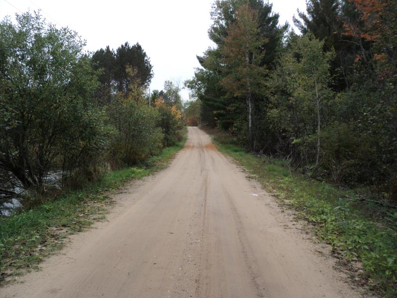
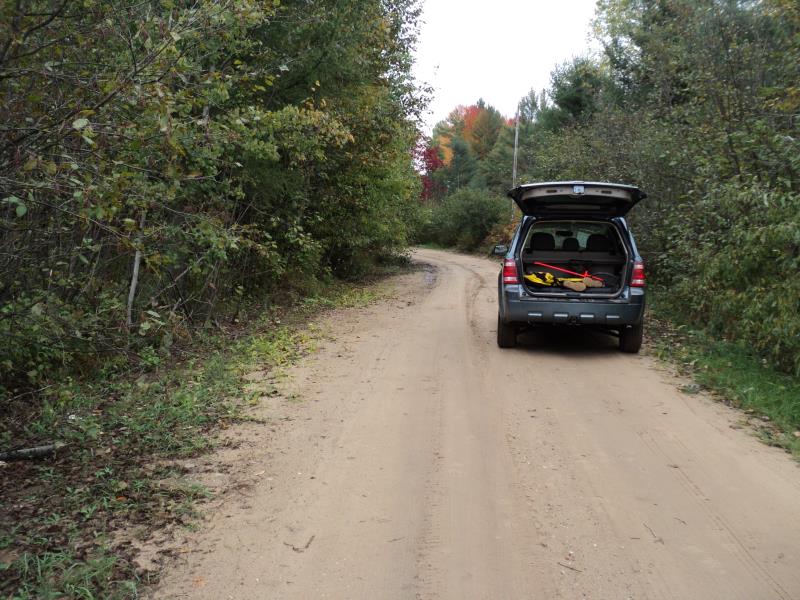
Sunrise Lake Rd
Leroy Twp,
Osceola County
Information collected by:
Site Location
GPS Coordinates: 44.03136
, -85.54897
T19N
R10W
Sec 18
Owned by Private
Fish Passability 0
Perch Height: 0.4 ft.
Total Erosion: 0.3681 tons/year
Severity: Severe
Year Inventoried: 2014
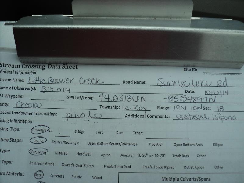
Site ID
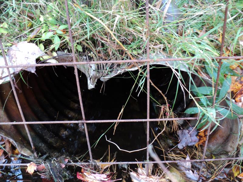
Inlet
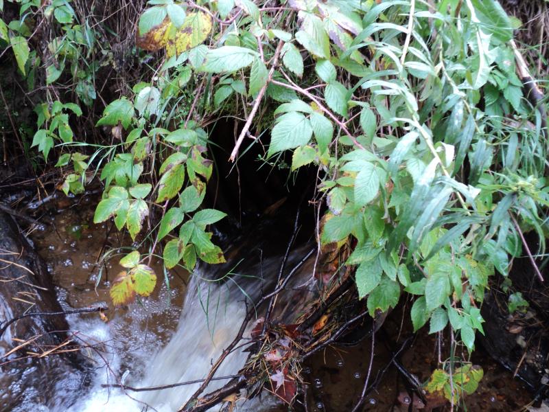
Outlet
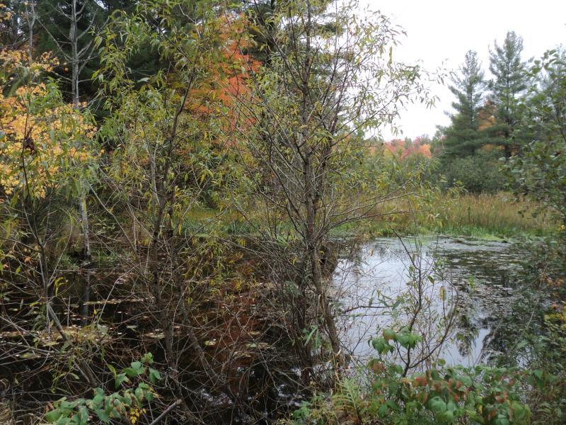
Upstream Conditions
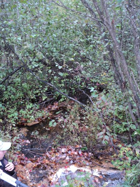
Downstream Conditions
Road Approach - Left
Road Approach - Right
Crossing Information
Type of Crossing: culvert(s)
Number of Structures: 1
Structure Shape: Round
Inlet Type: Projecting
Outlet Type: Freefall into Pool
Structure Material: Metal
Structure Substrate: None
General Conditions: Fair
Structure Interior: corrugated
Dimensions of Structure: Length 28 ft.
, Width 2 ft.
, Height 2 ft.
Percentage Crushed:
Inlet: 1% to 25%
Outlet: 0%
In Pipe: 0%
Perch Height: 0.4 ft.
Structure Inlet
Water Depth: 0.7 ft.
Embedded Depth of Structure: 0 ft.
Water Velocity*: 0.7 ft./sec.
Structure Outlet
Water Depth: 1 ft.
Embedded Depth of Structure: 0 ft.
Water Velocity*: 7 ft./sec.
*Water Velocities were measured 0.5 ft. below Surface
(with Meter)
Additional Comments
Upstream is pond.
Stream Information
Stream Flow: Less than Bankfull
Scour Pool: Length 12 ft.
, Width 8 ft.
, Depth 1.3 ft.
Upstream Pond: Length 120 ft.
, Width 145 ft.
, Depth 2 ft.
Riffle Information
Water Depth: 0.3 ft.
Bankfull Width: 9 ft.
Wetted Width: 7.5 ft.
Water Velocity: 1 ft./sec.
(Measured with Meter)
Dominant Substrate: Sand
Road Information
Gravel
County Road
Road Condition: Fair
Road Width at Culvert: 11 ft.
Location of Low Point: At Stream
Runoff Path: Roadway
Embankments
Upstream
Fill Depth: 0.7 ft.
Slope: 1:2
Downstream
Fill Depth: 2.2 ft.
Slope: 1:1
Approaches
Left Approach
Length: 300 ft.
Slope: Less Than 1%
Vegetation: Heavy
LS Factor: 0.05
Erosion: 0.0455 tons/year
Right Approach
Length: 0 ft.
Slope: Less Than 1%
Vegetation: Heavy
LS Factor: 0.05
Erosion: 0 tons/year
Erosion Information
Total Erosion at Crossing: 0.3681 tons/year
Extent of Erosion: Moderate
Notes: Steep embankment at outlet eroding.
Location of Erosion | Erosion Dimensions | Eroded Material | Material Eroded | Total Erosion | ||
facing downstream | Length | Width | Depth | Reaching Stream? | (tons/year) | |
Left Downstream Embankment |
6 ft. |
1 ft. |
4 ft. |
yes |
Sandy Loam |
0.1613 |
Right Downstream Embankment |
6 ft. |
1 ft. |
4 ft. |
yes |
Sandy Loam |
0.1613 |
Summary Information
Fish Passability 0
Fish Passage is an area of concern for this site.
Perched and very high outlet velocity, upstream is large pond/wetland, beaver activity also. Site should be monitored.
�