Road Stream Crossing Site P059
Pine River Watershed, Rose Lake outlet
Cleveland Rd
Burdell Twp,
Osceola County
Information collected by:
Site Location
GPS Coordinates: 44.11288
, -85.46415
T20N
R10W
Sec 23
Owned by Private
Structure is NOT Perched
Total Erosion: 0.593 tons/year
Severity: Moderate
Year Inventoried: 2014
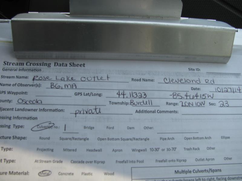
Site ID
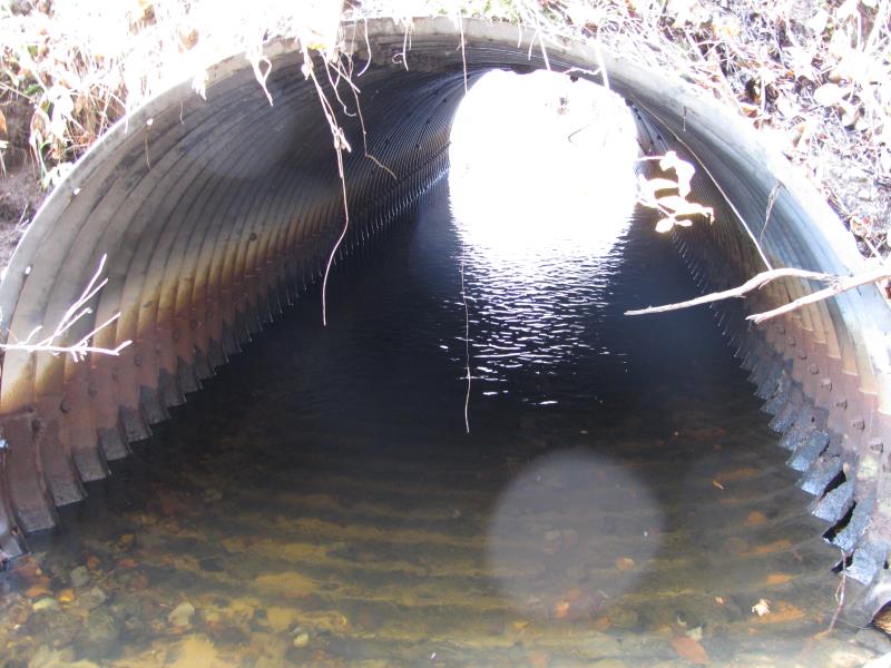
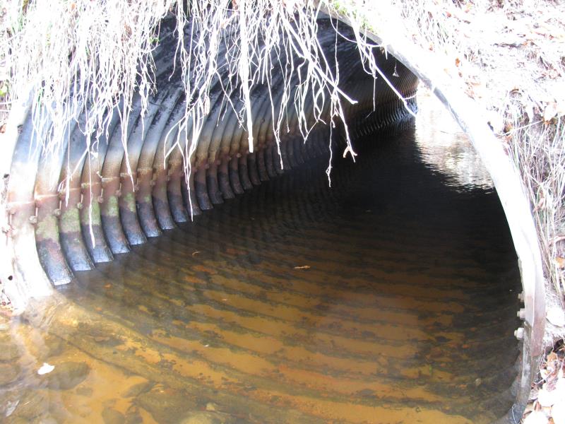
Inlet
Outlet
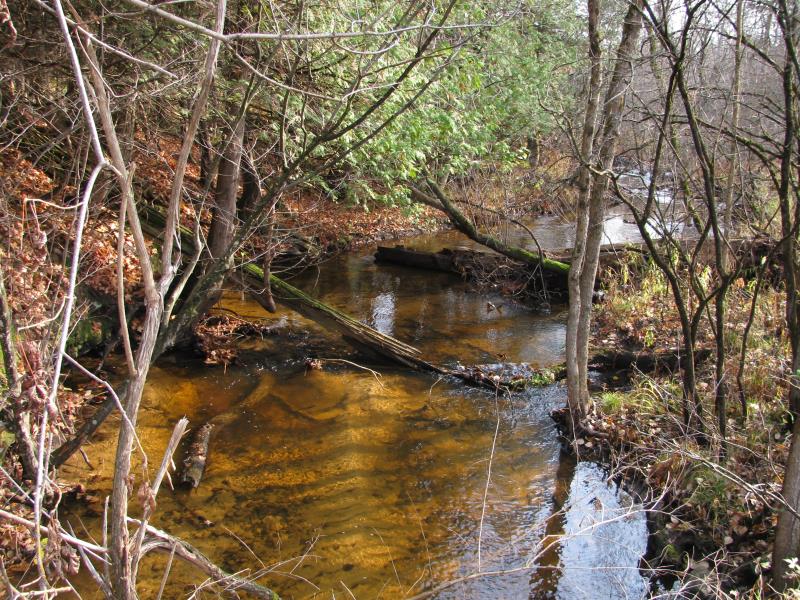
Upstream Conditions
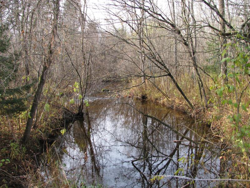
Downstream Conditions
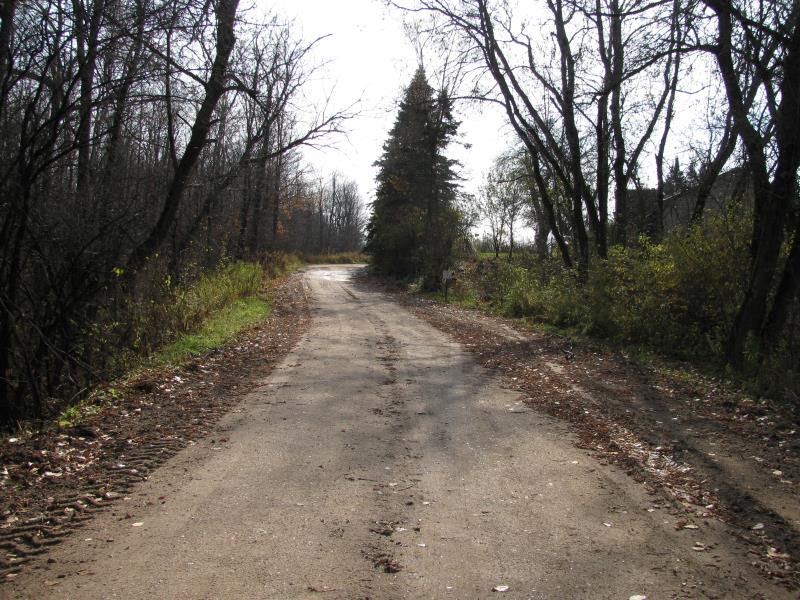
Road Approach - Left
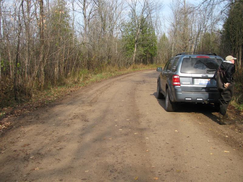
Road Approach - Right
Crossing Information
Type of Crossing: culvert(s)
Number of Structures: 1
Structure Shape: Pipe Arch
Inlet Type: Projecting
Outlet Type: At Stream Grade
Structure Material: Metal
Structure Substrate: None
General Conditions: Poor
Structure Interior: corrugated
Dimensions of Structure: Length 28 ft.
, Width 7 ft.
, Height 5 ft.
Structure is NOT Perched
Structure Inlet
Water Depth: 1 ft.
Embedded Depth of Structure: 0 ft.
Water Velocity*: 0.8 ft./sec.
Structure Outlet
Water Depth: 1.2 ft.
Embedded Depth of Structure: 0 ft.
Water Velocity*: 1 ft./sec.
*Water Velocities were measured 0.7 ft. below Surface
(with Meter)
Stream Information
Stream Flow: Less than Bankfull
Scour Pool: Length 0 ft.
, Width 0 ft.
, Depth 0 ft.
Upstream Pond: Length 0 ft.
, Width 0 ft.
, Depth 0 ft.
Riffle Information
Water Depth: 0.6 ft.
Bankfull Width: 22 ft.
Wetted Width: 18 ft.
Water Velocity: 0.7 ft./sec.
(Measured with Meter)
Dominant Substrate: Gravel
Road Information
Gravel
County Road
Road Condition: Fair
Road Width at Culvert: 21 ft.
Location of Low Point: At Stream
Runoff Path: Roadway
Embankments
Upstream
Fill Depth: 0.9 ft.
Slope: Vertical
Downstream
Fill Depth: 0.6 ft.
Slope: Vertical
Approaches
Left Approach
Length: 300 ft.
Slope: Less Than 1%
Vegetation: Heavy
LS Factor: 0.05
Erosion: 0.0868 tons/year
Right Approach
Length: 75 ft.
Slope: 1% to 5%
Vegetation: Heavy
LS Factor: 0.36
Erosion: 0.1562 tons/year
Erosion Information
Total Erosion at Crossing: 0.593 tons/year
Extent of Erosion: Moderate
Notes:
Very Steep/ vertical embankments erroding at culvert, some natural undercuttung at bends
Location of Erosion | Erosion Dimensions | Eroded Material | Material Eroded | Total Erosion | ||
facing downstream | Length | Width | Depth | Reaching Stream? | (tons/year) | |
Right Upstream Embankment |
2.5 ft. |
1 ft. |
5 ft. |
yes |
Gravelly Loam |
0.0875 |
Left Upstream Embankment |
2.5 ft. |
1 ft. |
5 ft. |
yes |
Gravelly Loam |
0.0875 |
Right Downstream Embankment |
2.5 ft. |
1 ft. |
5 ft. |
yes |
Gravelly Loam |
0.0875 |
Left Downstream Embankment |
2.5 ft. |
1 ft. |
5 ft. |
yes |
Gravelly Loam |
0.0875 |
Summary Information
Erosion is an area of concern for this site.
�