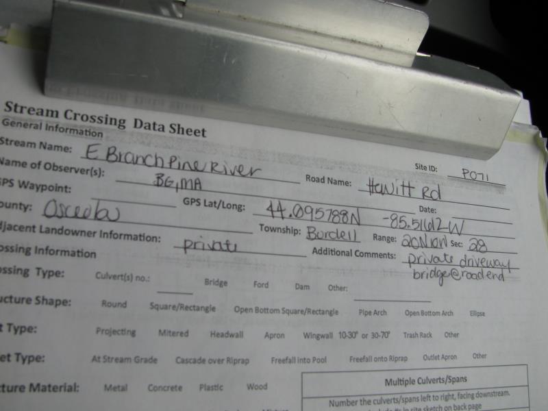
Road Stream Crossing Site P071
Pine River Watershed, East Branch Pine River
Hewitt Rd
Burdell Twp,
Osceola County
Information collected by:
Site Location
GPS Coordinates: 44.09578
, -85.51612
T20N
R10W
Sec 28
Owned by Private
Fish Passability 0.5
Structure is NOT Perched
Total Erosion: 0.4562 tons/year
Severity: Moderate
Year Inventoried: 2014
Site ID
Inlet
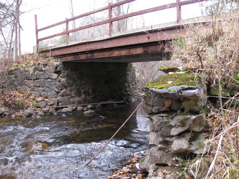
Outlet
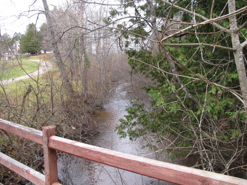
Upstream Conditions
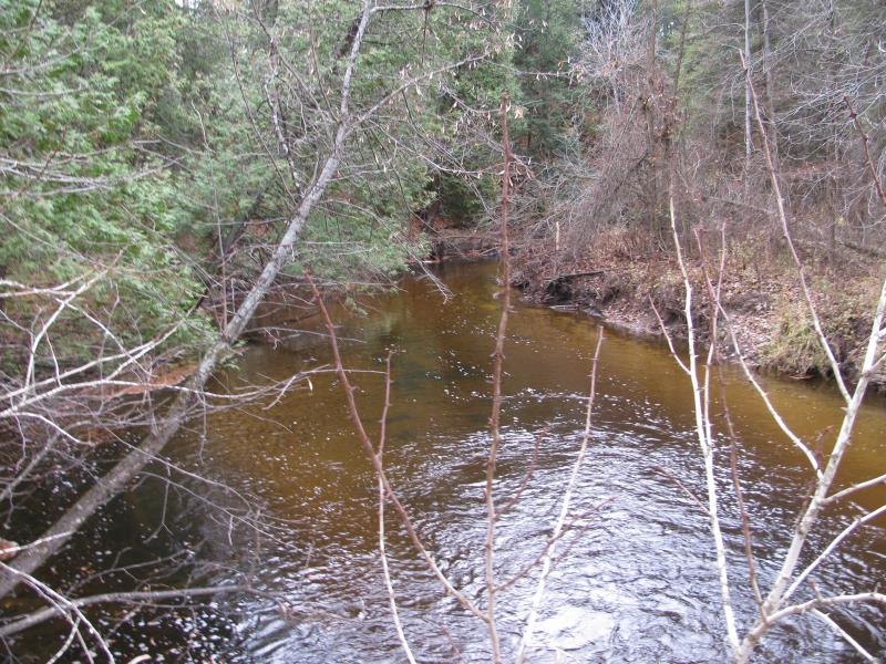
Downstream Conditions
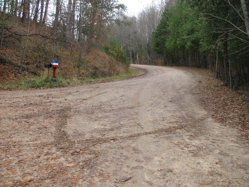
Road Approach - Left
Road Approach - Right
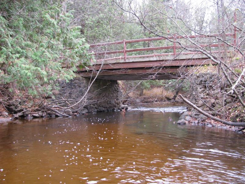
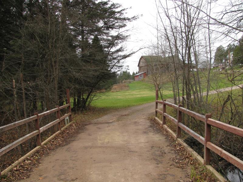
Crossing Information
Type of Crossing: Bridge
Structure Shape: Open Bottom Square/Rectangle
Inlet Type: Other
Outlet Type: At Stream Grade
Structure Material: Metal
Structure Substrate: Rock
General Conditions: Fair
Structure Interior: smooth
Dimensions of Structure: Length 13 ft.
, Width 19 ft.
, Height 8.3 ft.
Structure is NOT Perched
Structure Inlet
Water Depth: 2.3 ft.
Embedded Depth of Structure: 0 ft.
Water Velocity*: 1.7 ft./sec.
Structure Outlet
Water Depth: 1.5 ft.
Embedded Depth of Structure: 0 ft.
Water Velocity*: 3 ft./sec.
*Water Velocities were measured 1 ft. below Surface
(with Meter)
Additional Comments
Private driveway, bridge at road end.
Stream Information
Stream Flow: Less than Bankfull
Scour Pool: Length 90 ft.
, Width 60 ft.
, Depth 5 ft.
Upstream Pond: Length 0 ft.
, Width 0 ft.
, Depth 0 ft.
Riffle Information
Water Depth: 1.6 ft.
Bankfull Width: 24 ft.
Wetted Width: 19.5 ft.
Water Velocity: 1.5 ft./sec.
(Measured with Meter)
Dominant Substrate: Sand
Road Information
Gravel
County Road
Road Condition: Good
Road Width at Culvert: 12 ft.
Location of Low Point: Other
Runoff Path: Roadway
Fill Depth: 0 ft.
Slope: Vertical
Fill Depth: 0 ft.
Slope: Vertical
Approaches
Left Approach
Length: 300 ft.
Slope: 1% to 5%
Vegetation: Heavy
LS Factor: 0.46
Erosion: 0.4562 tons/year
Right Approach
Length: 0 ft.
Slope: Less Than 1%
Vegetation: Heavy
LS Factor: 0.05
Erosion: 0 tons/year
Erosion Information
Total Erosion at Crossing: 0.4562 tons/year
Summary Information
Fish Passability 0.5
�