Road Stream Crossing Site P072
Pine River Watershed, Tributary to East Branch Pine River
20 Mile Rd
Burdell Twp,
Osceola County
Information collected by:
Site Location
GPS Coordinates: 44.10308
, -85.49552
T20N
R10W
Sec 22
Owned by Private
Fish Passability 1
Structure is NOT Perched
Total Erosion: 0.1985 tons/year
Severity: Minor
Year Inventoried: 2014
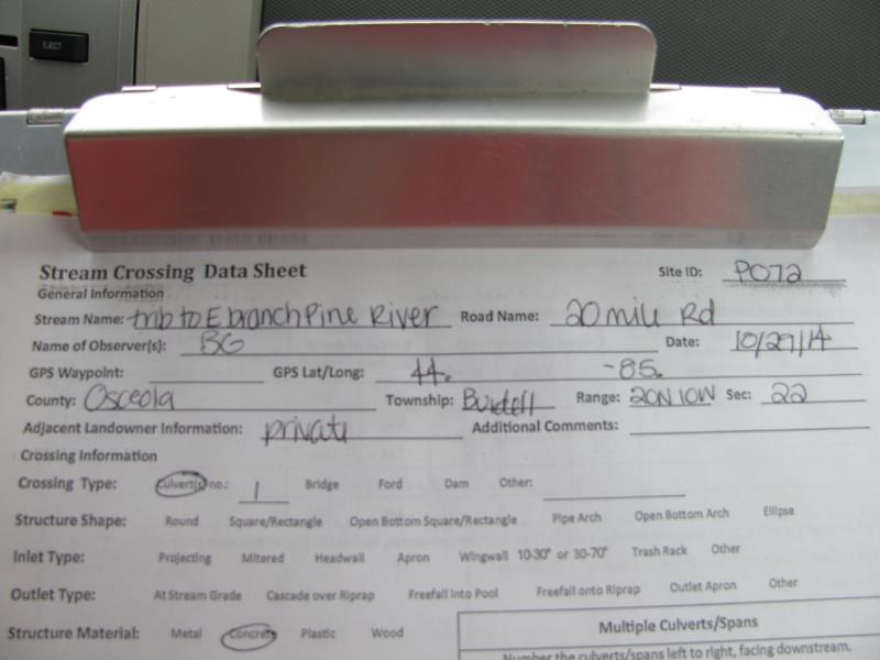
Site ID
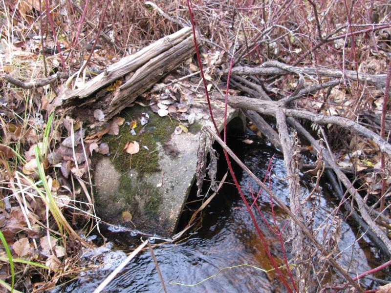
Inlet
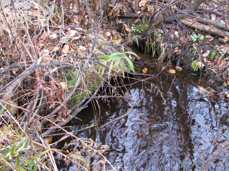
Outlet
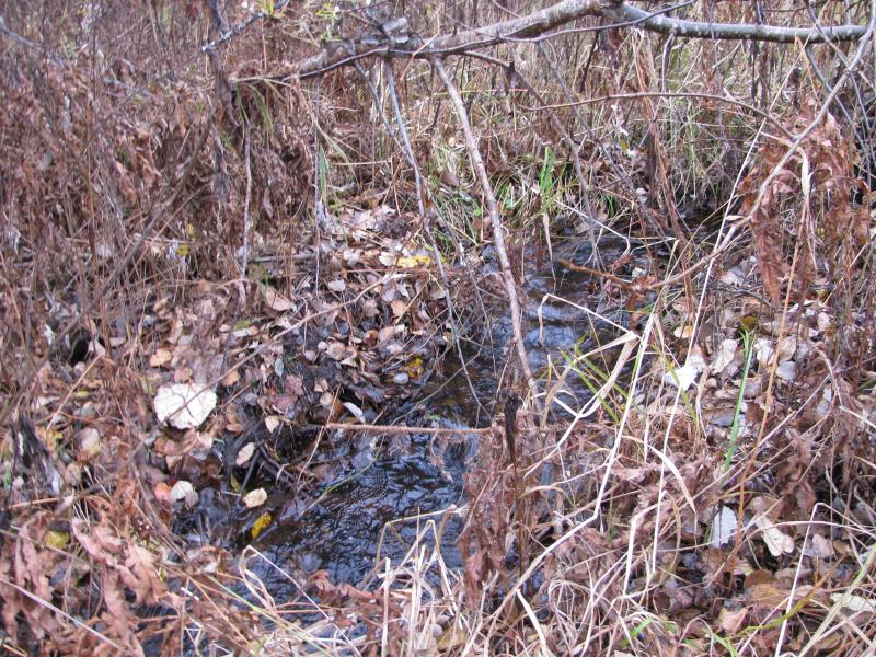
Upstream Conditions
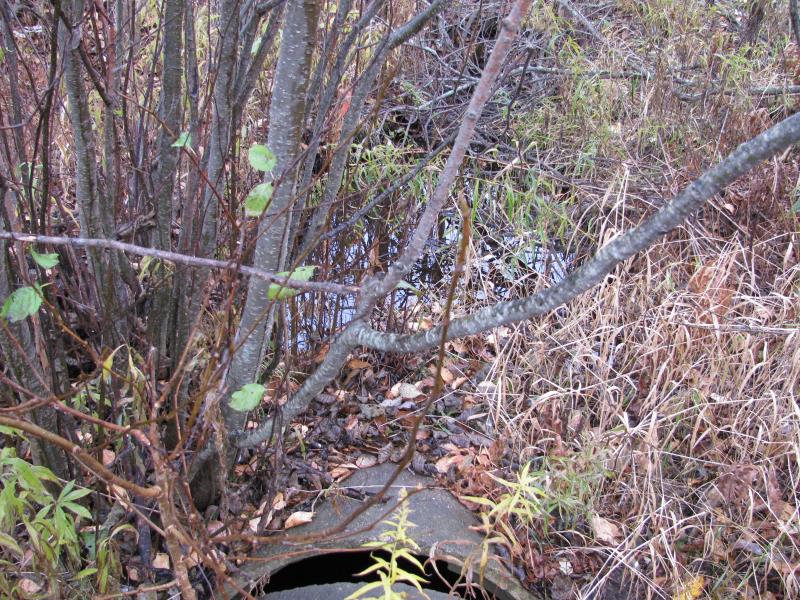
Downstream Conditions
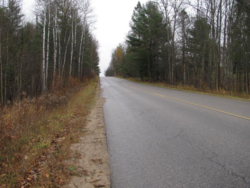
Road Approach - Left
Road Approach - Right
Crossing Information
Type of Crossing: culvert(s)
Number of Structures: 1
Structure Shape: Round
Inlet Type: Projecting
Outlet Type: At Stream Grade
Structure Material: Concrete
Structure Substrate: Sand
General Conditions: Poor
Structure Interior: smooth
Dimensions of Structure: Length 65 ft.
, Width 3 ft.
, Height 3 ft.
Percentage Crushed:
Inlet: 1% to 25%
Outlet: 1% to 25%
In Pipe: 0%
Structure is NOT Perched
Structure Inlet
Water Depth: 1.4 ft.
Embedded Depth of Structure: 0.8 ft.
Water Velocity*: 0.3 ft./sec.
Structure Outlet
Water Depth: 0.4 ft.
Embedded Depth of Structure: 1.8 ft.
Water Velocity*: 0.1 ft./sec.
*Water Velocities were measured 1 ft. below Surface
(with Meter)
Additional Comments
Broken culvert section on Inlet and outlet
Stream Information
Stream Flow: Less than Bankfull
Scour Pool: Length 0 ft.
, Width 0 ft.
, Depth 0 ft.
Upstream Pond: Length 0 ft.
, Width 0 ft.
, Depth 0 ft.
Riffle Information
Water Depth: 0.4 ft.
Bankfull Width: 3 ft.
Wetted Width: 2.3 ft.
Water Velocity: 0.5 ft./sec.
(Measured with Meter)
Dominant Substrate: Sand
Road Information
Paved
County Road
Road Condition: Good
Road Width at Culvert: 28 ft.
Location of Low Point: At Stream
Runoff Path: Ditch
Embankments
Upstream
Fill Depth: 2.5 ft.
Slope: More than 1:2
Downstream
Fill Depth: 2.8 ft.
Slope: More than 1:2
Approaches
Left Approach
Length: 450 ft.
Slope: Less Than 1%
Vegetation: Heavy
LS Factor: 0.05
Erosion: 0.0208 tons/year
Right Approach
Length: 400 ft.
Slope: 1% to 5%
Vegetation: Heavy
LS Factor: 0.48
Erosion: 0.1777 tons/year
Erosion Information
Total Erosion at Crossing: 0.1985 tons/year
Summary Information
Fish Passability 1
�