Road Stream Crossing Site P080
Pine River Watershed, North Branch Pine River
21 Mile Rd
Burdell Twp,
Osceola County
Information collected by:
Site Location
GPS Coordinates: 44.11781
, -85.53629
T20N
R10W
Sec 17
Owned by Private
Structure is NOT Perched
Total Erosion: 1.454 tons/year
Severity: Moderate
Year Inventoried: 2014
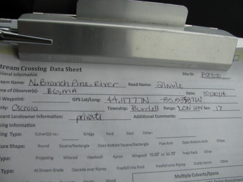
Site ID
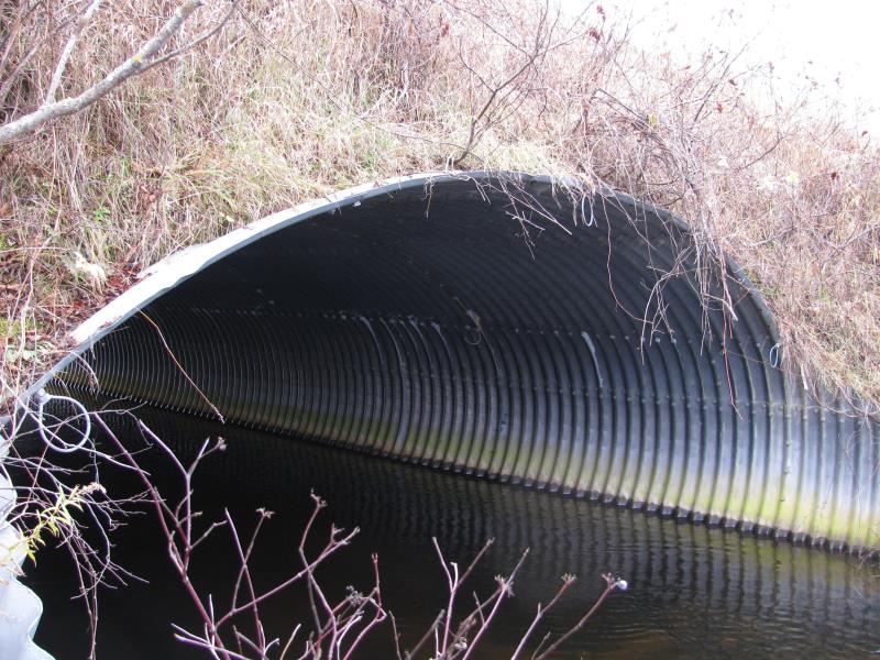
Inlet
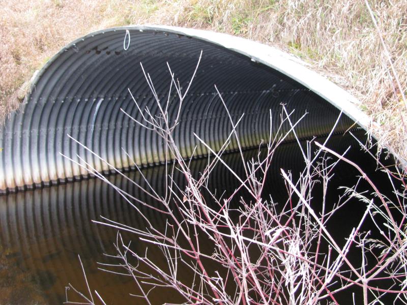
Outlet
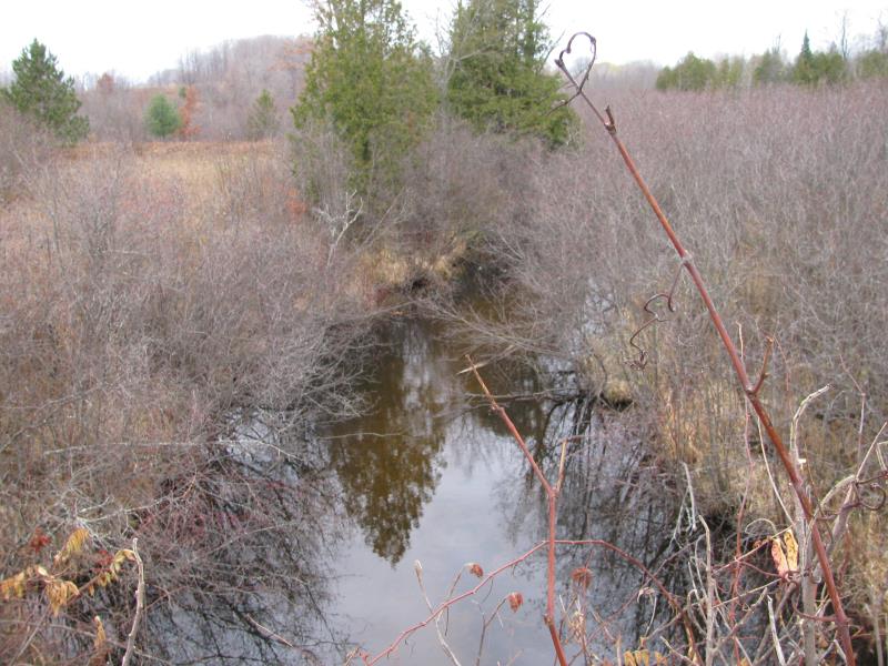
Upstream Conditions
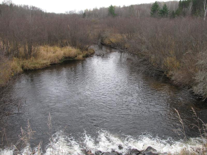
Downstream Conditions
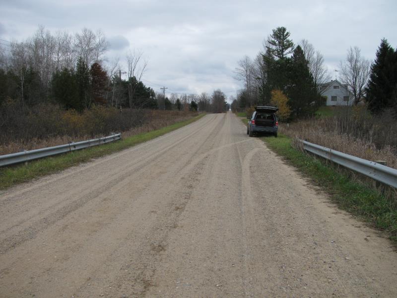
Road Approach - Left
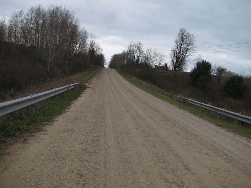
Road Approach - Right
Crossing Information
Type of Crossing: Bridge
Structure Shape: Pipe Arch
Inlet Type: Projecting
Outlet Type: Cascade over Riprap
Structure Material: Metal
Structure Substrate: Sand
General Conditions: Good
Structure Interior: corrugated
Dimensions of Structure: Length 50 ft.
, Width 22 ft.
, Height 11.5 ft.
Structure is NOT Perched
Structure Inlet
Water Depth: 3.1 ft.
Embedded Depth of Structure: 0.2 ft.
Water Velocity*: 1.2 ft./sec.
Structure Outlet
Water Depth: 3.2 ft.
Embedded Depth of Structure: 0.1 ft.
Water Velocity*: 1.4 ft./sec.
*Water Velocities were measured 1 ft. below Surface
(with Meter)
Stream Information
Stream Flow: Less than Bankfull
Scour Pool: Length 100 ft.
, Width 75 ft.
, Depth 5 ft.
Upstream Pond: Length 0 ft.
, Width 0 ft.
, Depth 0 ft.
Riffle Information
Water Depth: 1.3 ft.
Bankfull Width: 30 ft.
Wetted Width: 24 ft.
Water Velocity: 2.1 ft./sec.
(Measured with Meter)
Dominant Substrate: Gravel
Road Information
Gravel
County Road
Road Condition: Good
Road Width at Culvert: 29 ft.
Location of Low Point: At Stream
Runoff Path: Roadway
Embankments
Upstream
Fill Depth: 6.2 ft.
Slope: 1:2
Downstream
Fill Depth: 6 ft.
Slope: 1:2
Approaches
Left Approach
Length: 350 ft.
Slope: Less Than 1%
Vegetation: Heavy
LS Factor: 0.05
Erosion: 0.1398 tons/year
Right Approach
Length: 350 ft.
Slope: 1% to 5%
Vegetation: Heavy
LS Factor: 0.47
Erosion: 1.3142 tons/year
Erosion Information
Total Erosion at Crossing: 1.454 tons/year
Extent of Erosion: Moderate
Summary Information
Erosion is an area of concern for this site.
�