Road Stream Crossing Site P082
Pine River Watershed, Unknown (tributary to North Branch Pine River)
230th Ave
Burdell Twp,
Osceola County
Information collected by:
Site Location
GPS Coordinates: 44.12513
, -85.54485
T20N
R10W
Sec 18
Owned by Private
Fish Passability 0.5
Structure is NOT Perched
Total Erosion: 3.0303 tons/year
Severity: Severe
Year Inventoried: 2014
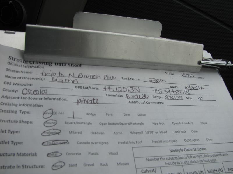
Site ID
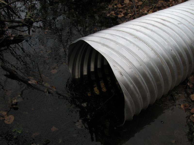
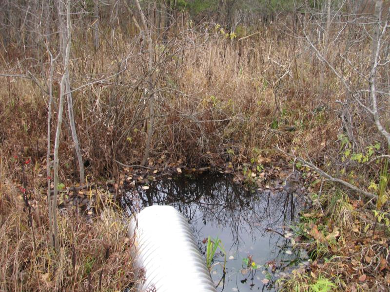
Inlet
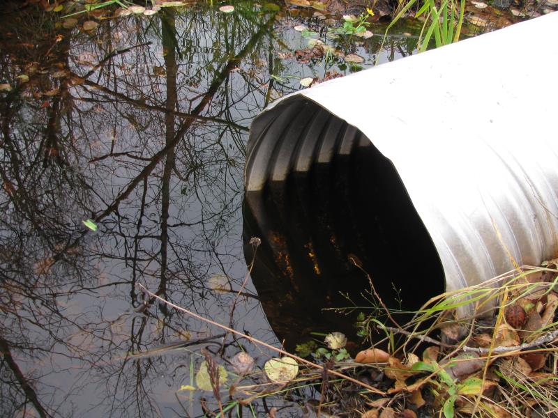
Outlet
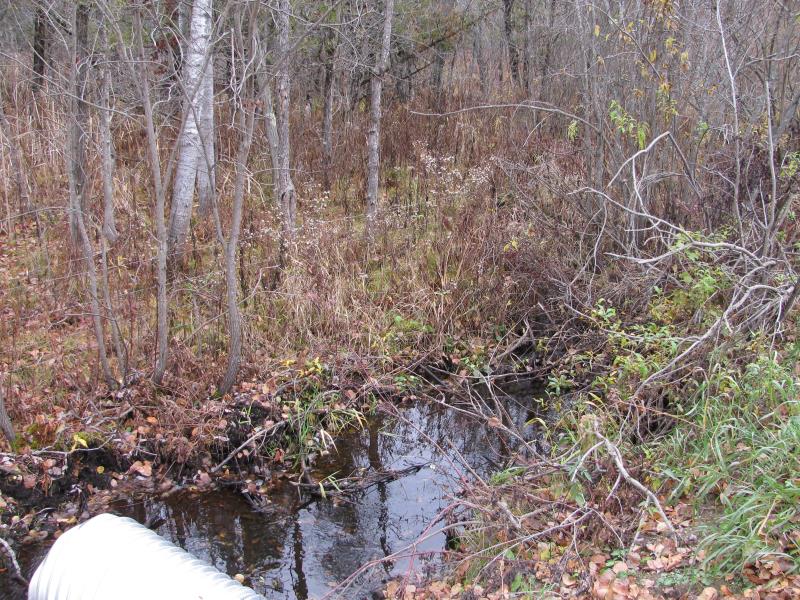
Upstream Conditions
Downstream Conditions
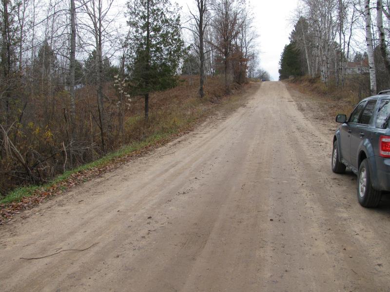
Road Approach - Left
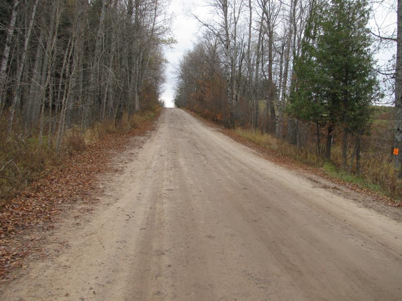
Road Approach - Right
Crossing Information
Type of Crossing: culvert(s)
Number of Structures: 1
Structure Shape: Round
Inlet Type: Projecting
Outlet Type: At Stream Grade
Structure Material: Metal
Structure Substrate: None
General Conditions: New
Structure Interior: corrugated
Dimensions of Structure: Length 50 ft.
, Width 2 ft.
, Height 2 ft.
Structure is NOT Perched
Structure Inlet
Water Depth: 0.5 ft.
Embedded Depth of Structure: 0 ft.
Water Velocity*: 0.4 ft./sec.
Structure Outlet
Water Depth: 0.7 ft.
Embedded Depth of Structure: 0 ft.
Water Velocity*: 0.2 ft./sec.
*Water Velocities were measured 0.3 ft. below Surface
(with Meter)
Stream Information
Stream Flow: Less than Bankfull
Scour Pool: Length 0 ft.
, Width 0 ft.
, Depth 0 ft.
Upstream Pond: Length 0 ft.
, Width 0 ft.
, Depth 0 ft.
Riffle Information
Water Depth: 0.3 ft.
Bankfull Width: 4 ft.
Wetted Width: 3 ft.
Water Velocity: 0.6 ft./sec.
(Measured with Meter)
Dominant Substrate: Organics
Road Information
Gravel
County Road
Road Condition: Good
Road Width at Culvert: 22 ft.
Location of Low Point: At Stream
Runoff Path: Ditch
Embankments
Upstream
Fill Depth: 1.8 ft.
Slope: More than 1:2
Downstream
Fill Depth: 2.4 ft.
Slope: More than 1:2
Approaches
Left Approach
Length: 500 ft.
Slope: 1% to 5%
Vegetation: Heavy
LS Factor: 0.5
Erosion: 1.5152 tons/year
Right Approach
Length: 500 ft.
Slope: 1% to 5%
Vegetation: Heavy
LS Factor: 0.5
Erosion: 1.5152 tons/year
Erosion Information
Total Erosion at Crossing: 3.0303 tons/year
Summary Information
Fish Passability 0.5
�