Road Stream Crossing Site P090
Pine River Watershed, Unknown (tributary to Coe Creek)
Lakola Rd
Burdell Twp,
Osceola County
Information collected by:
Site Location
GPS Coordinates: 44.10662
, -85.56384
T20N
R10W
Sec 19
Owned by Private
Fish Passability 1
Structure is NOT Perched
Total Erosion: 1.2959 tons/year
Severity: Moderate
Year Inventoried: 2014
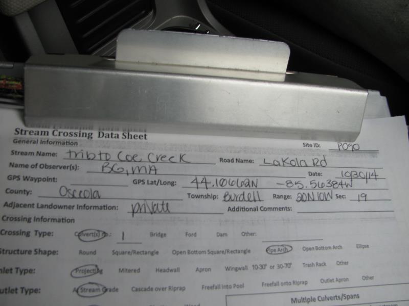
Site ID
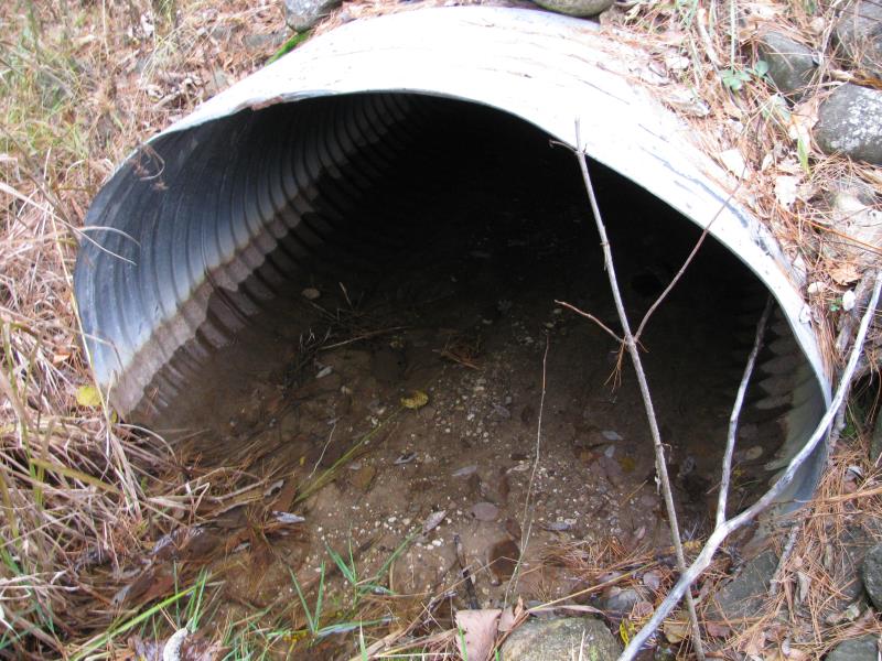
Inlet
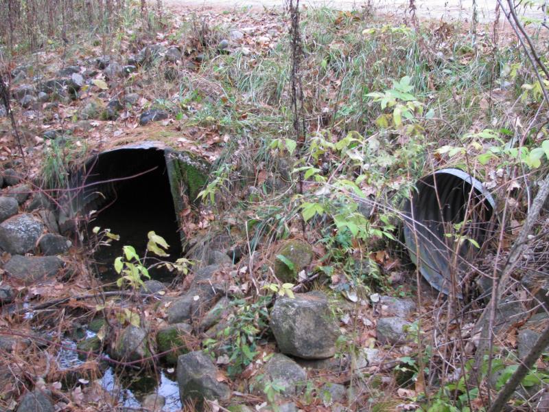
Outlet
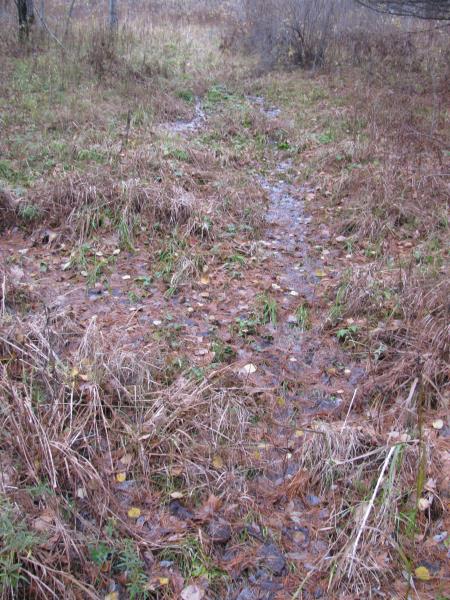
Upstream Conditions
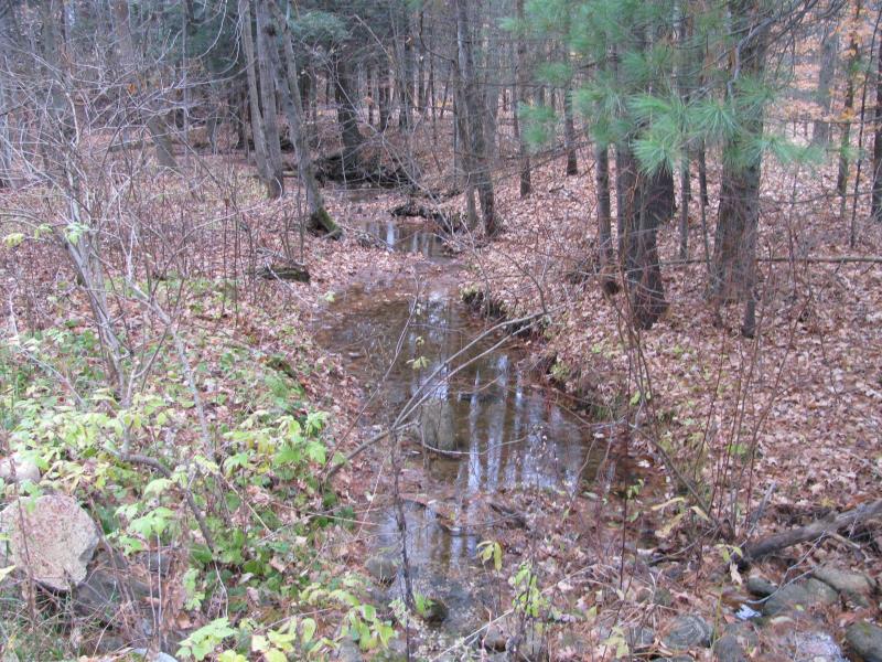
Downstream Conditions
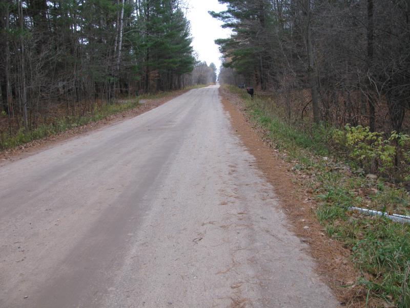
Road Approach - Left
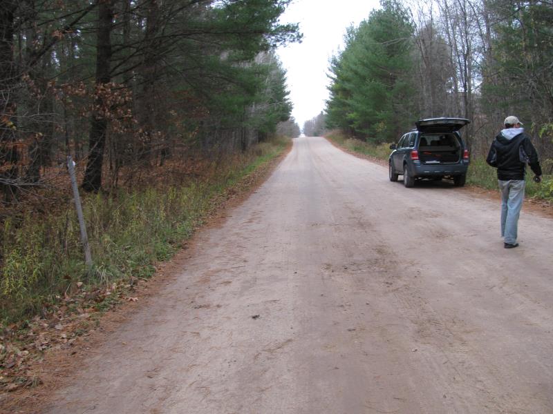
Road Approach - Right
Crossing Information
Type of Crossing: culvert(s)
Number of Structures: 2
Structure Shape: Pipe Arch
Inlet Type: Projecting
Outlet Type: At Stream Grade
Structure Material: Metal
Structure Substrate: Mixture
General Conditions: Fair
Multiple Culverts/Spans | ||||
Culvert/Span | Width | Length | Height | Material |
2 |
20 ft. |
32 ft. |
2 ft. |
Metal |
Structure Interior: corrugated
Dimensions of Structure: Length 50 ft.
, Width 4.4 ft.
, Height 2.8 ft.
Structure is NOT Perched
Structure Inlet
Water Depth: 0.2 ft.
Embedded Depth of Structure: 0.2 ft.
Water Velocity*: 0.1 ft./sec.
Structure Outlet
Water Depth: 0.7 ft.
Embedded Depth of Structure: 0 ft.
Water Velocity*: 0.1 ft./sec.
*Water Velocities were measured at the Surface
(with Meter)
Additional Comments
Smaller culvert for high water times.
Stream Information
Stream Flow: Less than Bankfull
Scour Pool: Length 0 ft.
, Width 0 ft.
, Depth 0 ft.
Upstream Pond: Length 0 ft.
, Width 0 ft.
, Depth 0 ft.
Riffle Information
Water Depth: 0.4 ft.
Bankfull Width: 8 ft.
Wetted Width: 6.6 ft.
Water Velocity: 0.2 ft./sec.
(Measured with Meter)
Dominant Substrate: Gravel
Road Information
Gravel
County Road
Road Condition: Good
Road Width at Culvert: 21 ft.
Location of Low Point: At Stream
Runoff Path: Ditch
Embankments
Upstream
Fill Depth: 1.3 ft.
Slope: More than 1:2
Downstream
Fill Depth: 1.8 ft.
Slope: More than 1:2
Approaches
Left Approach
Length: 200 ft.
Slope: 1% to 5%
Vegetation: Heavy
LS Factor: 0.43
Erosion: 0.4975 tons/year
Right Approach
Length: 300 ft.
Slope: 1% to 5%
Vegetation: Heavy
LS Factor: 0.46
Erosion: 0.7983 tons/year
Erosion Information
Total Erosion at Crossing: 1.2959 tons/year
Summary Information
Fish Passability 1
�