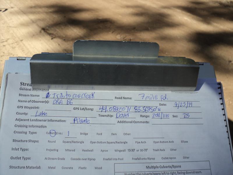
Road Stream Crossing Site P093
Pine River Watershed, Unknown (tributary to Coe Creek)
7 Mile Rd
Dover Twp,
Lake County
Information collected by:
Site Location
GPS Coordinates: 44.08908
, -85.5695
T20N
R11W
Sec 25
Owned by Private
Perch Height: 2.5 ft.
Total Erosion: 1.2496 tons/year
Severity: Severe
Year Inventoried: 2014
Site ID
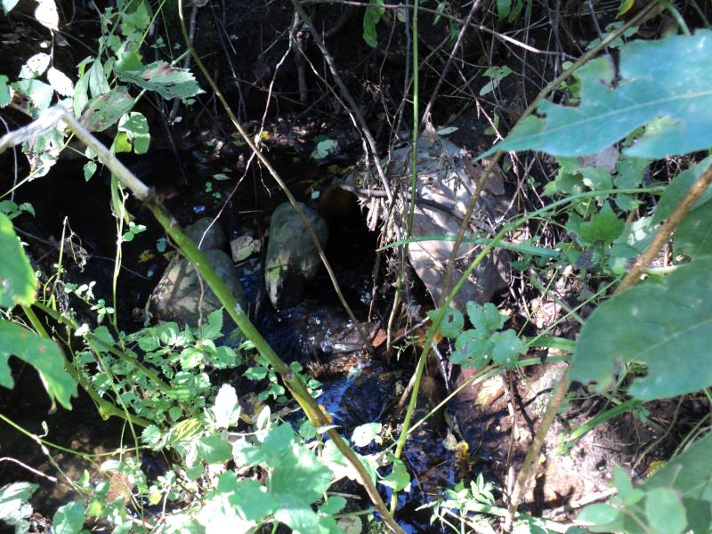
Inlet
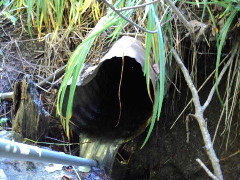
Outlet
Upstream Conditions
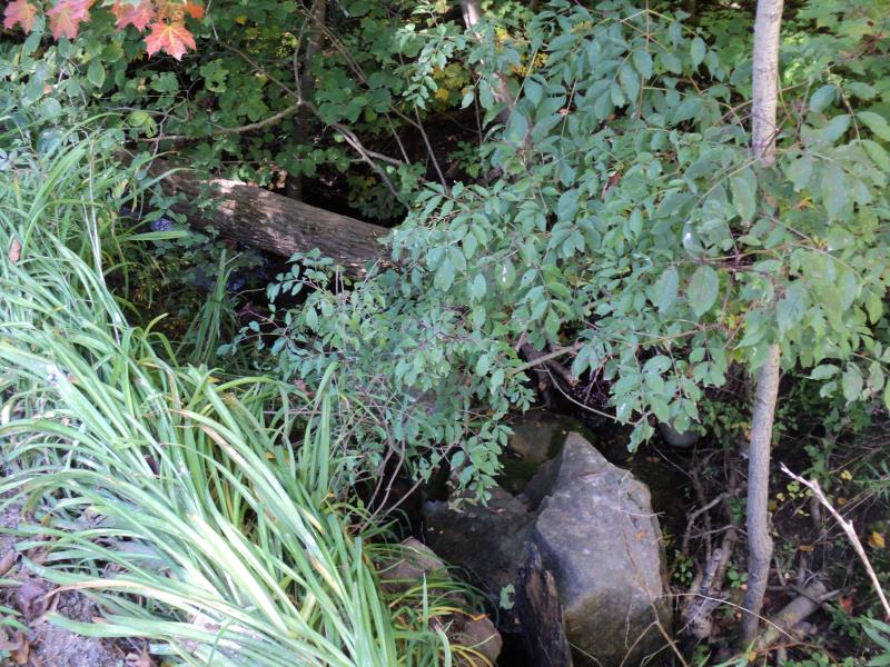
Downstream Conditions
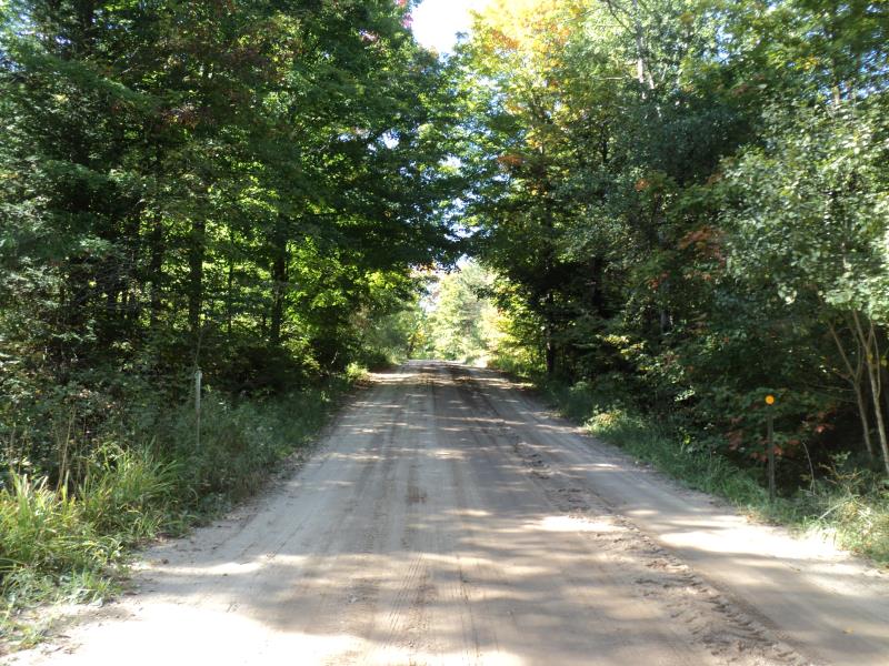
Road Approach - Left
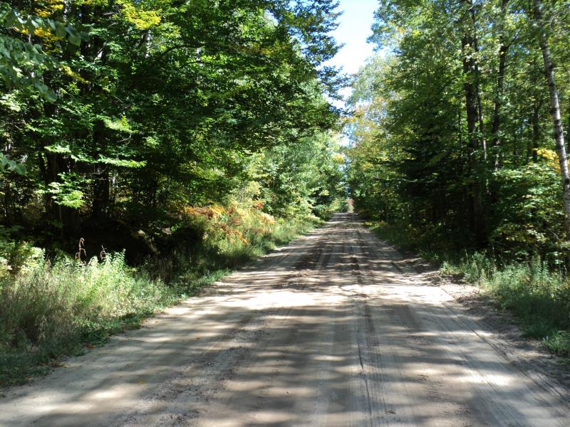
Road Approach - Right
Crossing Information
Type of Crossing: culvert(s)
Number of Structures: 1
Structure Shape: Round
Inlet Type: Projecting
Outlet Type: Freefall into Pool
Structure Material: Metal
Structure Substrate: None
General Conditions: Poor
Structure Interior: corrugated
Dimensions of Structure: Length 30 ft.
, Width 1.5 ft.
, Height 1.5 ft.
Percentage Plugged:
Inlet: 1% to 25%
Outlet: 0%
In Pipe: 0%
Percentage Crushed:
Inlet: 0%
Outlet: 26% to 50%
In Pipe: 0%
Perch Height: 2.5 ft.
Structure Inlet
Water Depth: 0.7 ft.
Embedded Depth of Structure: 0 ft.
Water Velocity*: 1 ft./sec.
Structure Outlet
Water Depth: 0.1 ft.
Embedded Depth of Structure: 0 ft.
Water Velocity*: 4 ft./sec.
*Water Velocities were measured at the Surface
(with Meter)
Stream Information
Stream Flow: Less than Bankfull
Scour Pool: Length 0 ft.
, Width 0 ft.
, Depth 0 ft.
Upstream Pond: Length 0 ft.
, Width 0 ft.
, Depth 0 ft.
Riffle Information
Water Depth: 0.7 ft.
Bankfull Width: 3 ft.
Wetted Width: 2 ft.
Water Velocity: 1 ft./sec.
(Measured with Meter)
Dominant Substrate: Organics
Road Information
Gravel
County Road
Road Condition: Fair
Road Width at Culvert: 18 ft.
Location of Low Point: At Stream
Runoff Path: Ditch
Embankments
Upstream
Fill Depth: 3 ft.
Slope: 1:1
Downstream
Fill Depth: 2.7 ft.
Slope: 1:1
Approaches
Left Approach
Length: 150 ft.
Slope: 1% to 5%
Vegetation: Heavy
LS Factor: 0.4
Erosion: 0.2975 tons/year
Right Approach
Length: 400 ft.
Slope: 1% to 5%
Vegetation: Heavy
LS Factor: 0.48
Erosion: 0.9521 tons/year
Erosion Information
Total Erosion at Crossing: 1.2496 tons/year
Extent of Erosion: Moderate
Notes:
Moderate erosion on embankments and streambanks downstream.
Summary Information
Fish Passage is an area of concern for this site.
yes, culvert is perched and in poor condition.
A future visit to this site is recommended.
Yes, culvert is due to be replaced.
�